Property Record
10176 Airline Hwy, Saint Rose, LA 70087

NEARBY LISTINGS FOR SALE OR LEASE
Property Detail
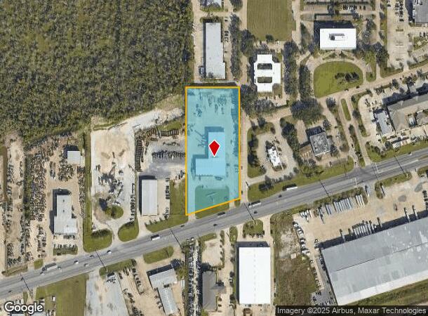
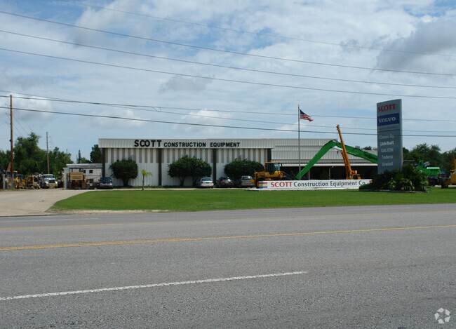
10176 Airline Hwy
New Orleans/Metairie/Kenner
James Park (Industrial) North
New Orleans-Metairie, LA
A TRACT OF LAND LYING WITHIN SEC. 39 T12SR9E, ST. CHAS. PARISH, BEGINNING AT THE INTERSECTION OF THE COMMON ST. CHAS. PAR.-JE
562403903759
St Charles
Warehouse
Louisiana
2024
3759
2024
3.71 AC
062100
St Charles Parish
25,044 SF
DEMOGRAPHICS near 10176 Airline Hwy
1 Mile
3 Mile
5 Mile
2024 Total Population
1,985
27,589
121,453
2029 Population
1,966
26,689
117,231
Pop Growth 2024-2029
(0.96%)
(3.26%)
(3.48%)
Average Age
40
39
41
2024 Total Households
745
10,196
47,566
HH Growth 2024-2029
(0.81%)
(3.33%)
(3.61%)
Median Household Inc
$50,633
$49,086
$57,629
Avg Household Size
2.70
2.60
2.50
2024 Avg HH Vehicles
2.00
2.00
2.00
Median Home Value
$143,918
$164,484
$217,088
Median Year Built
1985
1975
1974
Nearby Places
Map Layers
Map Styles
 Street
 Aerial
- Restaurants
- Banks
- Shops
- Fitness
- Groceries
PUBLIC TRANSPORTATION
AIRPORT
Louis Armstrong New Orleans International
DRIVE
WALK
Distance
Louis Armstrong New Orleans International
12 min
7.1 mi
Freight Ports
Port of New Orleans
DRIVE
WALK
Distance
Port of New Orleans
31 min
18.5 mi
Nearby Properties
Address
Land Use
TOTAL SIZE
Lot Size
Zoning
Address
Land Use
TOTAL SIZE
Lot Size
Zoning
728 AC
R1A
Address
Land Use
TOTAL SIZE
Lot Size
Zoning
0.14 AC
Address
Land Use
TOTAL SIZE
Lot Size
Zoning
Address
Land Use
TOTAL SIZE
Lot Size
Zoning
0.16 AC
Address
Land Use
TOTAL SIZE
Lot Size
Zoning
0.09 AC
Address
Land Use
TOTAL SIZE
Lot Size
Zoning
0.12 AC
Address
Land Use
TOTAL SIZE
Lot Size
Zoning
9.74 AC
Address
Land Use
TOTAL SIZE
Lot Size
Zoning
0.17 AC
Address
Land Use
TOTAL SIZE
Lot Size
Zoning
12.69 AC
Address
Land Use
TOTAL SIZE
Lot Size
Zoning
365,680 SF
14.53 AC
Address
Land Use
TOTAL SIZE
Lot Size
Zoning
669 AC
Address
Land Use
TOTAL SIZE
Lot Size
Zoning
Address
Land Use
TOTAL SIZE
Lot Size
Zoning
0.14 AC
Address
Land Use
TOTAL SIZE
Lot Size
Zoning
0.12 AC
Address
Land Use
TOTAL SIZE
Lot Size
Zoning
232,882 SF
Address
Land Use
TOTAL SIZE
Lot Size
Zoning
85,000 SF
3.60 AC
Address
Land Use
TOTAL SIZE
Lot Size
Zoning
253,722 SF
19.66 AC
Address
Land Use
TOTAL SIZE
Lot Size
Zoning
10.13 AC
Address
Land Use
TOTAL SIZE
Lot Size
Zoning
0.13 AC
Address
Land Use
TOTAL SIZE
Lot Size
Zoning
21.09 AC
Address
Land Use
TOTAL SIZE
Lot Size
Zoning
Address
Land Use
TOTAL SIZE
Lot Size
Zoning
Address
Land Use
TOTAL SIZE
Lot Size
Zoning
Address
Land Use
TOTAL SIZE
Lot Size
Zoning
0.17 AC
Address
Land Use
TOTAL SIZE
Lot Size
Zoning
12.30 AC
R1A
Address
Land Use
TOTAL SIZE
Lot Size
Zoning
Address
Land Use
TOTAL SIZE
Lot Size
Zoning
86,032 SF
3.39 AC
Address
Land Use
TOTAL SIZE
Lot Size
Zoning
2.46 AC
Address
Land Use
TOTAL SIZE
Lot Size
Zoning
Address
Land Use
TOTAL SIZE
Lot Size
Zoning
0.17 AC
The World's #1 Commercial Real Estate Marketplace
Connect with us
© 2025 CoStar Group
The information above has been obtained from sources believed reliable. While we do not doubt its accuracy we have not verified it and make no guarantee, warranty or representation about it. It is your responsibility to independently confirm its accuracy and completeness. Any projections, opinions, assumptions, or estimates used are for example only and do not represent the current or future performance of the property. The value of this transaction to you depends on tax and other factors which should be evaluated by your tax, financial, and legal advisors. You and your advisors should conduct a careful, independent investigation of the property to determine to your satisfaction the suitability of the property for your needs.