Property Record
1018 S Tamarack Dr, Fullerton, CA 92832


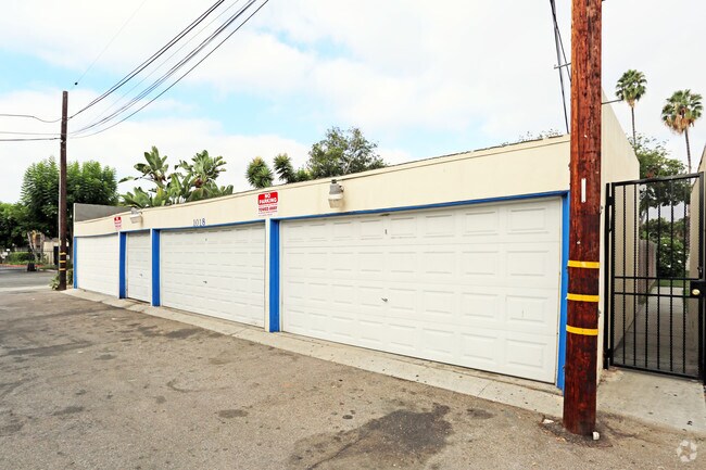
Property Detail
1018 S Tamarack Dr
Anaheim-Santa Ana-Irvine, CA
N TR 3123 BLK LOT 14
073-072-21
Orange
Multifamilydwelling
California
C and X Area of minimal flood hazard, usually depicted on FIRMs as above the 500-year flood level.
14
2024
0.20 AC
2025
North County
011601
Orange County (California)
4,924 SF
NEARBY LISTINGS FOR SALE OR LEASE
DEMOGRAPHICS near 1018 S Tamarack Dr
1 mile
3 mile
5 mile
2025 Total Population
31,892
238,889
612,665
2030 Population
31,795
238,126
612,012
Pop Growth 2025-2030
(0.30%)
(0.32%)
(0.11%)
Average Age
38
38
39
2025 Total Households
10,239
70,756
188,314
HH Growth 2025-2030
(0.51%)
(0.52%)
(0.27%)
Median Household Inc
$80,134
$91,462
$92,959
Avg Household Size
2.90
3.20
3.10
2025 Avg HH Vehicles
2.00
2.00
2.00
Median Home Value
$679,241
$778,836
$778,277
Median Year Built
1964
1966
1970
Nearby Places
Map Layers
Map Styles
 Street
 Aerial
Layers
 Traffic
 Biking
Places
Listings with unknown addresses are not visible on the map
- Restaurants
- Banks
- Shops
- Fitness
- Groceries
PUBLIC TRANSPORTATION
COMMUTER RAIL
Fullerton (91 Line - Southern California Regional Rail Authority (Metrolink), Orange County Line - Southern California Regional Rail Authority (Metrolink))
Drive
Walk
Distance
Fullerton (91 Line - Southern California Regional Rail Authority (Metrolink), Orange County Line - Southern California Regional Rail Authority (Metrolink))
3 min
16 min
0.8 mi
Buena Park (91 Line - Southern California Regional Rail Authority (Metrolink), Orange County Line - Southern California Regional Rail Authority (Metrolink))
Drive
Walk
Distance
Buena Park (91 Line - Southern California Regional Rail Authority (Metrolink), Orange County Line - Southern California Regional Rail Authority (Metrolink))
9 min
4.7 mi
AIRPORT
John Wayne/Orange County
Drive
Walk
Distance
John Wayne/Orange County
23 min
17.2 mi
Long Beach (Daugherty Field)
Drive
Walk
Distance
Long Beach (Daugherty Field)
29 min
19.4 mi
Ontario International
Drive
Walk
Distance
Ontario International
41 min
30.4 mi
Freight Ports
Port of Long Beach
Drive
Walk
Distance
Port of Long Beach
36 min
25.2 mi
Nearby Properties
Address
Land Use
TOTAL SIZE
Lot Size
Zoning
Address
Land Use
TOTAL SIZE
Lot Size
Zoning
Address
Land Use
TOTAL SIZE
Lot Size
Zoning
615,528 SF
17.93 AC
Address
Land Use
TOTAL SIZE
Lot Size
Zoning
Address
Land Use
TOTAL SIZE
Lot Size
Zoning
12.50 AC
Address
Land Use
TOTAL SIZE
Lot Size
Zoning
4.29 AC
Address
Land Use
TOTAL SIZE
Lot Size
Zoning
29.16 AC
Address
Land Use
TOTAL SIZE
Lot Size
Zoning
Address
Land Use
TOTAL SIZE
Lot Size
Zoning
Address
Land Use
TOTAL SIZE
Lot Size
Zoning
47,520 SF
1.92 AC
C
Address
Land Use
TOTAL SIZE
Lot Size
Zoning
Address
Land Use
TOTAL SIZE
Lot Size
Zoning
Address
Land Use
TOTAL SIZE
Lot Size
Zoning
Address
Land Use
TOTAL SIZE
Lot Size
Zoning
26.38 AC
Address
Land Use
TOTAL SIZE
Lot Size
Zoning
Address
Land Use
TOTAL SIZE
Lot Size
Zoning
Address
Land Use
TOTAL SIZE
Lot Size
Zoning
4.79 AC
Address
Land Use
TOTAL SIZE
Lot Size
Zoning
Address
Land Use
TOTAL SIZE
Lot Size
Zoning
215,384 SF
8.82 AC
Address
Land Use
TOTAL SIZE
Lot Size
Zoning
Address
Land Use
TOTAL SIZE
Lot Size
Zoning
Address
Land Use
TOTAL SIZE
Lot Size
Zoning
12,040 SF
1.82 AC
Address
Land Use
TOTAL SIZE
Lot Size
Zoning
140,973 SF
10.03 AC
Address
Land Use
TOTAL SIZE
Lot Size
Zoning
25.81 AC
Address
Land Use
TOTAL SIZE
Lot Size
Zoning
5.10 AC
Address
Land Use
TOTAL SIZE
Lot Size
Zoning
Address
Land Use
TOTAL SIZE
Lot Size
Zoning
Address
Land Use
TOTAL SIZE
Lot Size
Zoning
Address
Land Use
TOTAL SIZE
Lot Size
Zoning
24.80 AC
Address
Land Use
TOTAL SIZE
Lot Size
Zoning
208,000 SF
17.03 AC
Address
Land Use
TOTAL SIZE
Lot Size
Zoning
9.63 AC
The World's #1 Commercial Real Estate Marketplace
Connect with us
© 2026 CoStar Group
The information above has been obtained from sources believed reliable. While we do not doubt its accuracy we have not verified it and make no guarantee, warranty or representation about it. It is your responsibility to independently confirm its accuracy and completeness. Any projections, opinions, assumptions, or estimates used are for example only and do not represent the current or future performance of the property. The value of this transaction to you depends on tax and other factors which should be evaluated by your tax, financial, and legal advisors. You and your advisors should conduct a careful, independent investigation of the property to determine to your satisfaction the suitability of the property for your needs.