Property Record
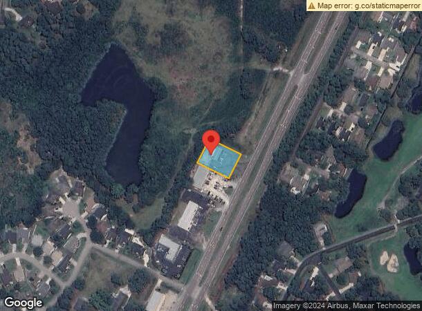
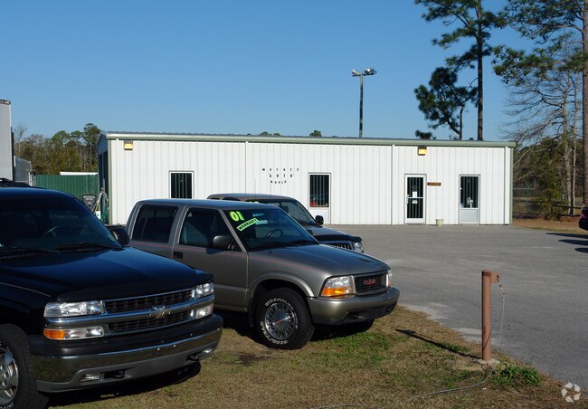
10180 Ocean Hwy W, Calabash, NC 28467

NEARBY LISTINGS FOR SALE OR LEASE
Property Detail
10180 Ocean Hwy W
Myrtle Beach-Conway-North Myrtle Beach, SC-NC
Bennett Est
240NC008
L-5 US#17 BENNETT ESTATE PLAT 6/70
Warehouse
Brunswick
X
North Carolina
45051C0464K
5
2024
0.48 AC
2025
West Brunswick
020515
Wilmington
911 SF
DEMOGRAPHICS near 10180 Ocean Hwy W
1 Mile
3 Mile
5 Mile
2024 Total Population
2,826
23,145
47,526
2029 Population
3,560
29,625
60,742
Pop Growth 2024-2029
+ 25.97%
+ 28.00%
+ 27.81%
Average Age
56
55
56
2024 Total Households
1,381
11,253
23,173
HH Growth 2024-2029
+ 25.56%
+ 27.50%
+ 27.16%
Median Household Inc
$56,330
$62,600
$63,578
Avg Household Size
2.00
2.00
2.00
2024 Avg HH Vehicles
2.00
2.00
2.00
Median Home Value
$238,799
$239,538
$261,167
Median Year Built
1996
2002
2000
Nearby Places
Map Layers
Map Styles
 Street
 Aerial
- Restaurants
- Banks
- Shops
- Fitness
- Groceries
PUBLIC TRANSPORTATION
AIRPORT
Myrtle Beach International
DRIVE
WALK
Distance
Myrtle Beach International
46 min
29.5 mi
Freight Ports
Port of Wilmington
DRIVE
WALK
Distance
Port of Wilmington
72 min
50.4 mi
SALE & LEASE HISTORY
LISTING DATE
SALE/LEASE

Sep 24, 2016
For Sale
Nearby Properties
Address
Land Use
TOTAL SIZE
Lot Size
Zoning
Address
Land Use
TOTAL SIZE
Lot Size
Zoning
19,008 SF
7.09 AC
R75
Address
Land Use
TOTAL SIZE
Lot Size
Zoning
11,748 SF
18.20 AC
R8
Address
Land Use
TOTAL SIZE
Lot Size
Zoning
1,539 SF
4.25 AC
CB
Address
Land Use
TOTAL SIZE
Lot Size
Zoning
450 SF
215.99 AC
PUD
Address
Land Use
TOTAL SIZE
Lot Size
Zoning
101,133 SF
1.96 AC
HC
Address
Land Use
TOTAL SIZE
Lot Size
Zoning
9,100 SF
181.26 AC
PUD
Address
Land Use
TOTAL SIZE
Lot Size
Zoning
20,713 SF
2.49 AC
NB
Address
Land Use
TOTAL SIZE
Lot Size
Zoning
34,987 SF
6.10 AC
NB
Address
Land Use
TOTAL SIZE
Lot Size
Zoning
1,200 SF
11.09 AC
HC
Address
Land Use
TOTAL SIZE
Lot Size
Zoning
15,086 SF
314.53 AC
R8
Address
Land Use
TOTAL SIZE
Lot Size
Zoning
68,841 SF
4.35 AC
MR32
Address
Land Use
TOTAL SIZE
Lot Size
Zoning
7,200 SF
5 AC
HC
Address
Land Use
TOTAL SIZE
Lot Size
Zoning
Address
Land Use
TOTAL SIZE
Lot Size
Zoning
8,294 SF
3.98 AC
CB
Address
Land Use
TOTAL SIZE
Lot Size
Zoning
15,256 SF
4.35 AC
HC
Address
Land Use
TOTAL SIZE
Lot Size
Zoning
9,336 SF
2.63 AC
CB
Address
Land Use
TOTAL SIZE
Lot Size
Zoning
9,150 SF
28.89 AC
Address
Land Use
TOTAL SIZE
Lot Size
Zoning
1,592 SF
3.15 AC
RC
Address
Land Use
TOTAL SIZE
Lot Size
Zoning
95,288 SF
10.37 AC
Address
Land Use
TOTAL SIZE
Lot Size
Zoning
576 SF
5.21 AC
CLD
Address
Land Use
TOTAL SIZE
Lot Size
Zoning
18,926 SF
2.75 AC
CB
Address
Land Use
TOTAL SIZE
Lot Size
Zoning
Address
Land Use
TOTAL SIZE
Lot Size
Zoning
25,900 SF
3.92 AC
HC
Address
Land Use
TOTAL SIZE
Lot Size
Zoning
16,000 SF
2.10 AC
R75
Address
Land Use
TOTAL SIZE
Lot Size
Zoning
8,316 SF
4.06 AC
CLD
Address
Land Use
TOTAL SIZE
Lot Size
Zoning
20,900 SF
18.61 AC
CLD
Address
Land Use
TOTAL SIZE
Lot Size
Zoning
3.16 AC
R15
Address
Land Use
TOTAL SIZE
Lot Size
Zoning
4,800 SF
1.59 AC
CB
Address
Land Use
TOTAL SIZE
Lot Size
Zoning
32,595 SF
10.80 AC
COR7500
Address
Land Use
TOTAL SIZE
Lot Size
Zoning
3,200 SF
23.70 AC
CI
The World's #1 Commercial Real Estate Marketplace
Connect with us
© 2025 CoStar Group
The information above has been obtained from sources believed reliable. While we do not doubt its accuracy we have not verified it and make no guarantee, warranty or representation about it. It is your responsibility to independently confirm its accuracy and completeness. Any projections, opinions, assumptions, or estimates used are for example only and do not represent the current or future performance of the property. The value of this transaction to you depends on tax and other factors which should be evaluated by your tax, financial, and legal advisors. You and your advisors should conduct a careful, independent investigation of the property to determine to your satisfaction the suitability of the property for your needs.