Property Record
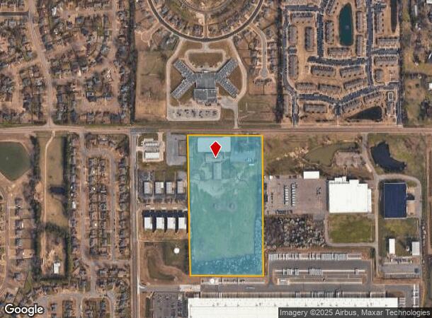
10181 Stateline Rd, Olive Branch, MS 38654

This Property Is For Sale
NEARBY LISTINGS FOR SALE OR LEASE
-
-
View all Olive Branch listings for sale on LoopNet.com
Property Detail
10181 Stateline Rd
Memphis, TN-MS-AR
Stateline Stables S/D
1066140300000100
DeSoto
Singlefamilyresidentialassumed
Mississippi
X
19.97 AC
28033C0110H
DeSoto County
2,469 SF
Memphis
DEMOGRAPHICS near 10181 Stateline Rd
1 Mile
3 Mile
5 Mile
2024 Total Population
7,039
54,561
119,227
2029 Population
6,951
54,551
119,843
Pop Growth 2024-2029
(1.25%)
(0.02%)
+ 0.52%
Average Age
38
38
38
2024 Total Households
2,632
19,899
45,653
HH Growth 2024-2029
(1.37%)
+ 0.04%
+ 0.51%
Median Household Inc
$69,936
$74,817
$70,257
Avg Household Size
2.70
2.70
2.60
2024 Avg HH Vehicles
2.00
2.00
2.00
Median Home Value
$225,634
$191,116
$203,785
Median Year Built
1998
1994
1992
Nearby Places
Map Layers
Map Styles
 Street
 Aerial
- Restaurants
- Banks
- Shops
- Fitness
- Groceries
PUBLIC TRANSPORTATION
AIRPORT
Memphis International
DRIVE
WALK
Distance
Memphis International
22 min
13.1 mi
Freight Ports
Port of Shreveport
DRIVE
WALK
Distance
Port of Shreveport
426 min
386.9 mi
Nearby Properties
Address
Land Use
TOTAL SIZE
Lot Size
Zoning
Address
Land Use
TOTAL SIZE
Lot Size
Zoning
1,059,729 SF
74.33 AC
M-2
Address
Land Use
TOTAL SIZE
Lot Size
Zoning
863,591 SF
35.66 AC
EMP
Address
Land Use
TOTAL SIZE
Lot Size
Zoning
834,463 SF
37.46 AC
EMP
Address
Land Use
TOTAL SIZE
Lot Size
Zoning
929,880 SF
41.14 AC
M-1
Address
Land Use
TOTAL SIZE
Lot Size
Zoning
434,122 SF
23.97 AC
R-6
Address
Land Use
TOTAL SIZE
Lot Size
Zoning
158,366 SF
24.31 AC
R-6
Address
Land Use
TOTAL SIZE
Lot Size
Zoning
52,688 SF
24.38 AC
CA
Address
Land Use
TOTAL SIZE
Lot Size
Zoning
326,743 SF
22.91 AC
R-8
Address
Land Use
TOTAL SIZE
Lot Size
Zoning
350,298 SF
12.68 AC
EMP
Address
Land Use
TOTAL SIZE
Lot Size
Zoning
330,758 SF
12.09 AC
EMP
Address
Land Use
TOTAL SIZE
Lot Size
Zoning
239,276 SF
17.72 AC
EMP
Address
Land Use
TOTAL SIZE
Lot Size
Zoning
38,566 SF
27.90 AC
CA
Address
Land Use
TOTAL SIZE
Lot Size
Zoning
689,307 SF
22.68 AC
EMP
Address
Land Use
TOTAL SIZE
Lot Size
Zoning
642,900 SF
29.71 AC
EMP
Address
Land Use
TOTAL SIZE
Lot Size
Zoning
10,128 SF
23.35 AC
CA
Address
Land Use
TOTAL SIZE
Lot Size
Zoning
466,532 SF
21.76 AC
EMP
Address
Land Use
TOTAL SIZE
Lot Size
Zoning
414,374 SF
19.74 AC
EMP
Address
Land Use
TOTAL SIZE
Lot Size
Zoning
1,093,788 SF
60.98 AC
M-1
Address
Land Use
TOTAL SIZE
Lot Size
Zoning
990,952 SF
60.30 AC
PUD
Address
Land Use
TOTAL SIZE
Lot Size
Zoning
1,299,800 SF
50.22 AC
M-1
Address
Land Use
TOTAL SIZE
Lot Size
Zoning
990,080 SF
55.79 AC
M-1
Address
Land Use
TOTAL SIZE
Lot Size
Zoning
622,675 SF
67.55 AC
M-1
Address
Land Use
TOTAL SIZE
Lot Size
Zoning
761,349 SF
57.62 AC
M-1
Address
Land Use
TOTAL SIZE
Lot Size
Zoning
722,560 SF
66.85 AC
M-1
Address
Land Use
TOTAL SIZE
Lot Size
Zoning
307,100 SF
18.95 AC
CA
Address
Land Use
TOTAL SIZE
Lot Size
Zoning
65,282 SF
15.92 AC
CA
Address
Land Use
TOTAL SIZE
Lot Size
Zoning
615,853 SF
39.07 AC
M-1
Address
Land Use
TOTAL SIZE
Lot Size
Zoning
277,936 SF
15.92 AC
EMP
Address
Land Use
TOTAL SIZE
Lot Size
Zoning
869,020 SF
43.85 AC
M-1
Address
Land Use
TOTAL SIZE
Lot Size
Zoning
309,885 SF
17.49 AC
R-8
The World's #1 Commercial Real Estate Marketplace
Connect with us
© 2025 CoStar Group
The information above has been obtained from sources believed reliable. While we do not doubt its accuracy we have not verified it and make no guarantee, warranty or representation about it. It is your responsibility to independently confirm its accuracy and completeness. Any projections, opinions, assumptions, or estimates used are for example only and do not represent the current or future performance of the property. The value of this transaction to you depends on tax and other factors which should be evaluated by your tax, financial, and legal advisors. You and your advisors should conduct a careful, independent investigation of the property to determine to your satisfaction the suitability of the property for your needs.