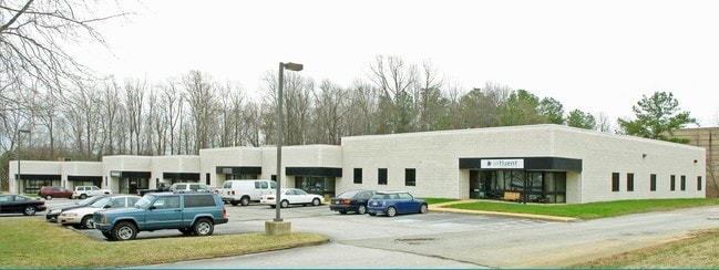
Property Record
10189 Maple Leaf Ct, Ashland, VA 23005

Save to a Folder
{{folder.Name}}
{{folder.ListingIds.length}} Properties
{{folder.ListingIds.length}} Property
Create a New Folder
Property Detail
10189 Maple Leaf Ct
7788-60-4064
LAKERIDGE IND PARK LOT 1 BLK B
Commercialnec
Hanover
M-2
Virginia
AE The base floodplain where base flood elevations are provided. AE Zones are now used on new format FIRMs instead of A1-A30 Zones.
1
2026
6.34 AC
2026
I-95 North/Ashland
320400
Richmond VA
25,654 SF
Richmond, VA
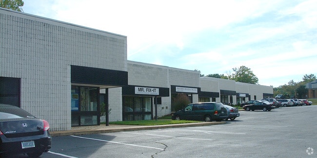
NEARBY LISTINGS FOR SALE OR LEASE
DEMOGRAPHICS near 10189 Maple Leaf Ct
1 mile
3 mile
5 mile
2025 Total Population
826
24,789
76,572
2030 Population
907
25,682
78,987
Pop Growth 2025-2030
+ 9.81%
+ 3.60%
+ 3.15%
Average Age
41
41
41
2025 Total Households
401
9,314
29,134
HH Growth 2025-2030
+ 9.98%
+ 3.74%
+ 3.19%
Median Household Inc
$57,845
$122,779
$107,016
Avg Household Size
2.10
2.60
2.50
2025 Avg HH Vehicles
2.00
2.00
2.00
Median Home Value
$337,500
$415,092
$382,859
Median Year Built
2010
1996
1992
Nearby Places
Map Layers
Map Styles
 Street
 Aerial
Layers
 Traffic
 Biking
Places
Listings with unknown addresses are not visible on the map
- Restaurants
- Banks
- Shops
- Fitness
- Groceries
PUBLIC TRANSPORTATION
COMMUTER RAIL
Ashland Amtrak (Northeast Regional - Amtrak)
Drive
Walk
Distance
Ashland Amtrak (Northeast Regional - Amtrak)
11 min
6.4 mi
Richmond Staples Mill Road Amtrak Station (Carolinian - Amtrak, Floridian - Amtrak, Northeast Regional - Amtrak, Palmetto - Amtrak, Silver Meteor - Amtrak)
Drive
Walk
Distance
Richmond Staples Mill Road Amtrak Station (Carolinian - Amtrak, Floridian - Amtrak, Northeast Regional - Amtrak, Palmetto - Amtrak, Silver Meteor - Amtrak)
16 min
9.1 mi
AIRPORT
Richmond International
Drive
Walk
Distance
Richmond International
29 min
20.7 mi
Freight Ports
Virginia Port Authority - Richmond
Drive
Walk
Distance
Virginia Port Authority - Richmond
30 min
20.3 mi
SALE & LEASE HISTORY
LISTING DATE
SALE/LEASE

Sep 25, 2016
For Lease
Jul 21, 2022
For Lease
Dec 12, 2018
For Lease
Nearby Properties
Address
Land Use
TOTAL SIZE
Lot Size
Zoning
Address
Land Use
TOTAL SIZE
Lot Size
Zoning
210.61 AC
M-2
Address
Land Use
TOTAL SIZE
Lot Size
Zoning
347,648 SF
24.75 AC
R-5
Address
Land Use
TOTAL SIZE
Lot Size
Zoning
186,034 SF
1 AC
B-3C
Address
Land Use
TOTAL SIZE
Lot Size
Zoning
43.49 AC
M-2
Address
Land Use
TOTAL SIZE
Lot Size
Zoning
162,972 SF
1 AC
R-6C
Address
Land Use
TOTAL SIZE
Lot Size
Zoning
59.30 AC
M-2
Address
Land Use
TOTAL SIZE
Lot Size
Zoning
135,874 SF
31.99 AC
MIXED
Address
Land Use
TOTAL SIZE
Lot Size
Zoning
21.38 AC
R-5C
Address
Land Use
TOTAL SIZE
Lot Size
Zoning
50.20 AC
M-2
Address
Land Use
TOTAL SIZE
Lot Size
Zoning
30.94 AC
M-2
Address
Land Use
TOTAL SIZE
Lot Size
Zoning
320,540 SF
18.50 AC
M-2
Address
Land Use
TOTAL SIZE
Lot Size
Zoning
2,952 SF
20.87 AC
RM
Address
Land Use
TOTAL SIZE
Lot Size
Zoning
159,432 SF
14 AC
R-5
Address
Land Use
TOTAL SIZE
Lot Size
Zoning
142,140 SF
10.01 AC
R-5
Address
Land Use
TOTAL SIZE
Lot Size
Zoning
25.94 AC
M-1
Address
Land Use
TOTAL SIZE
Lot Size
Zoning
216,900 SF
13.41 AC
R-6
Address
Land Use
TOTAL SIZE
Lot Size
Zoning
21 AC
M-2
Address
Land Use
TOTAL SIZE
Lot Size
Zoning
293,114 SF
15.56 AC
M-2
Address
Land Use
TOTAL SIZE
Lot Size
Zoning
25.93 AC
M-2
Address
Land Use
TOTAL SIZE
Lot Size
Zoning
24.80 AC
M-2
Address
Land Use
TOTAL SIZE
Lot Size
Zoning
24.17 AC
M-2
Address
Land Use
TOTAL SIZE
Lot Size
Zoning
76,749 SF
22.25 AC
A-1
Address
Land Use
TOTAL SIZE
Lot Size
Zoning
12.49 AC
M-2
Address
Land Use
TOTAL SIZE
Lot Size
Zoning
31.70 AC
M-2
Address
Land Use
TOTAL SIZE
Lot Size
Zoning
128,005 SF
16.91 AC
M-1
Address
Land Use
TOTAL SIZE
Lot Size
Zoning
215,072 SF
16.32 AC
M-2
Address
Land Use
TOTAL SIZE
Lot Size
Zoning
196,298 SF
12.60 AC
MIXED
Address
Land Use
TOTAL SIZE
Lot Size
Zoning
17.80 AC
B-3
Address
Land Use
TOTAL SIZE
Lot Size
Zoning
129,663 SF
14 AC
MIXED
Address
Land Use
TOTAL SIZE
Lot Size
Zoning
15.83 AC
M-2
The World's #1 Commercial Real Estate Marketplace
Connect with us
© 2026 CoStar Group
The information above has been obtained from sources believed reliable. While we do not doubt its accuracy we have not verified it and make no guarantee, warranty or representation about it. It is your responsibility to independently confirm its accuracy and completeness. Any projections, opinions, assumptions, or estimates used are for example only and do not represent the current or future performance of the property. The value of this transaction to you depends on tax and other factors which should be evaluated by your tax, financial, and legal advisors. You and your advisors should conduct a careful, independent investigation of the property to determine to your satisfaction the suitability of the property for your needs.