Property Record
1019 Taneytown Pike, Westminster, MD 21158


NEARBY LISTINGS FOR SALE OR LEASE
Property Detail
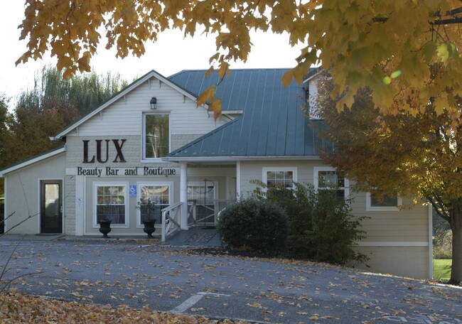
1019 Taneytown Pike
07-027931
LT - 2.76 ACS 1019 TANEYTOWN PIKE MEADOW BRANCH
Taxexempt
Carroll
AE
Maryland
24013C0183D
2.76 AC
2025
Carroll County
2025
Baltimore
507704
Baltimore-Columbia-Towson, MD
3,044 SF
DEMOGRAPHICS near 1019 Taneytown Pike
1 Mile
3 Mile
5 Mile
2024 Total Population
4,774
27,877
44,857
2029 Population
4,925
28,741
46,286
Pop Growth 2024-2029
+ 3.16%
+ 3.10%
+ 3.19%
Average Age
38
40
41
2024 Total Households
1,685
10,326
16,793
HH Growth 2024-2029
+ 3.26%
+ 3.22%
+ 3.31%
Median Household Inc
$88,690
$79,752
$87,511
Avg Household Size
2.70
2.50
2.50
2024 Avg HH Vehicles
2.00
2.00
2.00
Median Home Value
$327,077
$347,915
$359,487
Median Year Built
1987
1981
1979
Nearby Places
Map Layers
Map Styles
 Street
 Aerial
- Restaurants
- Banks
- Shops
- Fitness
- Groceries
SALE & LEASE HISTORY
LISTING DATE
SALE/LEASE

Sep 25, 2016
For Lease
Nearby Properties
Address
Land Use
TOTAL SIZE
Lot Size
Zoning
Address
Land Use
TOTAL SIZE
Lot Size
Zoning
28,080 SF
88.80 AC
R-100
Address
Land Use
TOTAL SIZE
Lot Size
Zoning
84,991 SF
24.06 AC
CONSE
Address
Land Use
TOTAL SIZE
Lot Size
Zoning
60,930 SF
18.85 AC
PLANN
Address
Land Use
TOTAL SIZE
Lot Size
Zoning
73,746 SF
27.73 AC
R-200
Address
Land Use
TOTAL SIZE
Lot Size
Zoning
4,520 SF
10.84 AC
BUSIN
Address
Land Use
TOTAL SIZE
Lot Size
Zoning
42,834 SF
12.05 AC
BUSIN
Address
Land Use
TOTAL SIZE
Lot Size
Zoning
8,372 SF
29.54 AC
R-750
Address
Land Use
TOTAL SIZE
Lot Size
Zoning
235,200 SF
24.39 AC
PLANN
Address
Land Use
TOTAL SIZE
Lot Size
Zoning
27,040 SF
9.39 AC
BUSIN
Address
Land Use
TOTAL SIZE
Lot Size
Zoning
34,200 SF
9.83 AC
R-100
Address
Land Use
TOTAL SIZE
Lot Size
Zoning
136,562 SF
25.60 AC
CONSE
Address
Land Use
TOTAL SIZE
Lot Size
Zoning
94,474 SF
5.57 AC
R-200
Address
Land Use
TOTAL SIZE
Lot Size
Zoning
17,245 SF
9.67 AC
BUSIN
Address
Land Use
TOTAL SIZE
Lot Size
Zoning
66,880 SF
1.24 AC
Address
Land Use
TOTAL SIZE
Lot Size
Zoning
125,518 SF
4.76 AC
R-200
Address
Land Use
TOTAL SIZE
Lot Size
Zoning
53,134 SF
2.84 AC
INDUS
Address
Land Use
TOTAL SIZE
Lot Size
Zoning
4,938 SF
7.76 AC
BUSIN
Address
Land Use
TOTAL SIZE
Lot Size
Zoning
64,886 SF
52.54 AC
AGRIC
Address
Land Use
TOTAL SIZE
Lot Size
Zoning
78,120 SF
1.31 AC
R-750
Address
Land Use
TOTAL SIZE
Lot Size
Zoning
74,145 SF
8.39 AC
BUSIN
Address
Land Use
TOTAL SIZE
Lot Size
Zoning
1,288 SF
6.44 AC
C-3
Address
Land Use
TOTAL SIZE
Lot Size
Zoning
62,562 SF
1.52 AC
BUSIN
Address
Land Use
TOTAL SIZE
Lot Size
Zoning
40,300 SF
17.81 AC
AGRIC
Address
Land Use
TOTAL SIZE
Lot Size
Zoning
31,900 SF
17.67 AC
I-2
Address
Land Use
TOTAL SIZE
Lot Size
Zoning
41,911 SF
1.57 AC
BUSIN
Address
Land Use
TOTAL SIZE
Lot Size
Zoning
44,800 SF
2.43 AC
NC
Address
Land Use
TOTAL SIZE
Lot Size
Zoning
151,000 SF
9 AC
INDUS
Address
Land Use
TOTAL SIZE
Lot Size
Zoning
66,999 SF
19.59 AC
CONSE
Address
Land Use
TOTAL SIZE
Lot Size
Zoning
13,358 SF
265 AC
BUSIN
Address
Land Use
TOTAL SIZE
Lot Size
Zoning
75,625 SF
6.50 AC
PLANN
The World's #1 Commercial Real Estate Marketplace
Connect with us
© 2025 CoStar Group
The information above has been obtained from sources believed reliable. While we do not doubt its accuracy we have not verified it and make no guarantee, warranty or representation about it. It is your responsibility to independently confirm its accuracy and completeness. Any projections, opinions, assumptions, or estimates used are for example only and do not represent the current or future performance of the property. The value of this transaction to you depends on tax and other factors which should be evaluated by your tax, financial, and legal advisors. You and your advisors should conduct a careful, independent investigation of the property to determine to your satisfaction the suitability of the property for your needs.