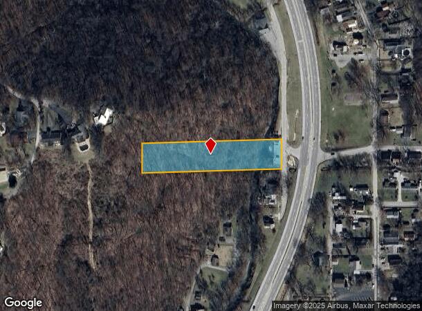
Property Record
1019 Walnut St, Madison, IN 47250

NEARBY LISTINGS FOR SALE OR LEASE
Property Detail
1019 Walnut St
39-08-35-442-044-000-007
011-02794-00 60 FT W SIDE WALNUT & DUNNS LAND 11-104.1-78 1019 WALN UT ST
Autorepair
Jefferson
AE
Indiana
21223C0007D
1.07 AC
2024
Indiana South Area
2024
Other Market Areas
966400
Madison, IN
2,150 SF
DEMOGRAPHICS near 1019 Walnut St
1 Mile
3 Mile
5 Mile
2024 Total Population
4,230
14,018
20,455
2029 Population
4,270
14,001
20,379
Pop Growth 2024-2029
+ 0.95%
(0.12%)
(0.37%)
Average Age
45
43
42
2024 Total Households
1,955
6,032
8,514
HH Growth 2024-2029
+ 0.97%
(0.13%)
(0.38%)
Median Household Inc
$49,929
$50,284
$49,993
Avg Household Size
2.00
2.10
2.20
2024 Avg HH Vehicles
2.00
2.00
2.00
Median Home Value
$171,881
$172,673
$172,001
Median Year Built
1947
1967
1971
Nearby Places
Map Layers
Map Styles
 Street
 Aerial
- Restaurants
- Banks
- Shops
- Fitness
- Groceries
SALE & LEASE HISTORY
LISTING DATE
SALE/LEASE

Sep 11, 2019
For Sale
Nearby Properties
Address
Land Use
TOTAL SIZE
Lot Size
Zoning
Address
Land Use
TOTAL SIZE
Lot Size
Zoning
73,680 SF
4.10 AC
Address
Land Use
TOTAL SIZE
Lot Size
Zoning
189,628 SF
60.30 AC
Address
Land Use
TOTAL SIZE
Lot Size
Zoning
198,900 SF
20.55 AC
Address
Land Use
TOTAL SIZE
Lot Size
Zoning
2,544 SF
2.33 AC
Address
Land Use
TOTAL SIZE
Lot Size
Zoning
280,486 SF
4.51 AC
Address
Land Use
TOTAL SIZE
Lot Size
Zoning
57,952 SF
1.08 AC
Address
Land Use
TOTAL SIZE
Lot Size
Zoning
119,041 SF
14.08 AC
Address
Land Use
TOTAL SIZE
Lot Size
Zoning
4.70 AC
Address
Land Use
TOTAL SIZE
Lot Size
Zoning
211,840 SF
30.63 AC
Address
Land Use
TOTAL SIZE
Lot Size
Zoning
42,966 SF
1.63 AC
Address
Land Use
TOTAL SIZE
Lot Size
Zoning
47,230 SF
0.40 AC
Address
Land Use
TOTAL SIZE
Lot Size
Zoning
9,768 SF
8.09 AC
Address
Land Use
TOTAL SIZE
Lot Size
Zoning
49,145 SF
3.73 AC
Address
Land Use
TOTAL SIZE
Lot Size
Zoning
189,600 SF
15 AC
Address
Land Use
TOTAL SIZE
Lot Size
Zoning
7,346 SF
1.28 AC
Address
Land Use
TOTAL SIZE
Lot Size
Zoning
58,870 SF
9.92 AC
Address
Land Use
TOTAL SIZE
Lot Size
Zoning
53,500 SF
5.82 AC
Address
Land Use
TOTAL SIZE
Lot Size
Zoning
11,664 SF
8.22 AC
Address
Land Use
TOTAL SIZE
Lot Size
Zoning
18,550 SF
0.82 AC
Address
Land Use
TOTAL SIZE
Lot Size
Zoning
14,634 SF
2.43 AC
Address
Land Use
TOTAL SIZE
Lot Size
Zoning
15,250 SF
4.89 AC
Address
Land Use
TOTAL SIZE
Lot Size
Zoning
35,200 SF
38.97 AC
Address
Land Use
TOTAL SIZE
Lot Size
Zoning
65,760 SF
7.64 AC
Address
Land Use
TOTAL SIZE
Lot Size
Zoning
25,365 SF
5.90 AC
Address
Land Use
TOTAL SIZE
Lot Size
Zoning
3,158 SF
8.26 AC
Address
Land Use
TOTAL SIZE
Lot Size
Zoning
7,835 SF
8.21 AC
Address
Land Use
TOTAL SIZE
Lot Size
Zoning
24,081 SF
0.86 AC
Address
Land Use
TOTAL SIZE
Lot Size
Zoning
4,314 SF
4.67 AC
Address
Land Use
TOTAL SIZE
Lot Size
Zoning
57,282 SF
4.23 AC
Address
Land Use
TOTAL SIZE
Lot Size
Zoning
53,526 SF
3.67 AC
The World's #1 Commercial Real Estate Marketplace
Connect with us
© 2025 CoStar Group
The information above has been obtained from sources believed reliable. While we do not doubt its accuracy we have not verified it and make no guarantee, warranty or representation about it. It is your responsibility to independently confirm its accuracy and completeness. Any projections, opinions, assumptions, or estimates used are for example only and do not represent the current or future performance of the property. The value of this transaction to you depends on tax and other factors which should be evaluated by your tax, financial, and legal advisors. You and your advisors should conduct a careful, independent investigation of the property to determine to your satisfaction the suitability of the property for your needs.