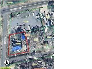
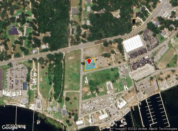
Property Record
10122 Nelle Ave, Pensacola, FL 32507
NEARBY LISTINGS FOR SALE OR LEASE
Property Detail
10122 Nelle Ave
Pensacola-Ferry Pass-Brent, FL
Quinavista
24-3S-31-1102-020-002
BEG AT SW COR BLK 2 N 74 DEG 40 MIN 0 SEC E ALG SLY LI BLK 2 130 FT N 15 DEG 20 MIN 0 SEC W 125 FT S 74 DEG 40 MIN 0 SEC W 95 73/100 FT TO ELY R/W LI CASA MARIA LN (60 FT R/W) S 0 DEG 0 MIN 0 SEC W ALG ELY R/W 129 61/100 FT TO POB BLK 2 QUINAVISTA PB
Residentialacreage
Escambia
AE
Florida
12033C0528G
20
2023
0.33 AC
2024
Perdido
002606
Pensacola
DEMOGRAPHICS near 10122 Nelle Ave
1 Mile
3 Mile
5 Mile
2024 Total Population
3,221
10,313
30,009
2029 Population
3,288
10,587
31,265
Pop Growth 2024-2029
+ 2.08%
+ 2.66%
+ 4.19%
Average Age
45
41
40
2024 Total Households
1,319
4,179
11,307
HH Growth 2024-2029
+ 2.12%
+ 2.61%
+ 4.66%
Median Household Inc
$98,144
$77,422
$68,738
Avg Household Size
2.40
2.40
2.40
2024 Avg HH Vehicles
2.00
2.00
2.00
Median Home Value
$352,621
$280,691
$264,103
Median Year Built
2001
1998
1996
Nearby Places
- Restaurants
- Banks
- Shops
- Fitness
- Groceries
PUBLIC TRANSPORTATION
AIRPORT
Pensacola International
DRIVE
WALK
Distance
Pensacola International
33 min
17.6 mi
Freight Ports
Port of Mobile
DRIVE
WALK
Distance
Port of Mobile
79 min
63.2 mi
Nearby Properties
Address
Land Use
TOTAL SIZE
Lot Size
Zoning
Address
Land Use
TOTAL SIZE
Lot Size
Zoning
124.51 AC
NONE
Address
Land Use
TOTAL SIZE
Lot Size
Zoning
73.08 AC
NONE
Address
Land Use
TOTAL SIZE
Lot Size
Zoning
199,800 SF
14.05 AC
HC/LI
Address
Land Use
TOTAL SIZE
Lot Size
Zoning
106.11 AC
NONE
Address
Land Use
TOTAL SIZE
Lot Size
Zoning
174,904 SF
12.71 AC
HC/LI
Address
Land Use
TOTAL SIZE
Lot Size
Zoning
193,561 SF
23.31 AC
COM
Address
Land Use
TOTAL SIZE
Lot Size
Zoning
72.60 AC
NONE
Address
Land Use
TOTAL SIZE
Lot Size
Zoning
174.99 AC
NONE
Address
Land Use
TOTAL SIZE
Lot Size
Zoning
153,007 SF
6.34 AC
COM
Address
Land Use
TOTAL SIZE
Lot Size
Zoning
208,596 SF
24.30 AC
COM
Address
Land Use
TOTAL SIZE
Lot Size
Zoning
53.94 AC
NONE
Address
Land Use
TOTAL SIZE
Lot Size
Zoning
20,818 SF
104.24 AC
NONE
Address
Land Use
TOTAL SIZE
Lot Size
Zoning
39 AC
NONE
Address
Land Use
TOTAL SIZE
Lot Size
Zoning
193,348 SF
29 AC
COM,HDR
Address
Land Use
TOTAL SIZE
Lot Size
Zoning
138,339 SF
57.97 AC
LDR
Address
Land Use
TOTAL SIZE
Lot Size
Zoning
128,434 SF
10.62 AC
COM
Address
Land Use
TOTAL SIZE
Lot Size
Zoning
54,693 SF
38.57 AC
COM,MDR
Address
Land Use
TOTAL SIZE
Lot Size
Zoning
36,960 SF
15.78 AC
COM
Address
Land Use
TOTAL SIZE
Lot Size
Zoning
41,837 SF
16.61 AC
MDR
Address
Land Use
TOTAL SIZE
Lot Size
Zoning
22,320 SF
2.05 AC
HDMU
Address
Land Use
TOTAL SIZE
Lot Size
Zoning
64,000 SF
4.72 AC
COM
Address
Land Use
TOTAL SIZE
Lot Size
Zoning
24,200 SF
3 AC
COM
Address
Land Use
TOTAL SIZE
Lot Size
Zoning
20,157 SF
2.60 AC
COM
Address
Land Use
TOTAL SIZE
Lot Size
Zoning
17,664 SF
0.82 AC
HDMU
Address
Land Use
TOTAL SIZE
Lot Size
Zoning
2,500 SF
32.40 AC
HC/LI
Address
Land Use
TOTAL SIZE
Lot Size
Zoning
19,038 SF
4.63 AC
COM
Address
Land Use
TOTAL SIZE
Lot Size
Zoning
48,126 SF
6.88 AC
HDMU
Address
Land Use
TOTAL SIZE
Lot Size
Zoning
9,621 SF
1.01 AC
COM
Address
Land Use
TOTAL SIZE
Lot Size
Zoning
5,685 SF
9.87 AC
COM
Address
Land Use
TOTAL SIZE
Lot Size
Zoning
47,000 SF
5.05 AC
COM
The World's #1 Commercial Real Estate Marketplace
Connect with us
© 2025 CoStar Group
The information above has been obtained from sources believed reliable. While we do not doubt its accuracy we have not verified it and make no guarantee, warranty or representation about it. It is your responsibility to independently confirm its accuracy and completeness. Any projections, opinions, assumptions, or estimates used are for example only and do not represent the current or future performance of the property. The value of this transaction to you depends on tax and other factors which should be evaluated by your tax, financial, and legal advisors. You and your advisors should conduct a careful, independent investigation of the property to determine to your satisfaction the suitability of the property for your needs.