Property Record
101St St, Lemont, IL 60439
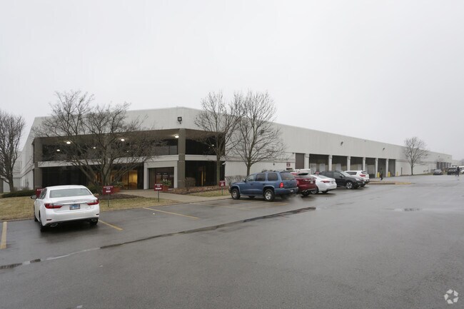

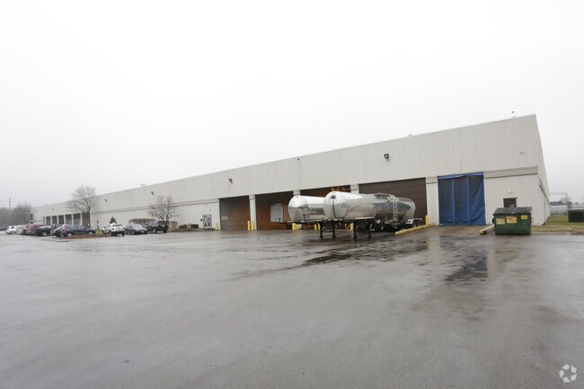
Property Detail
101St St
10-08-305-004
SANTE FE ARGONNE II ASSESSMENT PLAT NO 1 /EX HWY DESC 98-144001/
Industrialgeneral
DUPAGE
I
Illinois
B and X Area of moderate flood hazard, usually the area between the limits of the 100-year and 500-year floods.
2
2024
10.94 AC
2024
South I-55 Corridor
824003
Chicago
248,971 SF
Chicago-Naperville-Elgin, IL-IN
NEARBY LISTINGS FOR SALE OR LEASE
DEMOGRAPHICS near 101St St
1 mile
3 mile
5 mile
2025 Total Population
1,610
46,414
163,818
2030 Population
1,629
46,892
166,223
Pop Growth 2025-2030
+ 1.18%
+ 1.03%
+ 1.47%
Average Age
45
43
42
2025 Total Households
588
17,129
61,355
HH Growth 2025-2030
+ 1.19%
+ 0.97%
+ 1.50%
Median Household Inc
$123,386
$106,963
$99,626
Avg Household Size
2.70
2.60
2.60
2025 Avg HH Vehicles
2.00
2.00
2.00
Median Home Value
$453,296
$365,711
$366,112
Median Year Built
1990
1981
1978
Nearby Places
Map Layers
Map Styles
 Street
 Aerial
Transit
 Traffic
 Biking
Places
Listings with unknown addresses are not visible on the map
- Restaurants
- Banks
- Shops
- Fitness
- Groceries
PUBLIC TRANSPORTATION
COMMUTER RAIL
Lemont Station (Heritage Corridor Line - Northeast Illinois Regional Commuter Railroad (Metra))
Drive
Walk
Distance
Lemont Station (Heritage Corridor Line - Northeast Illinois Regional Commuter Railroad (Metra))
5 min
2.5 mi
Romeoville (Heritage Corridor - Metra)
Drive
Walk
Distance
Romeoville (Heritage Corridor - Metra)
13 min
6.7 mi
AIRPORT
Chicago Midway International
Drive
Walk
Distance
Chicago Midway International
23 min
16.0 mi
Chicago O'Hare International
Drive
Walk
Distance
Chicago O'Hare International
40 min
27.5 mi
Freight Ports
Port Milwaukee
Drive
Walk
Distance
Port Milwaukee
121 min
99.2 mi
Nearby Properties
Address
Land Use
TOTAL SIZE
Lot Size
Zoning
Address
Land Use
TOTAL SIZE
Lot Size
Zoning
21,520 SF
32.67 AC
Address
Land Use
TOTAL SIZE
Lot Size
Zoning
373,827 SF
21.30 AC
Address
Land Use
TOTAL SIZE
Lot Size
Zoning
759,709 SF
41.75 AC
Address
Land Use
TOTAL SIZE
Lot Size
Zoning
21.12 AC
Address
Land Use
TOTAL SIZE
Lot Size
Zoning
48.48 AC
Address
Land Use
TOTAL SIZE
Lot Size
Zoning
49.91 AC
Address
Land Use
TOTAL SIZE
Lot Size
Zoning
334,656 SF
17.72 AC
I
Address
Land Use
TOTAL SIZE
Lot Size
Zoning
353,286 SF
19.84 AC
Address
Land Use
TOTAL SIZE
Lot Size
Zoning
28.89 AC
Address
Land Use
TOTAL SIZE
Lot Size
Zoning
264,310 SF
12.21 AC
I
Address
Land Use
TOTAL SIZE
Lot Size
Zoning
18.82 AC
Address
Land Use
TOTAL SIZE
Lot Size
Zoning
581,000 SF
28.56 AC
Address
Land Use
TOTAL SIZE
Lot Size
Zoning
513,805 SF
23.84 AC
Address
Land Use
TOTAL SIZE
Lot Size
Zoning
500,160 SF
25.07 AC
Address
Land Use
TOTAL SIZE
Lot Size
Zoning
143,024 SF
21.50 AC
Address
Land Use
TOTAL SIZE
Lot Size
Zoning
13.42 AC
Address
Land Use
TOTAL SIZE
Lot Size
Zoning
351,257 SF
16.39 AC
I
Address
Land Use
TOTAL SIZE
Lot Size
Zoning
432,522 SF
20.38 AC
Address
Land Use
TOTAL SIZE
Lot Size
Zoning
396,546 SF
20.33 AC
I
Address
Land Use
TOTAL SIZE
Lot Size
Zoning
367,990 SF
17.32 AC
I
Address
Land Use
TOTAL SIZE
Lot Size
Zoning
Address
Land Use
TOTAL SIZE
Lot Size
Zoning
314,196 SF
21.08 AC
Address
Land Use
TOTAL SIZE
Lot Size
Zoning
263,010 SF
13.56 AC
I
Address
Land Use
TOTAL SIZE
Lot Size
Zoning
416,640 SF
24.17 AC
Address
Land Use
TOTAL SIZE
Lot Size
Zoning
3,913 SF
16.86 AC
Address
Land Use
TOTAL SIZE
Lot Size
Zoning
13.09 AC
C
Address
Land Use
TOTAL SIZE
Lot Size
Zoning
31.43 AC
Address
Land Use
TOTAL SIZE
Lot Size
Zoning
356,521 SF
16.32 AC
Address
Land Use
TOTAL SIZE
Lot Size
Zoning
148,044 SF
10.44 AC
Address
Land Use
TOTAL SIZE
Lot Size
Zoning
256,880 SF
15.38 AC
The World's #1 Commercial Real Estate Marketplace
Connect with us
© 2026 CoStar Group
The information above has been obtained from sources believed reliable. While we do not doubt its accuracy we have not verified it and make no guarantee, warranty or representation about it. It is your responsibility to independently confirm its accuracy and completeness. Any projections, opinions, assumptions, or estimates used are for example only and do not represent the current or future performance of the property. The value of this transaction to you depends on tax and other factors which should be evaluated by your tax, financial, and legal advisors. You and your advisors should conduct a careful, independent investigation of the property to determine to your satisfaction the suitability of the property for your needs.