Property Record
102 Cokesbury Rd, Lebanon, NJ 08833

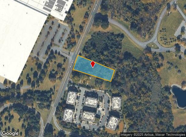

This Property Is For Sale
NEARBY LISTINGS FOR SALE OR LEASE
Property Detail
102 Cokesbury Rd
06-00003-0000-00028
Hunterdon
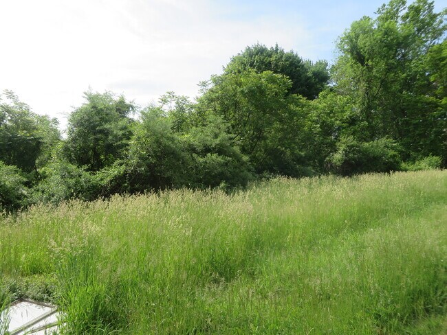
Vacantlandnec
New Jersey
X
28
34019C0139F
1.19 AC
2024
Route 78 West
2025
Northern New Jersey
011001
Newark, NJ-PA
DEMOGRAPHICS near 102 Cokesbury Rd
1 Mile
3 Mile
5 Mile
2024 Total Population
2,145
9,968
33,773
2029 Population
2,154
10,071
34,234
Pop Growth 2024-2029
+ 0.42%
+ 1.03%
+ 1.36%
Average Age
44
42
44
2024 Total Households
957
3,555
12,939
HH Growth 2024-2029
+ 0.31%
+ 1.24%
+ 1.45%
Median Household Inc
$118,198
$138,006
$129,904
Avg Household Size
2.20
2.50
2.50
2024 Avg HH Vehicles
2.00
2.00
2.00
Median Home Value
$400,311
$491,387
$465,961
Median Year Built
1982
1979
1979
Nearby Places
- Restaurants
- Banks
- Shops
- Fitness
- Groceries
PUBLIC TRANSPORTATION
COMMUTER RAIL
Lebanon (Raritan Valley Line - NJ Transit Commuter Rail (NJ Transit))
DRIVE
WALK
Distance
Lebanon (Raritan Valley Line - NJ Transit Commuter Rail (NJ Transit))
4 min
1.2 mi
Annandale (Raritan Valley Line - NJ Transit Commuter Rail (NJ Transit))
DRIVE
WALK
Distance
Annandale (Raritan Valley Line - NJ Transit Commuter Rail (NJ Transit))
6 min
3.0 mi
AIRPORT
Trenton Mercer
DRIVE
WALK
Distance
Trenton Mercer
53 min
34.1 mi
Lehigh Valley International
DRIVE
WALK
Distance
Lehigh Valley International
54 min
36.6 mi
Newark Liberty International
DRIVE
WALK
Distance
Newark Liberty International
47 min
39.5 mi
Freight Ports
Maher Terminal
DRIVE
WALK
Distance
Maher Terminal
51 min
40.1 mi
Nearby Properties
Address
Land Use
TOTAL SIZE
Lot Size
Zoning
Address
Land Use
TOTAL SIZE
Lot Size
Zoning
84.62 AC
ROM1
Address
Land Use
TOTAL SIZE
Lot Size
Zoning
3,703.19 AC
RC
Address
Land Use
TOTAL SIZE
Lot Size
Zoning
29,982 SF
7.76 AC
Address
Land Use
TOTAL SIZE
Lot Size
Zoning
76.99 AC
ROM2
Address
Land Use
TOTAL SIZE
Lot Size
Zoning
20 AC
AR
Address
Land Use
TOTAL SIZE
Lot Size
Zoning
40.13 AC
AH2
Address
Land Use
TOTAL SIZE
Lot Size
Zoning
Address
Land Use
TOTAL SIZE
Lot Size
Zoning
10,863 SF
77 AC
ROM1
Address
Land Use
TOTAL SIZE
Lot Size
Zoning
261.91 AC
RC
Address
Land Use
TOTAL SIZE
Lot Size
Zoning
9,408 SF
37 AC
ROM1
Address
Land Use
TOTAL SIZE
Lot Size
Zoning
20,764 SF
21.01 AC
ROM1
Address
Land Use
TOTAL SIZE
Lot Size
Zoning
4,990 SF
254.59 AC
AH1
Address
Land Use
TOTAL SIZE
Lot Size
Zoning
4.61 AC
Address
Land Use
TOTAL SIZE
Lot Size
Zoning
1,620 SF
15.85 AC
C2
Address
Land Use
TOTAL SIZE
Lot Size
Zoning
25 AC
RC
Address
Land Use
TOTAL SIZE
Lot Size
Zoning
1,056 SF
4 AC
Address
Land Use
TOTAL SIZE
Lot Size
Zoning
4.70 AC
Address
Land Use
TOTAL SIZE
Lot Size
Zoning
8.50 AC
Address
Land Use
TOTAL SIZE
Lot Size
Zoning
9,200 SF
10.95 AC
Address
Land Use
TOTAL SIZE
Lot Size
Zoning
7,782 SF
10 AC
ROM2
Address
Land Use
TOTAL SIZE
Lot Size
Zoning
Address
Land Use
TOTAL SIZE
Lot Size
Zoning
11,584 SF
4.17 AC
C1
Address
Land Use
TOTAL SIZE
Lot Size
Zoning
26 AC
RO
Address
Land Use
TOTAL SIZE
Lot Size
Zoning
2.19 AC
Address
Land Use
TOTAL SIZE
Lot Size
Zoning
21.27 AC
Address
Land Use
TOTAL SIZE
Lot Size
Zoning
0.83 AC
Address
Land Use
TOTAL SIZE
Lot Size
Zoning
6.56 AC
ROM3
Address
Land Use
TOTAL SIZE
Lot Size
Zoning
10.44 AC
PUD
Address
Land Use
TOTAL SIZE
Lot Size
Zoning
3.23 AC
B
Address
Land Use
TOTAL SIZE
Lot Size
Zoning
21,528 SF
2.43 AC
HL
The World's #1 Commercial Real Estate Marketplace
Connect with us
© 2025 CoStar Group
The information above has been obtained from sources believed reliable. While we do not doubt its accuracy we have not verified it and make no guarantee, warranty or representation about it. It is your responsibility to independently confirm its accuracy and completeness. Any projections, opinions, assumptions, or estimates used are for example only and do not represent the current or future performance of the property. The value of this transaction to you depends on tax and other factors which should be evaluated by your tax, financial, and legal advisors. You and your advisors should conduct a careful, independent investigation of the property to determine to your satisfaction the suitability of the property for your needs.