Property Record
102 E Bay St, Savannah, GA 31401


Save to a Folder
{{folder.Name}}
{{folder.ListingIds.length}} Properties
{{folder.ListingIds.length}} Property
Create a New Folder
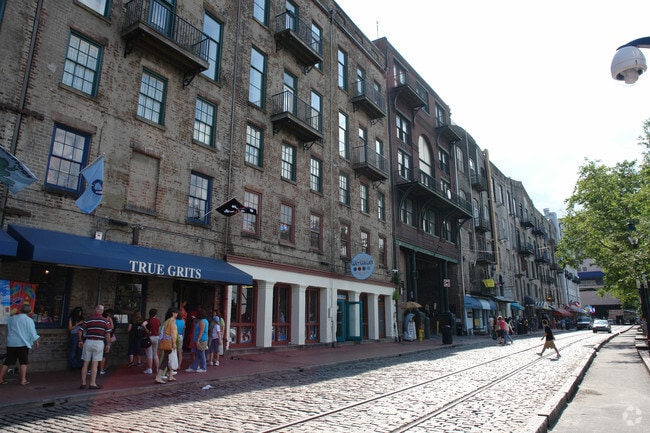
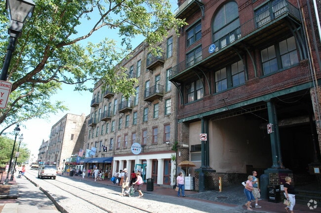
Property Detail
102 E Bay St
2000410001A
REAR WHARF LT 6 EAST OF BULL ST
Hotel
CHATHAM
BB
Georgia
AE The base floodplain where base flood elevations are provided. AE Zones are now used on new format FIRMs instead of A1-A30 Zones.
6
2025
0.16 AC
2025
Downtown Savannah
011900
Savannah
7,000 SF
Savannah, GA
NEARBY LISTINGS FOR SALE OR LEASE
DEMOGRAPHICS near 102 E Bay St
1 mile
3 mile
5 mile
2025 Total Population
12,791
67,905
116,425
2030 Population
13,741
71,848
122,581
Pop Growth 2025-2030
+ 7.43%
+ 5.81%
+ 5.29%
Average Age
35
38
38
2025 Total Households
5,426
28,738
47,036
HH Growth 2025-2030
+ 8.94%
+ 6.28%
+ 5.69%
Median Household Inc
$61,367
$50,616
$51,403
Avg Household Size
1.80
2.20
2.20
2025 Avg HH Vehicles
1.00
1.00
1.00
Median Home Value
$821,860
$306,774
$286,549
Median Year Built
1950
1953
1961
Nearby Places
Map Layers
Map Styles
 Street
 Aerial
Layers
 Traffic
 Biking
Places
Listings with unknown addresses are not visible on the map
- Restaurants
- Banks
- Shops
- Fitness
- Groceries
PUBLIC TRANSPORTATION
COMMUTER RAIL
Drive
Walk
Distance
10 min
4.4 mi
AIRPORT
Savannah/Hilton Head International
Drive
Walk
Distance
Savannah/Hilton Head International
20 min
9.9 mi
Hilton Head
Drive
Walk
Distance
Hilton Head
61 min
37.5 mi
Freight Ports
Georgia Ports - Savannah
Drive
Walk
Distance
Georgia Ports - Savannah
16 min
7.1 mi
Nearby Properties
Address
Land Use
TOTAL SIZE
Lot Size
Zoning
Address
Land Use
TOTAL SIZE
Lot Size
Zoning
1,400 SF
6.97 AC
D-X
Address
Land Use
TOTAL SIZE
Lot Size
Zoning
7,500 SF
382.12 AC
I-H
Address
Land Use
TOTAL SIZE
Lot Size
Zoning
22.34 AC
PUDBW
Address
Land Use
TOTAL SIZE
Lot Size
Zoning
453,984 SF
10.42 AC
Address
Land Use
TOTAL SIZE
Lot Size
Zoning
31,396 SF
1.69 AC
BG
Address
Land Use
TOTAL SIZE
Lot Size
Zoning
86,336 SF
1.08 AC
BB
Address
Land Use
TOTAL SIZE
Lot Size
Zoning
354,322 SF
6.30 AC
IH
Address
Land Use
TOTAL SIZE
Lot Size
Zoning
4,930 SF
1.18 AC
I-L
Address
Land Use
TOTAL SIZE
Lot Size
Zoning
421 SF
6.82 AC
PUDBW
Address
Land Use
TOTAL SIZE
Lot Size
Zoning
351,297 SF
2.08 AC
BC1
Address
Land Use
TOTAL SIZE
Lot Size
Zoning
124,080 SF
1.66 AC
BB
Address
Land Use
TOTAL SIZE
Lot Size
Zoning
173,554 SF
0.72 AC
BB
Address
Land Use
TOTAL SIZE
Lot Size
Zoning
108,273 SF
18.20 AC
PUDBC
Address
Land Use
TOTAL SIZE
Lot Size
Zoning
33,000 SF
1.92 AC
I-L
Address
Land Use
TOTAL SIZE
Lot Size
Zoning
199,424 SF
2.49 AC
BN
Address
Land Use
TOTAL SIZE
Lot Size
Zoning
116,928 SF
1.10 AC
BB
Address
Land Use
TOTAL SIZE
Lot Size
Zoning
84,560 SF
0.31 AC
BC1
Address
Land Use
TOTAL SIZE
Lot Size
Zoning
77,610 SF
0.33 AC
BC1
Address
Land Use
TOTAL SIZE
Lot Size
Zoning
245,610 SF
1.10 AC
RIPC
Address
Land Use
TOTAL SIZE
Lot Size
Zoning
92,132 SF
4.92 AC
PUDBW
Address
Land Use
TOTAL SIZE
Lot Size
Zoning
115,069 SF
1.14 AC
BC1
Address
Land Use
TOTAL SIZE
Lot Size
Zoning
9,303 SF
9.84 AC
PUDM
Address
Land Use
TOTAL SIZE
Lot Size
Zoning
120,084 SF
0.48 AC
BC1
Address
Land Use
TOTAL SIZE
Lot Size
Zoning
384,000 SF
48.45 AC
I-H
Address
Land Use
TOTAL SIZE
Lot Size
Zoning
116,000 SF
0.53 AC
BB
Address
Land Use
TOTAL SIZE
Lot Size
Zoning
400,000 SF
1.12 AC
I-L
Address
Land Use
TOTAL SIZE
Lot Size
Zoning
0.49 AC
BC1
Address
Land Use
TOTAL SIZE
Lot Size
Zoning
9 AC
RMF-2-35
Address
Land Use
TOTAL SIZE
Lot Size
Zoning
7,900 SF
1.98 AC
RIPB1
Address
Land Use
TOTAL SIZE
Lot Size
Zoning
60,911 SF
0.17 AC
BB
The World's #1 Commercial Real Estate Marketplace
Connect with us
© 2026 CoStar Group
The information above has been obtained from sources believed reliable. While we do not doubt its accuracy we have not verified it and make no guarantee, warranty or representation about it. It is your responsibility to independently confirm its accuracy and completeness. Any projections, opinions, assumptions, or estimates used are for example only and do not represent the current or future performance of the property. The value of this transaction to you depends on tax and other factors which should be evaluated by your tax, financial, and legal advisors. You and your advisors should conduct a careful, independent investigation of the property to determine to your satisfaction the suitability of the property for your needs.