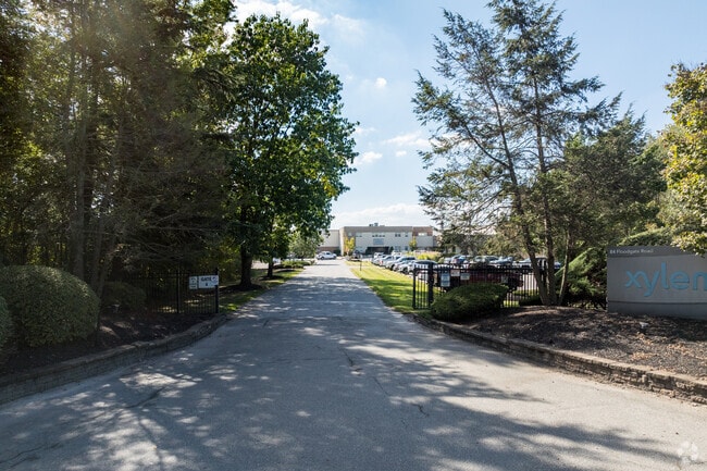
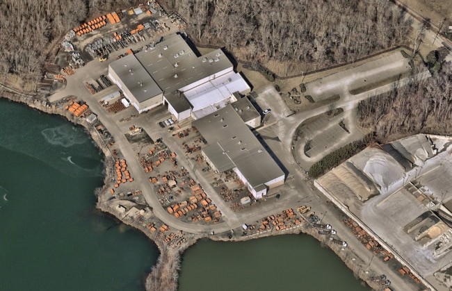
Property Record
102 Floodgate Rd, Swedesboro, NJ 08085
Property Detail
102 Floodgate Rd
09-00501-0000-00031
GLOUCESTER
Warehouse
New Jersey
R5
33
AE The base floodplain where base flood elevations are provided. AE Zones are now used on new format FIRMs instead of A1-A30 Zones.
87.76 AC
2024
Gloucester County
2025
Philadelphia
502400
Philadelphia-Camden-Wilmington, PA-NJ-DE-MD
5,931 SF
NEARBY LISTINGS FOR SALE OR LEASE
DEMOGRAPHICS near 102 Floodgate Rd
1 mile
3 mile
5 mile
2025 Total Population
124
6,478
117,257
2030 Population
128
6,657
120,797
Pop Growth 2025-2030
+ 3.23%
+ 2.76%
+ 3.02%
Average Age
43
42
39
2025 Total Households
48
1,999
43,953
HH Growth 2025-2030
+ 4.17%
+ 3.35%
+ 3.08%
Median Household Inc
$89,062
$89,106
$65,980
Avg Household Size
2.60
2.60
2.60
2025 Avg HH Vehicles
3.00
2.00
2.00
Median Home Value
$221,428
$246,730
$233,418
Median Year Built
1950
1954
1955
Nearby Places
Map Layers
Map Styles
 Street
 Aerial
Layers
 Traffic
 Biking
Places
Listings with unknown addresses are not visible on the map
- Restaurants
- Banks
- Shops
- Fitness
- Groceries
PUBLIC TRANSPORTATION
COMMUTER RAIL
Chester Transit Center (Wilmington/Newark Line - SEPTA)
Drive
Walk
Distance
Chester Transit Center (Wilmington/Newark Line - SEPTA)
16 min
8.2 mi
Eddystone (R2 - Southeastern Pennsylvania Transportation Authority Regional Rail (SEPTA Regional Rail))
Drive
Walk
Distance
Eddystone (R2 - Southeastern Pennsylvania Transportation Authority Regional Rail (SEPTA Regional Rail))
19 min
9.2 mi
AIRPORT
Philadelphia International
Drive
Walk
Distance
Philadelphia International
26 min
14.6 mi
Freight Ports
Port of Wilmington, RI
Drive
Walk
Distance
Port of Wilmington, RI
32 min
20.2 mi
Nearby Properties
Address
Land Use
TOTAL SIZE
Lot Size
Zoning
Address
Land Use
TOTAL SIZE
Lot Size
Zoning
11,013 SF
209.88 AC
RCC
Address
Land Use
TOTAL SIZE
Lot Size
Zoning
508,070 SF
65.06 AC
Address
Land Use
TOTAL SIZE
Lot Size
Zoning
66.85 AC
R5
Address
Land Use
TOTAL SIZE
Lot Size
Zoning
27.69 AC
RCC
Address
Land Use
TOTAL SIZE
Lot Size
Zoning
13.94 AC
RCC
Address
Land Use
TOTAL SIZE
Lot Size
Zoning
28 AC
IC
Address
Land Use
TOTAL SIZE
Lot Size
Zoning
20.24 AC
RCC
Address
Land Use
TOTAL SIZE
Lot Size
Zoning
4,701 SF
48.76 AC
LI
Address
Land Use
TOTAL SIZE
Lot Size
Zoning
18.40 AC
RCC
Address
Land Use
TOTAL SIZE
Lot Size
Zoning
25.67 AC
Address
Land Use
TOTAL SIZE
Lot Size
Zoning
88,396 SF
58 AC
Address
Land Use
TOTAL SIZE
Lot Size
Zoning
2,106 SF
18.79 AC
Address
Land Use
TOTAL SIZE
Lot Size
Zoning
994 AC
R3
Address
Land Use
TOTAL SIZE
Lot Size
Zoning
1,975 SF
22.35 AC
LI
Address
Land Use
TOTAL SIZE
Lot Size
Zoning
52.70 AC
Address
Land Use
TOTAL SIZE
Lot Size
Zoning
Address
Land Use
TOTAL SIZE
Lot Size
Zoning
10.13 AC
Address
Land Use
TOTAL SIZE
Lot Size
Zoning
46 AC
RC
Address
Land Use
TOTAL SIZE
Lot Size
Zoning
5.72 AC
R3
Address
Land Use
TOTAL SIZE
Lot Size
Zoning
15,000 SF
21.40 AC
Address
Land Use
TOTAL SIZE
Lot Size
Zoning
36.61 AC
RC
Address
Land Use
TOTAL SIZE
Lot Size
Zoning
220,480 SF
50 AC
Address
Land Use
TOTAL SIZE
Lot Size
Zoning
2,336 SF
1 AC
LI
Address
Land Use
TOTAL SIZE
Lot Size
Zoning
519,590 SF
10.40 AC
Address
Land Use
TOTAL SIZE
Lot Size
Zoning
1,000 SF
15.15 AC
LI
Address
Land Use
TOTAL SIZE
Lot Size
Zoning
11.27 AC
RCC
Address
Land Use
TOTAL SIZE
Lot Size
Zoning
22.68 AC
RC
Address
Land Use
TOTAL SIZE
Lot Size
Zoning
Address
Land Use
TOTAL SIZE
Lot Size
Zoning
390 SF
4.37 AC
LI
Address
Land Use
TOTAL SIZE
Lot Size
Zoning
684 SF
6.17 AC
LI
The World's #1 Commercial Real Estate Marketplace
Connect with us
© 2026 CoStar Group
The information above has been obtained from sources believed reliable. While we do not doubt its accuracy we have not verified it and make no guarantee, warranty or representation about it. It is your responsibility to independently confirm its accuracy and completeness. Any projections, opinions, assumptions, or estimates used are for example only and do not represent the current or future performance of the property. The value of this transaction to you depends on tax and other factors which should be evaluated by your tax, financial, and legal advisors. You and your advisors should conduct a careful, independent investigation of the property to determine to your satisfaction the suitability of the property for your needs.