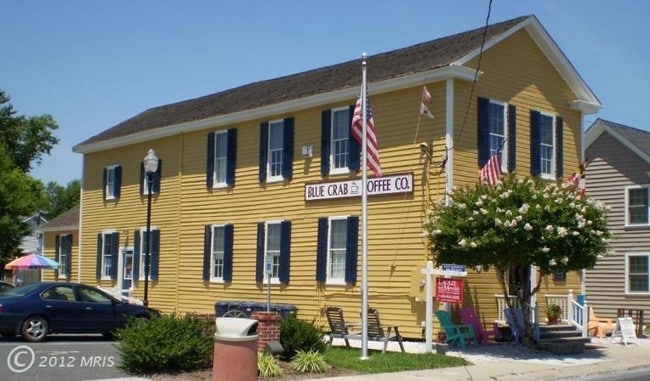
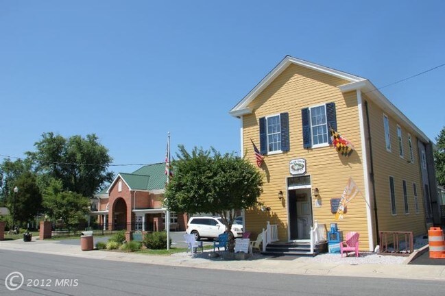
Property Record
102 Freemont St, Saint Michaels, MD 21663
NEARBY LISTINGS FOR SALE OR LEASE
Property Detail
102 Freemont St
Easton, MD
Plat Showing The Lands Of 102 Fremont St
02-112671
LOT 3,657 SF W/S FREMONT STREET ST MICHAELS
Storebuilding
Talbot
X
Maryland
24041C0161D
3,657
2025
0.08 AC
2025
Chesapeake Bay/Salisbury
960700
Other Market Areas
2,685 SF
DEMOGRAPHICS near 102 Freemont St
1 mile
3 mile
5 mile
2024 Total Population
1,316
3,379
5,857
2029 Population
1,316
3,432
5,962
Pop Growth 2024-2029
0.00%
+ 1.57%
+ 1.79%
Average Age
48
52
52
2024 Total Households
628
1,641
2,750
HH Growth 2024-2029
0.00%
+ 1.58%
+ 1.75%
Median Household Inc
$69,776
$76,074
$95,087
Avg Household Size
2.10
2.10
2.10
2024 Avg HH Vehicles
2.00
2.00
2.00
Median Home Value
$511,364
$622,531
$648,002
Median Year Built
1971
1977
1978
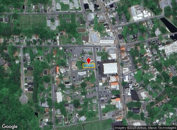
Nearby Places
Map Layers
Map Styles
 Street
 Aerial
Transit
 Traffic
 Biking
Places
Listings with unknown addresses are not visible on the map
- Restaurants
- Banks
- Shops
- Fitness
- Groceries
SALE & LEASE HISTORY
LISTING DATE
SALE/LEASE

Sep 23, 2016
For Sale
Nearby Properties
Address
Land Use
TOTAL SIZE
Lot Size
Zoning
Address
Land Use
TOTAL SIZE
Lot Size
Zoning
78,757 SF
38.03 AC
Address
Land Use
TOTAL SIZE
Lot Size
Zoning
3,640 SF
24.33 AC
Address
Land Use
TOTAL SIZE
Lot Size
Zoning
12,167 SF
75.98 AC
Address
Land Use
TOTAL SIZE
Lot Size
Zoning
768 SF
4.80 AC
Address
Land Use
TOTAL SIZE
Lot Size
Zoning
7,686 SF
11.31 AC
Address
Land Use
TOTAL SIZE
Lot Size
Zoning
17,094 SF
188.05 AC
Address
Land Use
TOTAL SIZE
Lot Size
Zoning
7,051 SF
91.14 AC
Address
Land Use
TOTAL SIZE
Lot Size
Zoning
9,968 SF
91.44 AC
Address
Land Use
TOTAL SIZE
Lot Size
Zoning
8,720 SF
57.71 AC
A5
Address
Land Use
TOTAL SIZE
Lot Size
Zoning
13,986 SF
8.60 AC
Address
Land Use
TOTAL SIZE
Lot Size
Zoning
9,552 SF
62.35 AC
Address
Land Use
TOTAL SIZE
Lot Size
Zoning
9,671 SF
9.72 AC
Address
Land Use
TOTAL SIZE
Lot Size
Zoning
7,540 SF
17.55 AC
Address
Land Use
TOTAL SIZE
Lot Size
Zoning
48,886 SF
4.60 AC
Address
Land Use
TOTAL SIZE
Lot Size
Zoning
8,360 SF
4.12 AC
Address
Land Use
TOTAL SIZE
Lot Size
Zoning
7,247 SF
43.88 AC
Address
Land Use
TOTAL SIZE
Lot Size
Zoning
7,488 SF
7.87 AC
Address
Land Use
TOTAL SIZE
Lot Size
Zoning
11,675 SF
12.55 AC
Address
Land Use
TOTAL SIZE
Lot Size
Zoning
6,750 SF
155.37 AC
Address
Land Use
TOTAL SIZE
Lot Size
Zoning
9,769 SF
5.94 AC
Address
Land Use
TOTAL SIZE
Lot Size
Zoning
10,154 SF
11.72 AC
Address
Land Use
TOTAL SIZE
Lot Size
Zoning
8,914 SF
11.21 AC
Address
Land Use
TOTAL SIZE
Lot Size
Zoning
8,488 SF
2.35 AC
Address
Land Use
TOTAL SIZE
Lot Size
Zoning
8,233 SF
2.25 AC
Address
Land Use
TOTAL SIZE
Lot Size
Zoning
9,062 SF
3.03 AC
Address
Land Use
TOTAL SIZE
Lot Size
Zoning
7,117 SF
13.58 AC
Address
Land Use
TOTAL SIZE
Lot Size
Zoning
7,415 SF
13.77 AC
Address
Land Use
TOTAL SIZE
Lot Size
Zoning
5,645 SF
2.04 AC
Address
Land Use
TOTAL SIZE
Lot Size
Zoning
4,864 SF
27.13 AC
Address
Land Use
TOTAL SIZE
Lot Size
Zoning
8,416 SF
8.95 AC
The World's #1 Commercial Real Estate Marketplace
Connect with us
© 2026 CoStar Group
The information above has been obtained from sources believed reliable. While we do not doubt its accuracy we have not verified it and make no guarantee, warranty or representation about it. It is your responsibility to independently confirm its accuracy and completeness. Any projections, opinions, assumptions, or estimates used are for example only and do not represent the current or future performance of the property. The value of this transaction to you depends on tax and other factors which should be evaluated by your tax, financial, and legal advisors. You and your advisors should conduct a careful, independent investigation of the property to determine to your satisfaction the suitability of the property for your needs.