Property Record
102 Juliustown Rd, Browns Mills, NJ 08015
NEARBY LISTINGS FOR SALE OR LEASE
Property Detail
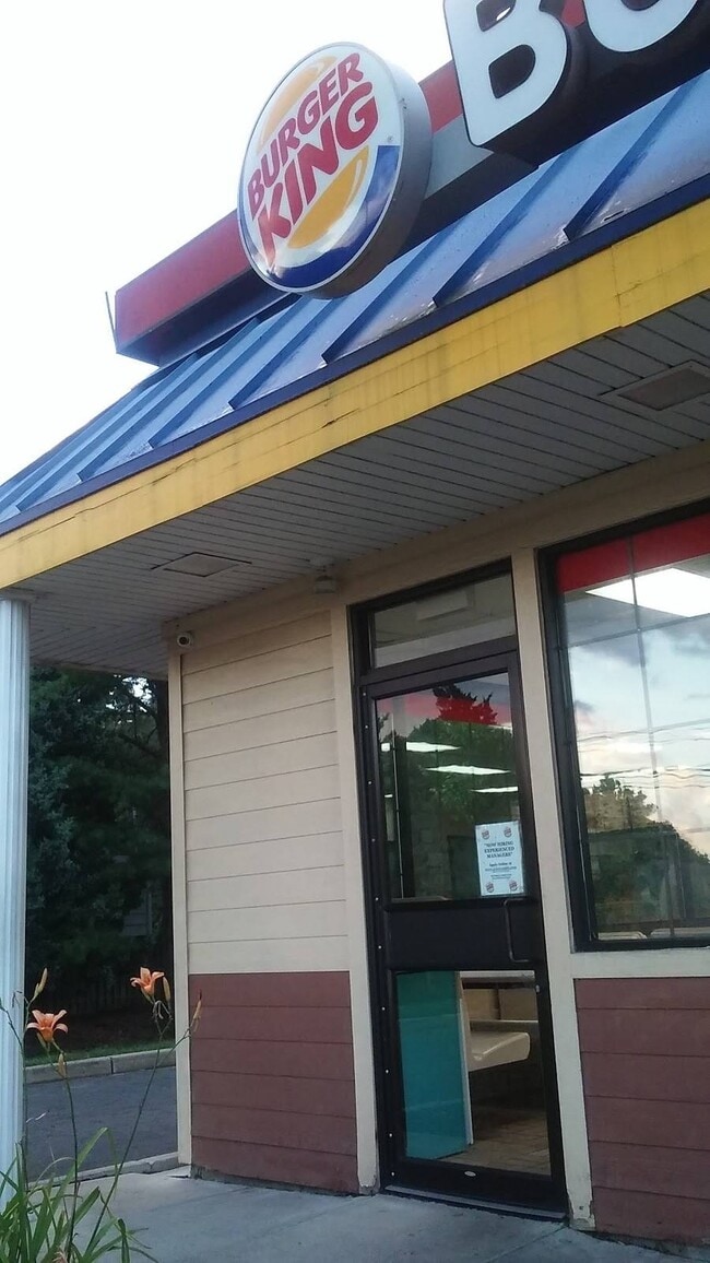
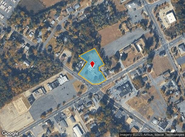
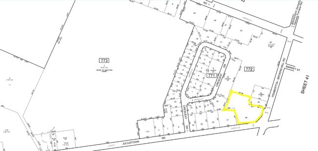
102 Juliustown Rd
29-00772-0000-00039
80% BLDG.ASSMT.2000
Restaurantdrivein
Burlington
X
New Jersey
34005C0302F
39
2024
1.32 AC
2025
South Burlington County
702210
Philadelphia
2,824 SF
Philadelphia-Camden-Wilmington, PA-NJ-DE-MD
DEMOGRAPHICS near 102 Juliustown Rd
1 Mile
3 Mile
5 Mile
2024 Total Population
6,109
16,341
32,589
2029 Population
6,283
16,792
33,276
Pop Growth 2024-2029
+ 2.85%
+ 2.76%
+ 2.11%
Average Age
40
41
39
2024 Total Households
2,305
5,935
10,439
HH Growth 2024-2029
+ 2.91%
+ 2.86%
+ 2.29%
Median Household Inc
$55,731
$70,463
$78,046
Avg Household Size
2.60
2.60
2.70
2024 Avg HH Vehicles
2.00
2.00
2.00
Median Home Value
$172,198
$168,822
$182,423
Median Year Built
1974
1973
1975
Nearby Places
Map Layers
Map Styles
 Street
 Aerial
- Restaurants
- Banks
- Shops
- Fitness
- Groceries
PUBLIC TRANSPORTATION
AIRPORT
Trenton Mercer
DRIVE
WALK
Distance
Trenton Mercer
51 min
32.5 mi
Philadelphia International
DRIVE
WALK
Distance
Philadelphia International
66 min
43.8 mi
Freight Ports
South Jersey Port
DRIVE
WALK
Distance
South Jersey Port
49 min
30.6 mi
Nearby Properties
Address
Land Use
TOTAL SIZE
Lot Size
Zoning
Address
Land Use
TOTAL SIZE
Lot Size
Zoning
4.95 AC
Address
Land Use
TOTAL SIZE
Lot Size
Zoning
21.97 AC
Address
Land Use
TOTAL SIZE
Lot Size
Zoning
1,812.67 AC
Address
Land Use
TOTAL SIZE
Lot Size
Zoning
38.59 AC
Address
Land Use
TOTAL SIZE
Lot Size
Zoning
31.07 AC
Address
Land Use
TOTAL SIZE
Lot Size
Zoning
22.89 AC
Address
Land Use
TOTAL SIZE
Lot Size
Zoning
16.31 AC
Address
Land Use
TOTAL SIZE
Lot Size
Zoning
9.39 AC
Address
Land Use
TOTAL SIZE
Lot Size
Zoning
11.67 AC
Address
Land Use
TOTAL SIZE
Lot Size
Zoning
9,792 SF
2.67 AC
Address
Land Use
TOTAL SIZE
Lot Size
Zoning
21.20 AC
Address
Land Use
TOTAL SIZE
Lot Size
Zoning
8.97 AC
Address
Land Use
TOTAL SIZE
Lot Size
Zoning
20.52 AC
Address
Land Use
TOTAL SIZE
Lot Size
Zoning
46.04 AC
Address
Land Use
TOTAL SIZE
Lot Size
Zoning
1,886.59 AC
Address
Land Use
TOTAL SIZE
Lot Size
Zoning
4.68 AC
Address
Land Use
TOTAL SIZE
Lot Size
Zoning
Address
Land Use
TOTAL SIZE
Lot Size
Zoning
3,660 SF
4.58 AC
Address
Land Use
TOTAL SIZE
Lot Size
Zoning
40.57 AC
Address
Land Use
TOTAL SIZE
Lot Size
Zoning
709.56 AC
Address
Land Use
TOTAL SIZE
Lot Size
Zoning
2.49 AC
Address
Land Use
TOTAL SIZE
Lot Size
Zoning
0.60 AC
Address
Land Use
TOTAL SIZE
Lot Size
Zoning
12,572 SF
4.23 AC
Address
Land Use
TOTAL SIZE
Lot Size
Zoning
Address
Land Use
TOTAL SIZE
Lot Size
Zoning
10,880 SF
1.48 AC
Address
Land Use
TOTAL SIZE
Lot Size
Zoning
20.30 AC
Address
Land Use
TOTAL SIZE
Lot Size
Zoning
19,375 SF
3.68 AC
Address
Land Use
TOTAL SIZE
Lot Size
Zoning
527 AC
Address
Land Use
TOTAL SIZE
Lot Size
Zoning
450.87 AC
Address
Land Use
TOTAL SIZE
Lot Size
Zoning
1,658 SF
5.43 AC
The World's #1 Commercial Real Estate Marketplace
Connect with us
© 2026 CoStar Group
The information above has been obtained from sources believed reliable. While we do not doubt its accuracy we have not verified it and make no guarantee, warranty or representation about it. It is your responsibility to independently confirm its accuracy and completeness. Any projections, opinions, assumptions, or estimates used are for example only and do not represent the current or future performance of the property. The value of this transaction to you depends on tax and other factors which should be evaluated by your tax, financial, and legal advisors. You and your advisors should conduct a careful, independent investigation of the property to determine to your satisfaction the suitability of the property for your needs.