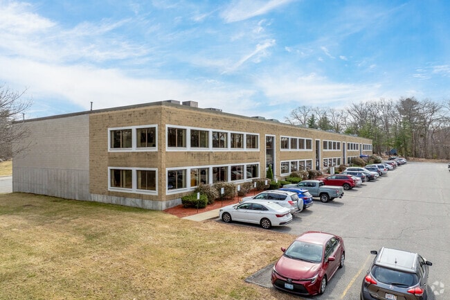
Property Record
100 Otis St, Northborough, MA 01532

Current Lease Availabilities
NEARBY LISTINGS FOR SALE OR LEASE
Property Detail
100 Otis St
NBOR-001050-000000-000028-000030
Worcester
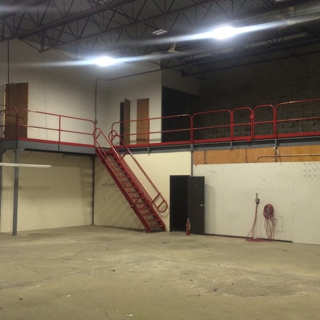
Industrialcondominium
Massachusetts
X
28-60
25027C0641F
8.78 AC
2025
The Boroughs
2025
Boston
740101
Worcester, MA-CT
6,480 SF
DEMOGRAPHICS near 100 Otis St
1 Mile
3 Mile
5 Mile
2024 Total Population
5,451
41,310
87,413
2029 Population
5,478
41,425
87,815
Pop Growth 2024-2029
+ 0.50%
+ 0.28%
+ 0.46%
Average Age
37
41
41
2024 Total Households
1,953
15,338
32,606
HH Growth 2024-2029
+ 0.46%
+ 0.37%
+ 0.55%
Median Household Inc
$131,014
$131,568
$125,944
Avg Household Size
2.80
2.60
2.60
2024 Avg HH Vehicles
2.00
2.00
2.00
Median Home Value
$523,786
$548,619
$535,211
Median Year Built
1984
1980
1981
Nearby Places
Map Layers
Map Styles
 Street
 Aerial
- Restaurants
- Banks
- Shops
- Fitness
- Groceries
PUBLIC TRANSPORTATION
COMMUTER RAIL
Westborough (Framingham/Worcester Line - Massachusetts Bay Transportation Authority Commuter Rail (Purple Line))
DRIVE
WALK
Distance
Westborough (Framingham/Worcester Line - Massachusetts Bay Transportation Authority Commuter Rail (Purple Line))
6 min
2.2 mi
Grafton (Framingham/Worcester Line - Massachusetts Bay Transportation Authority Commuter Rail (Purple Line))
DRIVE
WALK
Distance
Grafton (Framingham/Worcester Line - Massachusetts Bay Transportation Authority Commuter Rail (Purple Line))
10 min
4.6 mi
AIRPORT
Worcester Regional
DRIVE
WALK
Distance
Worcester Regional
26 min
13.1 mi
Freight Ports
Port of Boston
DRIVE
WALK
Distance
Port of Boston
52 min
35.7 mi
Nearby Properties
Address
Land Use
TOTAL SIZE
Lot Size
Zoning
Address
Land Use
TOTAL SIZE
Lot Size
Zoning
42.01 AC
I
Address
Land Use
TOTAL SIZE
Lot Size
Zoning
274,000 SF
32 AC
M-1
Address
Land Use
TOTAL SIZE
Lot Size
Zoning
68.85 AC
OFF-RE
Address
Land Use
TOTAL SIZE
Lot Size
Zoning
22.40 AC
COM BU
Address
Land Use
TOTAL SIZE
Lot Size
Zoning
67.29 AC
IB
Address
Land Use
TOTAL SIZE
Lot Size
Zoning
23.65 AC
RUR A
Address
Land Use
TOTAL SIZE
Lot Size
Zoning
19.69 AC
BA
Address
Land Use
TOTAL SIZE
Lot Size
Zoning
205,712 SF
3.95 AC
BA
Address
Land Use
TOTAL SIZE
Lot Size
Zoning
201,818 SF
5.55 AC
BA
Address
Land Use
TOTAL SIZE
Lot Size
Zoning
205,712 SF
5.76 AC
BA
Address
Land Use
TOTAL SIZE
Lot Size
Zoning
107,308 SF
45.40 AC
M-1
Address
Land Use
TOTAL SIZE
Lot Size
Zoning
260,605 SF
29 AC
I
Address
Land Use
TOTAL SIZE
Lot Size
Zoning
412,272 SF
42.44 AC
OFF-RE
Address
Land Use
TOTAL SIZE
Lot Size
Zoning
299,149 SF
28.81 AC
I
Address
Land Use
TOTAL SIZE
Lot Size
Zoning
43.90 AC
M-1
Address
Land Use
TOTAL SIZE
Lot Size
Zoning
21.04 AC
APT 99
Address
Land Use
TOTAL SIZE
Lot Size
Zoning
10.28 AC
R
Address
Land Use
TOTAL SIZE
Lot Size
Zoning
9.70 AC
COM BU
Address
Land Use
TOTAL SIZE
Lot Size
Zoning
167,438 SF
23.82 AC
I
Address
Land Use
TOTAL SIZE
Lot Size
Zoning
170,000 SF
27.66 AC
BA
Address
Land Use
TOTAL SIZE
Lot Size
Zoning
102,181 SF
38.62 AC
RES B-
Address
Land Use
TOTAL SIZE
Lot Size
Zoning
108,038 SF
19.68 AC
M-1
Address
Land Use
TOTAL SIZE
Lot Size
Zoning
12.96 AC
MF-1
Address
Land Use
TOTAL SIZE
Lot Size
Zoning
10.34 AC
APT 91
Address
Land Use
TOTAL SIZE
Lot Size
Zoning
125,914 SF
111.02 AC
Address
Land Use
TOTAL SIZE
Lot Size
Zoning
19.05 AC
I
Address
Land Use
TOTAL SIZE
Lot Size
Zoning
40.46 AC
R4
Address
Land Use
TOTAL SIZE
Lot Size
Zoning
22.06 AC
COM BU
Address
Land Use
TOTAL SIZE
Lot Size
Zoning
216,518 SF
6.64 AC
R
Address
Land Use
TOTAL SIZE
Lot Size
Zoning
97,171 SF
27.77 AC
M-1
The World's #1 Commercial Real Estate Marketplace
Connect with us
© 2025 CoStar Group
The information above has been obtained from sources believed reliable. While we do not doubt its accuracy we have not verified it and make no guarantee, warranty or representation about it. It is your responsibility to independently confirm its accuracy and completeness. Any projections, opinions, assumptions, or estimates used are for example only and do not represent the current or future performance of the property. The value of this transaction to you depends on tax and other factors which should be evaluated by your tax, financial, and legal advisors. You and your advisors should conduct a careful, independent investigation of the property to determine to your satisfaction the suitability of the property for your needs.