Property Record
102 Pratts Junction Rd, Sterling, MA 01564


Property Detail
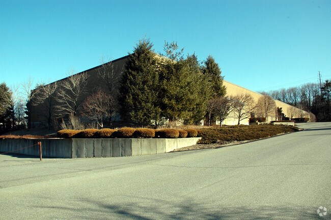
102 Pratts Junction Rd
STER-000051-000000-000016
Worcester
Manufacturinglight
Massachusetts
C and X Area of minimal flood hazard, usually depicted on FIRMs as above the 500-year flood level.
16
2025
3 AC
2025
Outlying Worcester
719100
Boston
42,440 SF
Worcester, MA
NEARBY LISTINGS FOR SALE OR LEASE
DEMOGRAPHICS near 102 Pratts Junction Rd
1 mile
3 mile
5 mile
2025 Total Population
1,267
15,249
57,064
2030 Population
1,325
15,695
58,357
Pop Growth 2025-2030
+ 4.58%
+ 2.92%
+ 2.27%
Average Age
44
43
42
2025 Total Households
468
5,705
22,601
HH Growth 2025-2030
+ 4.49%
+ 3.03%
+ 2.31%
Median Household Inc
$130,435
$115,189
$93,497
Avg Household Size
2.70
2.50
2.40
2025 Avg HH Vehicles
2.00
2.00
2.00
Median Home Value
$519,417
$473,152
$423,282
Median Year Built
1991
1980
1964
Nearby Places
Map Layers
Map Styles
 Street
 Aerial
Layers
 Traffic
 Biking
Places
Listings with unknown addresses are not visible on the map
- Restaurants
- Banks
- Shops
- Fitness
- Groceries
PUBLIC TRANSPORTATION
COMMUTER RAIL
North Leominster (Fitchburg/South Acton Line - Massachusetts Bay Transportation Authority Commuter Rail (Purple Line))
Drive
Walk
Distance
North Leominster (Fitchburg/South Acton Line - Massachusetts Bay Transportation Authority Commuter Rail (Purple Line))
13 min
8.8 mi
AIRPORT
Worcester Regional
Drive
Walk
Distance
Worcester Regional
33 min
22.2 mi
Freight Ports
Port of Boston
Drive
Walk
Distance
Port of Boston
73 min
50.9 mi
Nearby Properties
Address
Land Use
TOTAL SIZE
Lot Size
Zoning
Address
Land Use
TOTAL SIZE
Lot Size
Zoning
120.52 AC
Address
Land Use
TOTAL SIZE
Lot Size
Zoning
24.35 AC
Address
Land Use
TOTAL SIZE
Lot Size
Zoning
45,066 SF
18.52 AC
Address
Land Use
TOTAL SIZE
Lot Size
Zoning
552,952 SF
27.44 AC
Address
Land Use
TOTAL SIZE
Lot Size
Zoning
20.30 AC
Address
Land Use
TOTAL SIZE
Lot Size
Zoning
9.30 AC
Address
Land Use
TOTAL SIZE
Lot Size
Zoning
68,822 SF
9.83 AC
Address
Land Use
TOTAL SIZE
Lot Size
Zoning
111,960 SF
4.75 AC
Address
Land Use
TOTAL SIZE
Lot Size
Zoning
171,063 SF
14.62 AC
Address
Land Use
TOTAL SIZE
Lot Size
Zoning
107,828 SF
7.41 AC
Address
Land Use
TOTAL SIZE
Lot Size
Zoning
119,038 SF
12.17 AC
Address
Land Use
TOTAL SIZE
Lot Size
Zoning
102,628 SF
10.50 AC
Address
Land Use
TOTAL SIZE
Lot Size
Zoning
81,594 SF
1.59 AC
Address
Land Use
TOTAL SIZE
Lot Size
Zoning
4.71 AC
Address
Land Use
TOTAL SIZE
Lot Size
Zoning
2.07 AC
Address
Land Use
TOTAL SIZE
Lot Size
Zoning
59,587 SF
1.13 AC
Address
Land Use
TOTAL SIZE
Lot Size
Zoning
133,068 SF
9 AC
Address
Land Use
TOTAL SIZE
Lot Size
Zoning
171,354 SF
21.97 AC
Address
Land Use
TOTAL SIZE
Lot Size
Zoning
54,351 SF
4.82 AC
Address
Land Use
TOTAL SIZE
Lot Size
Zoning
9.16 AC
Address
Land Use
TOTAL SIZE
Lot Size
Zoning
45,066 SF
3.96 AC
Address
Land Use
TOTAL SIZE
Lot Size
Zoning
45,060 SF
3.92 AC
Address
Land Use
TOTAL SIZE
Lot Size
Zoning
60.46 AC
Address
Land Use
TOTAL SIZE
Lot Size
Zoning
128,788 SF
6.44 AC
Address
Land Use
TOTAL SIZE
Lot Size
Zoning
Address
Land Use
TOTAL SIZE
Lot Size
Zoning
5.68 AC
Address
Land Use
TOTAL SIZE
Lot Size
Zoning
24,776 SF
13.58 AC
Address
Land Use
TOTAL SIZE
Lot Size
Zoning
7.51 AC
Address
Land Use
TOTAL SIZE
Lot Size
Zoning
57,400 SF
4.81 AC
Address
Land Use
TOTAL SIZE
Lot Size
Zoning
77,420 SF
7.76 AC
The World's #1 Commercial Real Estate Marketplace
Connect with us
© 2026 CoStar Group
The information above has been obtained from sources believed reliable. While we do not doubt its accuracy we have not verified it and make no guarantee, warranty or representation about it. It is your responsibility to independently confirm its accuracy and completeness. Any projections, opinions, assumptions, or estimates used are for example only and do not represent the current or future performance of the property. The value of this transaction to you depends on tax and other factors which should be evaluated by your tax, financial, and legal advisors. You and your advisors should conduct a careful, independent investigation of the property to determine to your satisfaction the suitability of the property for your needs.