Property Record
102 S Euclid Ave, Sandpoint, ID 83864


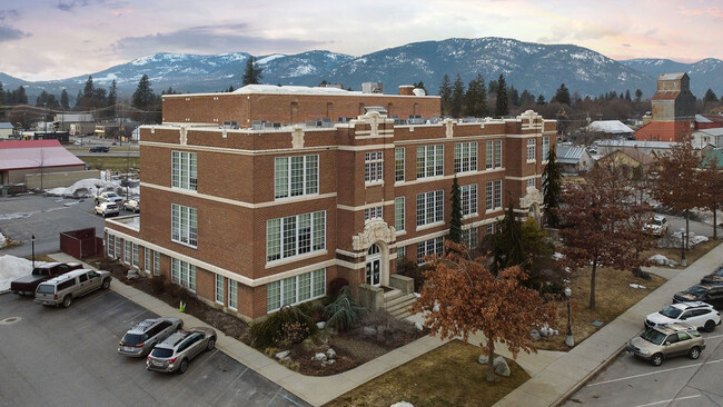
Property Detail
102 S Euclid Ave
Sandpoint, ID
22-57N-2W SCOTT'S PLAT LOT 2
RPS39-000-000020A
Bonner
Stateproperty
Idaho
B and X Area of moderate flood hazard, usually the area between the limits of the 100-year and 500-year floods.
2
2025
0.48 AC
2025
Bonner
950300
Coeur D'Alene
33,830 SF
NEARBY LISTINGS FOR SALE OR LEASE
DEMOGRAPHICS near 102 S Euclid Ave
1 mile
3 mile
5 mile
2025 Total Population
7,281
14,389
21,594
2030 Population
8,019
15,887
23,876
Pop Growth 2025-2030
+ 10.14%
+ 10.41%
+ 10.57%
Average Age
42
43
44
2025 Total Households
3,204
6,192
9,064
HH Growth 2025-2030
+ 9.83%
+ 10.06%
+ 10.19%
Median Household Inc
$71,806
$68,325
$70,608
Avg Household Size
2.20
2.20
2.30
2025 Avg HH Vehicles
2.00
2.00
2.00
Median Home Value
$491,643
$499,021
$511,784
Median Year Built
1978
1990
1991
Nearby Places
Map Layers
Map Styles
 Street
 Aerial
Transit
 Traffic
 Biking
Places
Listings with unknown addresses are not visible on the map
- Restaurants
- Banks
- Shops
- Fitness
- Groceries
PUBLIC TRANSPORTATION
COMMUTER RAIL
Sandpoint Amtrak (Empire Builder - Amtrak)
Drive
Walk
Distance
Sandpoint Amtrak (Empire Builder - Amtrak)
3 min
11 min
0.6 mi
Freight Ports
Port of Everett
Drive
Walk
Distance
Port of Everett
427 min
372.9 mi
SALE & LEASE HISTORY
LISTING DATE
SALE/LEASE

Nov 14, 2018
For Sale
May 16, 2018
For Sale
Mar 29, 2022
For Sale
Jul 12, 2017
For Sale
Jul 03, 2018
For Sale
Jan 09, 2019
For Lease
Dec 13, 2021
For Lease
Aug 11, 2019
For Lease
Nearby Properties
Address
Land Use
TOTAL SIZE
Lot Size
Zoning
Address
Land Use
TOTAL SIZE
Lot Size
Zoning
3.84 AC
Address
Land Use
TOTAL SIZE
Lot Size
Zoning
24,639 SF
3 AC
Address
Land Use
TOTAL SIZE
Lot Size
Zoning
66,673 SF
3.17 AC
Address
Land Use
TOTAL SIZE
Lot Size
Zoning
86,100 SF
1.79 AC
Address
Land Use
TOTAL SIZE
Lot Size
Zoning
49,500 SF
16.53 AC
Address
Land Use
TOTAL SIZE
Lot Size
Zoning
Address
Land Use
TOTAL SIZE
Lot Size
Zoning
4,413 SF
4.79 AC
Address
Land Use
TOTAL SIZE
Lot Size
Zoning
4,512 SF
3.90 AC
Address
Land Use
TOTAL SIZE
Lot Size
Zoning
156,891 SF
14.84 AC
Address
Land Use
TOTAL SIZE
Lot Size
Zoning
29,154 SF
3.80 AC
Address
Land Use
TOTAL SIZE
Lot Size
Zoning
92,969 SF
15.72 AC
Address
Land Use
TOTAL SIZE
Lot Size
Zoning
82,053 SF
5.26 AC
Address
Land Use
TOTAL SIZE
Lot Size
Zoning
35,708 SF
2.47 AC
Address
Land Use
TOTAL SIZE
Lot Size
Zoning
57,611 SF
2.37 AC
Address
Land Use
TOTAL SIZE
Lot Size
Zoning
12,024 SF
2.86 AC
Address
Land Use
TOTAL SIZE
Lot Size
Zoning
1,306 SF
3.05 AC
Rec
Address
Land Use
TOTAL SIZE
Lot Size
Zoning
53,580 SF
5.63 AC
Address
Land Use
TOTAL SIZE
Lot Size
Zoning
106,375 SF
11.87 AC
Address
Land Use
TOTAL SIZE
Lot Size
Zoning
5,148 SF
0.91 AC
Address
Land Use
TOTAL SIZE
Lot Size
Zoning
38,980 SF
2.71 AC
Address
Land Use
TOTAL SIZE
Lot Size
Zoning
88,699 SF
6.93 AC
Address
Land Use
TOTAL SIZE
Lot Size
Zoning
16,462 SF
1.63 AC
Address
Land Use
TOTAL SIZE
Lot Size
Zoning
32,130 SF
4.33 AC
Address
Land Use
TOTAL SIZE
Lot Size
Zoning
17,828 SF
1.21 AC
Address
Land Use
TOTAL SIZE
Lot Size
Zoning
16,000 SF
2.32 AC
Address
Land Use
TOTAL SIZE
Lot Size
Zoning
20,396 SF
1.40 AC
Address
Land Use
TOTAL SIZE
Lot Size
Zoning
29,910 SF
2.96 AC
Address
Land Use
TOTAL SIZE
Lot Size
Zoning
33,287 SF
8.05 AC
Address
Land Use
TOTAL SIZE
Lot Size
Zoning
38,496 SF
6.63 AC
Address
Land Use
TOTAL SIZE
Lot Size
Zoning
3.30 AC
The World's #1 Commercial Real Estate Marketplace
Connect with us
© 2026 CoStar Group
The information above has been obtained from sources believed reliable. While we do not doubt its accuracy we have not verified it and make no guarantee, warranty or representation about it. It is your responsibility to independently confirm its accuracy and completeness. Any projections, opinions, assumptions, or estimates used are for example only and do not represent the current or future performance of the property. The value of this transaction to you depends on tax and other factors which should be evaluated by your tax, financial, and legal advisors. You and your advisors should conduct a careful, independent investigation of the property to determine to your satisfaction the suitability of the property for your needs.