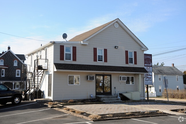
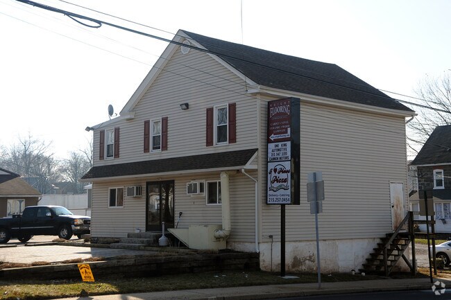
Property Record
102 W Main St, Perkasie, PA 18944
NEARBY LISTINGS FOR SALE OR LEASE
Property Detail
102 W Main St
40-003-065
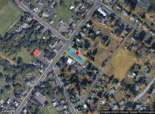
SE COR MAIN & WALNUT STS 121X268
Storemultistory
Bucks
X
Pennsylvania
42091C0135G
0.63 AC
2024
Upper Bucks County
2025
Philadelphia
106300
Philadelphia-Camden-Wilmington, PA-NJ-DE-MD
2,360 SF
DEMOGRAPHICS near 102 W Main St
1 Mile
3 Mile
5 Mile
2024 Total Population
4,491
31,947
79,765
2029 Population
4,415
31,843
80,170
Pop Growth 2024-2029
(1.69%)
(0.33%)
+ 0.51%
Average Age
40
42
42
2024 Total Households
1,560
12,098
30,500
HH Growth 2024-2029
(1.79%)
(0.32%)
+ 0.49%
Median Household Inc
$132,731
$102,779
$99,096
Avg Household Size
2.90
2.60
2.60
2024 Avg HH Vehicles
2.00
2.00
2.00
Median Home Value
$371,404
$355,365
$356,757
Median Year Built
1991
1977
1976
Nearby Places
Map Layers
Map Styles
 Street
 Aerial
- Restaurants
- Banks
- Shops
- Fitness
- Groceries
PUBLIC TRANSPORTATION
COMMUTER RAIL
Chalfont (R5 - Southeastern Pennsylvania Transportation Authority Regional Rail (SEPTA Regional Rail))
DRIVE
WALK
Distance
Chalfont (R5 - Southeastern Pennsylvania Transportation Authority Regional Rail (SEPTA Regional Rail))
11 min
6.1 mi
Link Belt (R5 - Southeastern Pennsylvania Transportation Authority Regional Rail (SEPTA Regional Rail))
DRIVE
WALK
Distance
Link Belt (R5 - Southeastern Pennsylvania Transportation Authority Regional Rail (SEPTA Regional Rail))
13 min
6.7 mi
AIRPORT
Lehigh Valley International
DRIVE
WALK
Distance
Lehigh Valley International
48 min
28.4 mi
Trenton Mercer
DRIVE
WALK
Distance
Trenton Mercer
54 min
32.1 mi
Freight Ports
Port of Philadelphia
DRIVE
WALK
Distance
Port of Philadelphia
52 min
30.9 mi
Nearby Properties
Address
Land Use
TOTAL SIZE
Lot Size
Zoning
Address
Land Use
TOTAL SIZE
Lot Size
Zoning
98,397 SF
8.23 AC
LI
Address
Land Use
TOTAL SIZE
Lot Size
Zoning
256,512 SF
21.31 AC
CR
Address
Land Use
TOTAL SIZE
Lot Size
Zoning
210,700 SF
16.64 AC
PC1
Address
Land Use
TOTAL SIZE
Lot Size
Zoning
205,462 SF
34.20 AC
52PI
Address
Land Use
TOTAL SIZE
Lot Size
Zoning
1,261,187 SF
13.86 AC
CR
Address
Land Use
TOTAL SIZE
Lot Size
Zoning
1,266,591 SF
14.82 AC
PC-1
Address
Land Use
TOTAL SIZE
Lot Size
Zoning
92,018 SF
22.18 AC
I2
Address
Land Use
TOTAL SIZE
Lot Size
Zoning
29,166 SF
2.18 AC
LI
Address
Land Use
TOTAL SIZE
Lot Size
Zoning
27,500 SF
2.37 AC
LI
Address
Land Use
TOTAL SIZE
Lot Size
Zoning
59,996 SF
17.61 AC
PC-1
Address
Land Use
TOTAL SIZE
Lot Size
Zoning
131,218 SF
14.23 AC
PRD
Address
Land Use
TOTAL SIZE
Lot Size
Zoning
137,040 SF
18.95 AC
LI
Address
Land Use
TOTAL SIZE
Lot Size
Zoning
63,433 SF
8.20 AC
CO
Address
Land Use
TOTAL SIZE
Lot Size
Zoning
13,250 SF
2.41 AC
LI
Address
Land Use
TOTAL SIZE
Lot Size
Zoning
18,780 SF
2.45 AC
LI
Address
Land Use
TOTAL SIZE
Lot Size
Zoning
132,250 SF
28.32 AC
RR
Address
Land Use
TOTAL SIZE
Lot Size
Zoning
65,800 SF
7.22 AC
PC1
Address
Land Use
TOTAL SIZE
Lot Size
Zoning
68,463 SF
10.86 AC
IS
Address
Land Use
TOTAL SIZE
Lot Size
Zoning
7.61 AC
CR
Address
Land Use
TOTAL SIZE
Lot Size
Zoning
94,897 SF
14.52 AC
PC-1
Address
Land Use
TOTAL SIZE
Lot Size
Zoning
105,840 SF
2.42 AC
R1B
Address
Land Use
TOTAL SIZE
Lot Size
Zoning
26,065 SF
7.27 AC
Address
Land Use
TOTAL SIZE
Lot Size
Zoning
101,920 SF
21.05 AC
R1B
Address
Land Use
TOTAL SIZE
Lot Size
Zoning
98,213 SF
8.24 AC
LI
Address
Land Use
TOTAL SIZE
Lot Size
Zoning
7,680 SF
2.41 AC
LI
Address
Land Use
TOTAL SIZE
Lot Size
Zoning
39,966 SF
2.78 AC
I2
Address
Land Use
TOTAL SIZE
Lot Size
Zoning
40,000 SF
8.55 AC
I
Address
Land Use
TOTAL SIZE
Lot Size
Zoning
523,360 SF
8.40 AC
PC1
Address
Land Use
TOTAL SIZE
Lot Size
Zoning
23,108 SF
7.91 AC
PI
Address
Land Use
TOTAL SIZE
Lot Size
Zoning
52,819 SF
15.35 AC
CR
The World's #1 Commercial Real Estate Marketplace
Connect with us
© 2025 CoStar Group
The information above has been obtained from sources believed reliable. While we do not doubt its accuracy we have not verified it and make no guarantee, warranty or representation about it. It is your responsibility to independently confirm its accuracy and completeness. Any projections, opinions, assumptions, or estimates used are for example only and do not represent the current or future performance of the property. The value of this transaction to you depends on tax and other factors which should be evaluated by your tax, financial, and legal advisors. You and your advisors should conduct a careful, independent investigation of the property to determine to your satisfaction the suitability of the property for your needs.