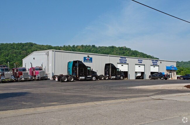
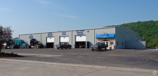
Property Record
102 Williams Way, Wilder, KY 41076
NEARBY LISTINGS FOR SALE OR LEASE
Property Detail
102 Williams Way
Cincinnati, OH-KY-IN
University Centre
999-99-17-684.00
PARCEL 2A UNIVERSITY CTR SUBD 3.71 ACRES
Commercialnec
Campbell
AE
Kentucky
21037C0038E
2.54 AC
2024
Campbell County
2025
Cincinnati/Dayton
053301
DEMOGRAPHICS near 102 Williams Way
1 Mile
3 Mile
5 Mile
2024 Total Population
490
30,121
99,092
2029 Population
494
30,465
100,823
Pop Growth 2024-2029
+ 0.82%
+ 1.14%
+ 1.75%
Average Age
43
41
40
2024 Total Households
206
12,374
39,896
HH Growth 2024-2029
+ 0.49%
+ 1.06%
+ 1.70%
Median Household Inc
$59,285
$69,849
$68,204
Avg Household Size
2.40
2.30
2.40
2024 Avg HH Vehicles
2.00
2.00
2.00
Median Home Value
$171,518
$203,439
$215,785
Median Year Built
1977
1988
1974
Nearby Places
Map Layers
Map Styles
 Street
 Aerial
- Restaurants
- Banks
- Shops
- Fitness
- Groceries
PUBLIC TRANSPORTATION
AIRPORT
Cincinnati/Northern Kentucky International
DRIVE
WALK
Distance
Cincinnati/Northern Kentucky International
27 min
13.7 mi
Freight Ports
Port of Toledo
DRIVE
WALK
Distance
Port of Toledo
256 min
213.5 mi
Nearby Properties
Address
Land Use
TOTAL SIZE
Lot Size
Zoning
Address
Land Use
TOTAL SIZE
Lot Size
Zoning
560 SF
218.94 AC
Address
Land Use
TOTAL SIZE
Lot Size
Zoning
243,000 SF
11.30 AC
Address
Land Use
TOTAL SIZE
Lot Size
Zoning
0.95 AC
Address
Land Use
TOTAL SIZE
Lot Size
Zoning
0.83 AC
Address
Land Use
TOTAL SIZE
Lot Size
Zoning
0.74 AC
Address
Land Use
TOTAL SIZE
Lot Size
Zoning
0.71 AC
Address
Land Use
TOTAL SIZE
Lot Size
Zoning
0.71 AC
Address
Land Use
TOTAL SIZE
Lot Size
Zoning
360,000 SF
Address
Land Use
TOTAL SIZE
Lot Size
Zoning
0.53 AC
Address
Land Use
TOTAL SIZE
Lot Size
Zoning
0.56 AC
Address
Land Use
TOTAL SIZE
Lot Size
Zoning
0.57 AC
Address
Land Use
TOTAL SIZE
Lot Size
Zoning
0.49 AC
Address
Land Use
TOTAL SIZE
Lot Size
Zoning
0.59 AC
Address
Land Use
TOTAL SIZE
Lot Size
Zoning
0.48 AC
Address
Land Use
TOTAL SIZE
Lot Size
Zoning
0.40 AC
Address
Land Use
TOTAL SIZE
Lot Size
Zoning
441,907 SF
Address
Land Use
TOTAL SIZE
Lot Size
Zoning
1,049,050 SF
8.60 AC
Address
Land Use
TOTAL SIZE
Lot Size
Zoning
0.33 AC
Address
Land Use
TOTAL SIZE
Lot Size
Zoning
1,800 SF
10.18 AC
Address
Land Use
TOTAL SIZE
Lot Size
Zoning
16.50 AC
Address
Land Use
TOTAL SIZE
Lot Size
Zoning
15,570 SF
21.35 AC
Address
Land Use
TOTAL SIZE
Lot Size
Zoning
179,770 SF
Address
Land Use
TOTAL SIZE
Lot Size
Zoning
2,837 SF
3.77 AC
Address
Land Use
TOTAL SIZE
Lot Size
Zoning
385,100 SF
4.60 AC
Address
Land Use
TOTAL SIZE
Lot Size
Zoning
175,481 SF
38.92 AC
Address
Land Use
TOTAL SIZE
Lot Size
Zoning
78.58 AC
Address
Land Use
TOTAL SIZE
Lot Size
Zoning
3,726,400 SF
12.60 AC
Address
Land Use
TOTAL SIZE
Lot Size
Zoning
173,940 SF
22.52 AC
Address
Land Use
TOTAL SIZE
Lot Size
Zoning
65.43 AC
Address
Land Use
TOTAL SIZE
Lot Size
Zoning
29,264 SF
22.18 AC
The World's #1 Commercial Real Estate Marketplace
Connect with us
© 2025 CoStar Group
The information above has been obtained from sources believed reliable. While we do not doubt its accuracy we have not verified it and make no guarantee, warranty or representation about it. It is your responsibility to independently confirm its accuracy and completeness. Any projections, opinions, assumptions, or estimates used are for example only and do not represent the current or future performance of the property. The value of this transaction to you depends on tax and other factors which should be evaluated by your tax, financial, and legal advisors. You and your advisors should conduct a careful, independent investigation of the property to determine to your satisfaction the suitability of the property for your needs.