Property Record
1020 E Homedale Rd, Caldwell, ID 83607
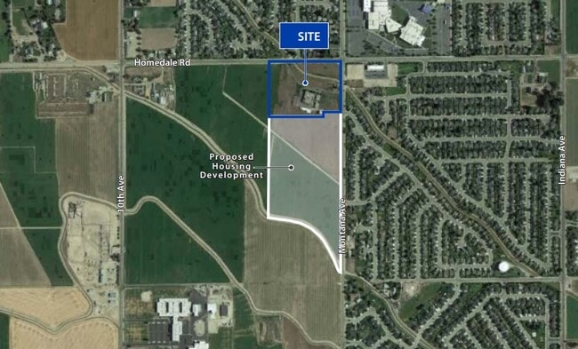

Property Detail
1020 E Homedale Rd
Boise City, ID
10-3N-3W NW TX 19536 IN E 1/2 NW
3272100000
Canyon
Commercialnec
Idaho
B and X Area of moderate flood hazard, usually the area between the limits of the 100-year and 500-year floods.
13.11 AC
2024
Caldwell
2025
Boise City/Nampa
021003
NEARBY LISTINGS FOR SALE OR LEASE
DEMOGRAPHICS near 1020 E Homedale Rd
1 mile
3 mile
5 mile
2025 Total Population
9,577
50,625
103,814
2030 Population
10,606
56,271
115,859
Pop Growth 2025-2030
+ 10.74%
+ 11.15%
+ 11.60%
Average Age
34
36
36
2025 Total Households
2,834
16,501
34,394
HH Growth 2025-2030
+ 11.08%
+ 11.48%
+ 11.89%
Median Household Inc
$86,935
$71,510
$68,591
Avg Household Size
3.30
3.00
2.90
2025 Avg HH Vehicles
2.00
2.00
2.00
Median Home Value
$356,788
$364,366
$363,018
Median Year Built
2005
2002
2003
Nearby Places
Map Layers
Map Styles
 Street
 Aerial
Transit
 Traffic
 Biking
Places
Listings with unknown addresses are not visible on the map
- Restaurants
- Banks
- Shops
- Fitness
- Groceries
PUBLIC TRANSPORTATION
AIRPORT
Boise Air Trml/Gowen Field
Drive
Walk
Distance
Boise Air Trml/Gowen Field
49 min
29.5 mi
Freight Ports
Port of Portland
Drive
Walk
Distance
Port of Portland
455 min
410.6 mi
Nearby Properties
Address
Land Use
TOTAL SIZE
Lot Size
Zoning
Address
Land Use
TOTAL SIZE
Lot Size
Zoning
9,718 SF
14.94 AC
C2
Address
Land Use
TOTAL SIZE
Lot Size
Zoning
Address
Land Use
TOTAL SIZE
Lot Size
Zoning
119.97 AC
Address
Land Use
TOTAL SIZE
Lot Size
Zoning
5,978 SF
23.48 AC
Address
Land Use
TOTAL SIZE
Lot Size
Zoning
25.32 AC
Address
Land Use
TOTAL SIZE
Lot Size
Zoning
27.55 AC
Address
Land Use
TOTAL SIZE
Lot Size
Zoning
1.40 AC
Address
Land Use
TOTAL SIZE
Lot Size
Zoning
6.43 AC
Address
Land Use
TOTAL SIZE
Lot Size
Zoning
50.17 AC
Address
Land Use
TOTAL SIZE
Lot Size
Zoning
32.81 AC
Address
Land Use
TOTAL SIZE
Lot Size
Zoning
6.95 AC
R1
Address
Land Use
TOTAL SIZE
Lot Size
Zoning
15.24 AC
Address
Land Use
TOTAL SIZE
Lot Size
Zoning
Address
Land Use
TOTAL SIZE
Lot Size
Zoning
17.90 AC
Address
Land Use
TOTAL SIZE
Lot Size
Zoning
62.05 AC
Address
Land Use
TOTAL SIZE
Lot Size
Zoning
35.03 AC
Address
Land Use
TOTAL SIZE
Lot Size
Zoning
41,427 SF
0.57 AC
Address
Land Use
TOTAL SIZE
Lot Size
Zoning
161,518 SF
21.66 AC
Address
Land Use
TOTAL SIZE
Lot Size
Zoning
Address
Land Use
TOTAL SIZE
Lot Size
Zoning
89,575 SF
74.20 AC
M1
Address
Land Use
TOTAL SIZE
Lot Size
Zoning
5.91 AC
Address
Land Use
TOTAL SIZE
Lot Size
Zoning
38.92 AC
Address
Land Use
TOTAL SIZE
Lot Size
Zoning
10 AC
R1
Address
Land Use
TOTAL SIZE
Lot Size
Zoning
2.17 AC
Address
Land Use
TOTAL SIZE
Lot Size
Zoning
42.69 AC
Address
Land Use
TOTAL SIZE
Lot Size
Zoning
63.83 AC
Address
Land Use
TOTAL SIZE
Lot Size
Zoning
58,423 SF
9.30 AC
Address
Land Use
TOTAL SIZE
Lot Size
Zoning
48,804 SF
3.71 AC
Address
Land Use
TOTAL SIZE
Lot Size
Zoning
8.58 AC
Address
Land Use
TOTAL SIZE
Lot Size
Zoning
32,496 SF
3.13 AC
The World's #1 Commercial Real Estate Marketplace
Connect with us
© 2026 CoStar Group
The information above has been obtained from sources believed reliable. While we do not doubt its accuracy we have not verified it and make no guarantee, warranty or representation about it. It is your responsibility to independently confirm its accuracy and completeness. Any projections, opinions, assumptions, or estimates used are for example only and do not represent the current or future performance of the property. The value of this transaction to you depends on tax and other factors which should be evaluated by your tax, financial, and legal advisors. You and your advisors should conduct a careful, independent investigation of the property to determine to your satisfaction the suitability of the property for your needs.