Property Record
1020 Jim Johnson Rd, Winder, GA 30680
NEARBY LISTINGS FOR SALE OR LEASE
Property Detail
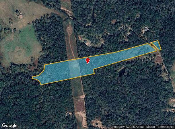
1020 Jim Johnson Rd
Atlanta-Sandy Springs-Roswell, GA
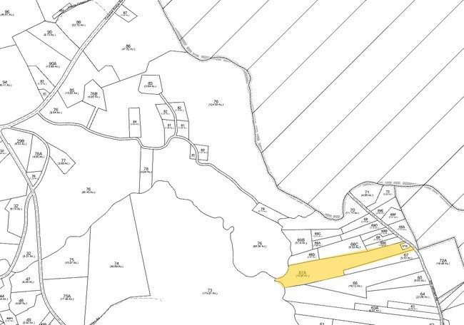
06 & 06 A
XX047-067A
1034 JIM JOHNSON RD LANDLOT: RUR
Privatepreserveopenspacevacantlandforestlandconservation
Barrow
A
Georgia
13013C0045D
0
2024
15.80 AC
2024
Barrow County
180203
Atlanta
DEMOGRAPHICS near 1020 Jim Johnson Rd
1 Mile
3 Mile
5 Mile
2024 Total Population
803
11,579
45,154
2029 Population
965
14,065
54,490
Pop Growth 2024-2029
+ 20.17%
+ 21.47%
+ 20.68%
Average Age
39
39
39
2024 Total Households
268
3,914
15,558
HH Growth 2024-2029
+ 20.15%
+ 21.08%
+ 20.18%
Median Household Inc
$98,863
$92,008
$81,645
Avg Household Size
3.00
2.90
2.90
2024 Avg HH Vehicles
3.00
3.00
2.00
Median Home Value
$286,764
$298,050
$273,156
Median Year Built
2007
2002
2000
Nearby Places
Map Layers
Map Styles
 Street
 Aerial
- Restaurants
- Banks
- Shops
- Fitness
- Groceries
Nearby Properties
Address
Land Use
TOTAL SIZE
Lot Size
Zoning
Address
Land Use
TOTAL SIZE
Lot Size
Zoning
979,317 SF
107.36 AC
001
Address
Land Use
TOTAL SIZE
Lot Size
Zoning
500,500 SF
53.92 AC
MI
Address
Land Use
TOTAL SIZE
Lot Size
Zoning
554,285 SF
70.18 AC
Address
Land Use
TOTAL SIZE
Lot Size
Zoning
572.63 AC
004
Address
Land Use
TOTAL SIZE
Lot Size
Zoning
128,874 SF
11.57 AC
001
Address
Land Use
TOTAL SIZE
Lot Size
Zoning
224.76 AC
004
Address
Land Use
TOTAL SIZE
Lot Size
Zoning
56,085 SF
R3
Address
Land Use
TOTAL SIZE
Lot Size
Zoning
76,768 SF
25 AC
R-1
Address
Land Use
TOTAL SIZE
Lot Size
Zoning
173.05 AC
004
Address
Land Use
TOTAL SIZE
Lot Size
Zoning
81,900 SF
8.61 AC
001
Address
Land Use
TOTAL SIZE
Lot Size
Zoning
20,634 SF
9.80 AC
003
Address
Land Use
TOTAL SIZE
Lot Size
Zoning
325 AC
R-3
Address
Land Use
TOTAL SIZE
Lot Size
Zoning
44,870 SF
11.78 AC
M1
Address
Land Use
TOTAL SIZE
Lot Size
Zoning
10.96 AC
004
Address
Land Use
TOTAL SIZE
Lot Size
Zoning
9.80 AC
004
Address
Land Use
TOTAL SIZE
Lot Size
Zoning
3,150 SF
004
Address
Land Use
TOTAL SIZE
Lot Size
Zoning
50,316 SF
2.78 AC
M
Address
Land Use
TOTAL SIZE
Lot Size
Zoning
41.48 AC
003
Address
Land Use
TOTAL SIZE
Lot Size
Zoning
1,680 SF
312.10 AC
AG
Address
Land Use
TOTAL SIZE
Lot Size
Zoning
74.20 AC
R1 C1
Address
Land Use
TOTAL SIZE
Lot Size
Zoning
6,800 SF
7.30 AC
C-3
Address
Land Use
TOTAL SIZE
Lot Size
Zoning
27,000 SF
5.68 AC
MI
Address
Land Use
TOTAL SIZE
Lot Size
Zoning
5,433 SF
11.80 AC
AG
Address
Land Use
TOTAL SIZE
Lot Size
Zoning
7,296 SF
2.48 AC
Address
Land Use
TOTAL SIZE
Lot Size
Zoning
4,706 SF
3.07 AC
002
Address
Land Use
TOTAL SIZE
Lot Size
Zoning
15,000 SF
3.13 AC
M1
Address
Land Use
TOTAL SIZE
Lot Size
Zoning
178.60 AC
AG
Address
Land Use
TOTAL SIZE
Lot Size
Zoning
106.36 AC
004
Address
Land Use
TOTAL SIZE
Lot Size
Zoning
26,746 SF
3.29 AC
C2
Address
Land Use
TOTAL SIZE
Lot Size
Zoning
102.23 AC
004
The World's #1 Commercial Real Estate Marketplace
Connect with us
© 2025 CoStar Group
The information above has been obtained from sources believed reliable. While we do not doubt its accuracy we have not verified it and make no guarantee, warranty or representation about it. It is your responsibility to independently confirm its accuracy and completeness. Any projections, opinions, assumptions, or estimates used are for example only and do not represent the current or future performance of the property. The value of this transaction to you depends on tax and other factors which should be evaluated by your tax, financial, and legal advisors. You and your advisors should conduct a careful, independent investigation of the property to determine to your satisfaction the suitability of the property for your needs.