Property Record
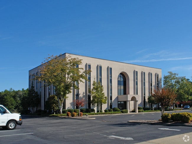
1020 John Sims Pky E, Niceville, FL 32578


NEARBY LISTINGS FOR SALE OR LEASE
Property Detail
1020 John Sims Pky E
Crestview-Fort Walton Beach-Destin, FL
Valp P/C
05-1S-22-256E-0011-0020
VALP P/C #5 BEG AT INTER OF E LINE OF PALM BLVD & N SIDE OF HW # 20 S 75 DEG E 350 FT FOR BEG S 75 DEG E 300 FT N 14 DEG E 350 FT N 75 DEG W 300 FT S 14 DEG W 350 FT TO BEG 700-816 LESS PART SOLD TO CITY AS PER OR 3544-3849
Financialbuilding
Okaloosa
X
Florida
12091C0388J
20
2025
2.40 AC
2025
Fort Walton Beach
020900
Other Market Areas
24,968 SF
DEMOGRAPHICS near 1020 John Sims Pky E
1 Mile
3 Mile
5 Mile
2024 Total Population
7,205
26,178
36,183
2029 Population
7,469
27,257
37,573
Pop Growth 2024-2029
+ 3.66%
+ 4.12%
+ 3.84%
Average Age
40
40
40
2024 Total Households
2,985
10,198
13,931
HH Growth 2024-2029
+ 3.58%
+ 4.03%
+ 3.75%
Median Household Inc
$69,639
$86,380
$92,545
Avg Household Size
2.40
2.50
2.50
2024 Avg HH Vehicles
2.00
2.00
2.00
Median Home Value
$284,344
$344,571
$357,732
Median Year Built
1982
1986
1987
Nearby Places
Map Layers
Map Styles
 Street
 Aerial
- Restaurants
- Banks
- Shops
- Fitness
- Groceries
PUBLIC TRANSPORTATION
AIRPORT
Eglin AFB/Destin-Ft Walton Beach
DRIVE
WALK
Distance
Eglin AFB/Destin-Ft Walton Beach
26 min
6.1 mi
Nearby Properties
Address
Land Use
TOTAL SIZE
Lot Size
Zoning
Address
Land Use
TOTAL SIZE
Lot Size
Zoning
480 AC
Address
Land Use
TOTAL SIZE
Lot Size
Zoning
817,501 SF
121.04 AC
Address
Land Use
TOTAL SIZE
Lot Size
Zoning
263,492 SF
29.88 AC
Address
Land Use
TOTAL SIZE
Lot Size
Zoning
138,251 SF
11.32 AC
Address
Land Use
TOTAL SIZE
Lot Size
Zoning
10,401 SF
7.20 AC
Address
Land Use
TOTAL SIZE
Lot Size
Zoning
49,417 SF
3.19 AC
Address
Land Use
TOTAL SIZE
Lot Size
Zoning
75,002 SF
4.42 AC
Address
Land Use
TOTAL SIZE
Lot Size
Zoning
101,695 SF
15.11 AC
Address
Land Use
TOTAL SIZE
Lot Size
Zoning
56,412 SF
2.09 AC
Address
Land Use
TOTAL SIZE
Lot Size
Zoning
28,763 SF
0.23 AC
Address
Land Use
TOTAL SIZE
Lot Size
Zoning
165,059 SF
17.62 AC
Address
Land Use
TOTAL SIZE
Lot Size
Zoning
335.95 AC
Address
Land Use
TOTAL SIZE
Lot Size
Zoning
33,575 SF
1.67 AC
Address
Land Use
TOTAL SIZE
Lot Size
Zoning
126,169 SF
8.90 AC
Address
Land Use
TOTAL SIZE
Lot Size
Zoning
76,262 SF
10.67 AC
Address
Land Use
TOTAL SIZE
Lot Size
Zoning
129,846 SF
19.65 AC
Address
Land Use
TOTAL SIZE
Lot Size
Zoning
3.90 AC
Address
Land Use
TOTAL SIZE
Lot Size
Zoning
107,789 SF
10.47 AC
Address
Land Use
TOTAL SIZE
Lot Size
Zoning
54,627 SF
2.05 AC
Address
Land Use
TOTAL SIZE
Lot Size
Zoning
27,450 SF
0.85 AC
Address
Land Use
TOTAL SIZE
Lot Size
Zoning
21,687 SF
0.91 AC
Address
Land Use
TOTAL SIZE
Lot Size
Zoning
101,110 SF
20.64 AC
Address
Land Use
TOTAL SIZE
Lot Size
Zoning
83,644 SF
1.39 AC
Address
Land Use
TOTAL SIZE
Lot Size
Zoning
40,261 SF
6.21 AC
Address
Land Use
TOTAL SIZE
Lot Size
Zoning
84,848 SF
41.85 AC
Address
Land Use
TOTAL SIZE
Lot Size
Zoning
30,953 SF
1.46 AC
Address
Land Use
TOTAL SIZE
Lot Size
Zoning
82,203 SF
7.14 AC
Address
Land Use
TOTAL SIZE
Lot Size
Zoning
88,750 SF
9.95 AC
Address
Land Use
TOTAL SIZE
Lot Size
Zoning
43,920 SF
9.08 AC
Address
Land Use
TOTAL SIZE
Lot Size
Zoning
1,620 SF
128.18 AC
The World's #1 Commercial Real Estate Marketplace
Connect with us
© 2026 CoStar Group
The information above has been obtained from sources believed reliable. While we do not doubt its accuracy we have not verified it and make no guarantee, warranty or representation about it. It is your responsibility to independently confirm its accuracy and completeness. Any projections, opinions, assumptions, or estimates used are for example only and do not represent the current or future performance of the property. The value of this transaction to you depends on tax and other factors which should be evaluated by your tax, financial, and legal advisors. You and your advisors should conduct a careful, independent investigation of the property to determine to your satisfaction the suitability of the property for your needs.