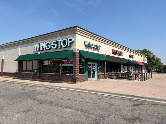
Property Record
1020 Ken Pratt Blvd, Longmont, CO 80501


Current Lease Availabilities
Property Detail
1020 Ken Pratt Blvd
Boulder, CO
LOT 4 BLK 1 BURLINGTON VILLAGE REPLAT D
1315102-29-003
BOULDER
Commercialnec
Colorado
B and X Area of moderate flood hazard, usually the area between the limits of the 100-year and 500-year floods.
4
2023
1.58 AC
2025
Longmont
013210
Denver
17,905 SF
NEARBY LISTINGS FOR SALE OR LEASE
DEMOGRAPHICS near 1020 Ken Pratt Blvd
1 mile
3 mile
5 mile
2024 Total Population
8,228
73,945
107,578
2029 Population
8,308
73,772
107,761
Pop Growth 2024-2029
+ 0.97%
(0.23%)
+ 0.17%
Average Age
40
41
41
2024 Total Households
3,197
29,646
42,840
HH Growth 2024-2029
+ 0.97%
(0.20%)
+ 0.15%
Median Household Inc
$77,220
$84,020
$90,655
Avg Household Size
2.50
2.40
2.40
2024 Avg HH Vehicles
2.00
2.00
2.00
Median Home Value
$502,016
$611,264
$658,980
Median Year Built
1974
1987
1990
Nearby Places
Map Layers
Map Styles
 Street
 Aerial
Transit
 Traffic
 Biking
Places
Listings with unknown addresses are not visible on the map
- Restaurants
- Banks
- Shops
- Fitness
- Groceries
PUBLIC TRANSPORTATION
AIRPORT
Denver International
Drive
Walk
Distance
Denver International
51 min
44.0 mi
Nearby Properties
Address
Land Use
TOTAL SIZE
Lot Size
Zoning
Address
Land Use
TOTAL SIZE
Lot Size
Zoning
750,908 SF
64.12 AC
Address
Land Use
TOTAL SIZE
Lot Size
Zoning
1,152 SF
17.20 AC
Address
Land Use
TOTAL SIZE
Lot Size
Zoning
557,104 SF
44.13 AC
Address
Land Use
TOTAL SIZE
Lot Size
Zoning
621 SF
118.25 AC
A
Address
Land Use
TOTAL SIZE
Lot Size
Zoning
304,151 SF
45.04 AC
Address
Land Use
TOTAL SIZE
Lot Size
Zoning
38.30 AC
Address
Land Use
TOTAL SIZE
Lot Size
Zoning
219,393 SF
25.13 AC
Address
Land Use
TOTAL SIZE
Lot Size
Zoning
73.36 AC
A
Address
Land Use
TOTAL SIZE
Lot Size
Zoning
1,092 SF
150.73 AC
A
Address
Land Use
TOTAL SIZE
Lot Size
Zoning
146.34 AC
A
Address
Land Use
TOTAL SIZE
Lot Size
Zoning
34,137 SF
19.99 AC
Address
Land Use
TOTAL SIZE
Lot Size
Zoning
75.02 AC
A
Address
Land Use
TOTAL SIZE
Lot Size
Zoning
140.16 AC
A
Address
Land Use
TOTAL SIZE
Lot Size
Zoning
139.01 AC
A
Address
Land Use
TOTAL SIZE
Lot Size
Zoning
54.45 AC
Address
Land Use
TOTAL SIZE
Lot Size
Zoning
197,659 SF
34.12 AC
Address
Land Use
TOTAL SIZE
Lot Size
Zoning
45.32 AC
Address
Land Use
TOTAL SIZE
Lot Size
Zoning
465,094 SF
23.57 AC
Address
Land Use
TOTAL SIZE
Lot Size
Zoning
277,321 SF
14.96 AC
Address
Land Use
TOTAL SIZE
Lot Size
Zoning
152,160 SF
9.02 AC
Address
Land Use
TOTAL SIZE
Lot Size
Zoning
83.57 AC
A
Address
Land Use
TOTAL SIZE
Lot Size
Zoning
107,805 SF
7.45 AC
Address
Land Use
TOTAL SIZE
Lot Size
Zoning
126,408 SF
9.11 AC
Address
Land Use
TOTAL SIZE
Lot Size
Zoning
146,153 SF
13.60 AC
Address
Land Use
TOTAL SIZE
Lot Size
Zoning
135,601 SF
17.30 AC
Address
Land Use
TOTAL SIZE
Lot Size
Zoning
1,000 SF
71.43 AC
A
Address
Land Use
TOTAL SIZE
Lot Size
Zoning
152,160 SF
10.48 AC
Address
Land Use
TOTAL SIZE
Lot Size
Zoning
71.22 AC
A
Address
Land Use
TOTAL SIZE
Lot Size
Zoning
18.42 AC
Address
Land Use
TOTAL SIZE
Lot Size
Zoning
133,569 SF
14.67 AC
The World's #1 Commercial Real Estate Marketplace
Connect with us
© 2026 CoStar Group
The information above has been obtained from sources believed reliable. While we do not doubt its accuracy we have not verified it and make no guarantee, warranty or representation about it. It is your responsibility to independently confirm its accuracy and completeness. Any projections, opinions, assumptions, or estimates used are for example only and do not represent the current or future performance of the property. The value of this transaction to you depends on tax and other factors which should be evaluated by your tax, financial, and legal advisors. You and your advisors should conduct a careful, independent investigation of the property to determine to your satisfaction the suitability of the property for your needs.