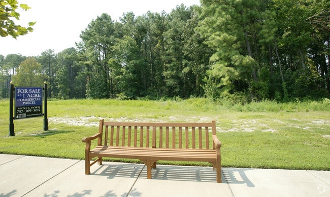
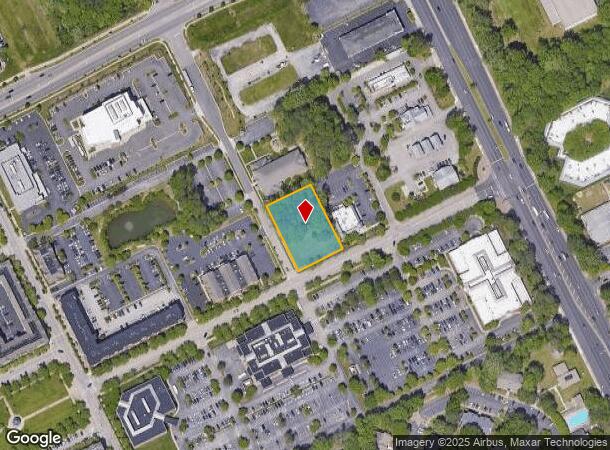
Property Record
1020 Loftis Blvd, Newport News, VA 23606
NEARBY LISTINGS FOR SALE OR LEASE
Property Detail
1020 Loftis Blvd
Virginia Beach-Norfolk-Newport News, VA-NC
Port Warwick Llc
194.00-02-13
PARCEL B (0.7888A) 154 X 223.11
Commercialacreage
Newport News
X
Virginia
5101030128D
b
2025
0.79 AC
2025
Oyster Point
032133
Hampton Roads
DEMOGRAPHICS near 1020 Loftis Blvd
1 Mile
3 Mile
5 Mile
2024 Total Population
13,302
83,833
169,520
2029 Population
13,027
83,195
169,847
Pop Growth 2024-2029
(2.07%)
(0.76%)
+ 0.19%
Average Age
36
38
38
2024 Total Households
6,319
34,612
68,867
HH Growth 2024-2029
(2.06%)
(0.94%)
+ 0.01%
Median Household Inc
$54,829
$69,479
$71,015
Avg Household Size
2.10
2.30
2.40
2024 Avg HH Vehicles
1.00
2.00
2.00
Median Home Value
$240,581
$269,850
$265,866
Median Year Built
1986
1984
1983
Nearby Places
Map Layers
Map Styles
 Street
 Aerial
- Restaurants
- Banks
- Shops
- Fitness
- Groceries
PUBLIC TRANSPORTATION
COMMUTER RAIL
Newport News (Northeast Regional - Amtrak)
DRIVE
WALK
Distance
Newport News (Northeast Regional - Amtrak)
11 min
5.2 mi
AIRPORT
Newport News/Williamsburg International
DRIVE
WALK
Distance
Newport News/Williamsburg International
10 min
4.4 mi
Norfolk International
DRIVE
WALK
Distance
Norfolk International
38 min
24.9 mi
Freight Ports
Virginia Port Authority - Newport News
DRIVE
WALK
Distance
Virginia Port Authority - Newport News
17 min
8.7 mi
Nearby Properties
Address
Land Use
TOTAL SIZE
Lot Size
Zoning
Address
Land Use
TOTAL SIZE
Lot Size
Zoning
551,257 SF
53.88 AC
O2 P1
Address
Land Use
TOTAL SIZE
Lot Size
Zoning
15,621 SF
67.16 AC
P1
Address
Land Use
TOTAL SIZE
Lot Size
Zoning
717,621 SF
141.28 AC
M1
Address
Land Use
TOTAL SIZE
Lot Size
Zoning
271,000 SF
24.28 AC
P1
Address
Land Use
TOTAL SIZE
Lot Size
Zoning
464,936 SF
33.26 AC
R7
Address
Land Use
TOTAL SIZE
Lot Size
Zoning
565,343 SF
46.70 AC
C1
Address
Land Use
TOTAL SIZE
Lot Size
Zoning
68,814 SF
462.33 AC
P1
Address
Land Use
TOTAL SIZE
Lot Size
Zoning
393,640 SF
14.12 AC
PLANNED DE
Address
Land Use
TOTAL SIZE
Lot Size
Zoning
35,125 SF
5.81 AC
R9
Address
Land Use
TOTAL SIZE
Lot Size
Zoning
25 AC
R8
Address
Land Use
TOTAL SIZE
Lot Size
Zoning
210,585 SF
32.06 AC
R9
Address
Land Use
TOTAL SIZE
Lot Size
Zoning
100 SF
7.27 AC
R9
Address
Land Use
TOTAL SIZE
Lot Size
Zoning
264,447 SF
2.30 AC
C4
Address
Land Use
TOTAL SIZE
Lot Size
Zoning
13.01 AC
R7
Address
Land Use
TOTAL SIZE
Lot Size
Zoning
71,551 SF
110 AC
O3
Address
Land Use
TOTAL SIZE
Lot Size
Zoning
4.62 AC
C4
Address
Land Use
TOTAL SIZE
Lot Size
Zoning
100 SF
7.68 AC
R9
Address
Land Use
TOTAL SIZE
Lot Size
Zoning
22,652 SF
74.72 AC
P1
Address
Land Use
TOTAL SIZE
Lot Size
Zoning
4.10 AC
R9
Address
Land Use
TOTAL SIZE
Lot Size
Zoning
617 SF
73.49 AC
M1
Address
Land Use
TOTAL SIZE
Lot Size
Zoning
19.86 AC
R8
Address
Land Use
TOTAL SIZE
Lot Size
Zoning
100 SF
14 AC
R7
Address
Land Use
TOTAL SIZE
Lot Size
Zoning
11.95 AC
R8
Address
Land Use
TOTAL SIZE
Lot Size
Zoning
517,920 SF
1.56 AC
C4
Address
Land Use
TOTAL SIZE
Lot Size
Zoning
13.10 AC
R5
Address
Land Use
TOTAL SIZE
Lot Size
Zoning
8.09 AC
R8
Address
Land Use
TOTAL SIZE
Lot Size
Zoning
20.73 AC
R7
Address
Land Use
TOTAL SIZE
Lot Size
Zoning
44,999 SF
63.89 AC
P1
Address
Land Use
TOTAL SIZE
Lot Size
Zoning
3.95 AC
C4
Address
Land Use
TOTAL SIZE
Lot Size
Zoning
60,000 SF
1.64 AC
C4
The World's #1 Commercial Real Estate Marketplace
Connect with us
© 2025 CoStar Group
The information above has been obtained from sources believed reliable. While we do not doubt its accuracy we have not verified it and make no guarantee, warranty or representation about it. It is your responsibility to independently confirm its accuracy and completeness. Any projections, opinions, assumptions, or estimates used are for example only and do not represent the current or future performance of the property. The value of this transaction to you depends on tax and other factors which should be evaluated by your tax, financial, and legal advisors. You and your advisors should conduct a careful, independent investigation of the property to determine to your satisfaction the suitability of the property for your needs.