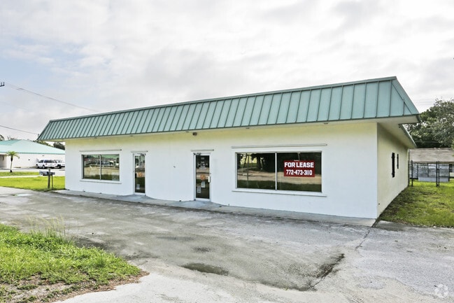
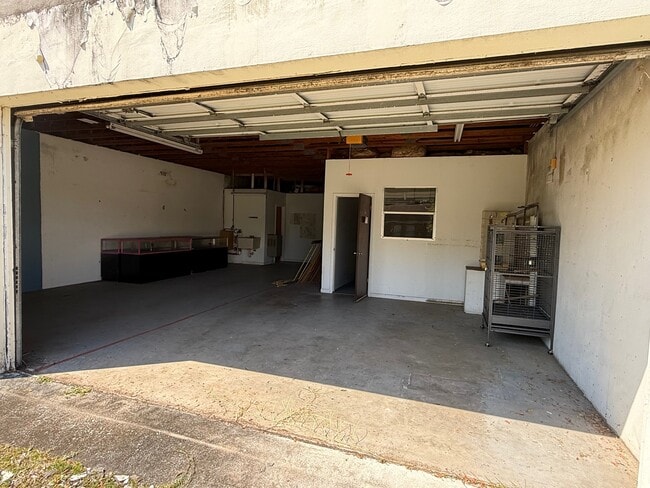
Property Record
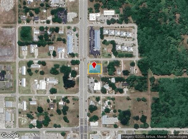
1020 N Parrott Ave, Okeechobee, FL 34972
Current Lease Availabilities
NEARBY LISTINGS FOR SALE OR LEASE
Property Detail
1020 N Parrott Ave
Okeechobee, FL
City Of Okeechobee
R3-15-37-35-0010-00310-0110
CITY OF OKEECHOBEE (PLAT BOOK 1 PAGE 10 & PLAT BOOK 5 PAGE 5) LOTS 11 & 12 BLOCK 31
Officebuilding
Okeechobee
X
Florida
12093C0415C
11,12
2025
0.34 AC
2025
Florida Central South Area
910300
Other Market Areas
3,840 SF
DEMOGRAPHICS near 1020 N Parrott Ave
1 Mile
3 Mile
5 Mile
2024 Total Population
2,372
17,690
27,439
2029 Population
2,501
18,775
29,154
Pop Growth 2024-2029
+ 5.44%
+ 6.13%
+ 6.25%
Average Age
40
39
42
2024 Total Households
864
6,215
10,297
HH Growth 2024-2029
+ 5.56%
+ 6.58%
+ 6.76%
Median Household Inc
$29,196
$48,579
$44,776
Avg Household Size
2.60
2.70
2.50
2024 Avg HH Vehicles
2.00
2.00
2.00
Median Home Value
$89,694
$140,861
$135,499
Median Year Built
1984
1984
1985
Nearby Places
Map Layers
Map Styles
 Street
 Aerial
- Restaurants
- Banks
- Shops
- Fitness
- Groceries
PUBLIC TRANSPORTATION
COMMUTER RAIL
Okeechobee Amtrak (Silver Star - Amtrak)
DRIVE
WALK
Distance
Okeechobee Amtrak (Silver Star - Amtrak)
1 min
4 min
0.2 mi
Freight Ports
Port of Palm Beach
DRIVE
WALK
Distance
Port of Palm Beach
88 min
60.2 mi
Nearby Properties
Address
Land Use
TOTAL SIZE
Lot Size
Zoning
Address
Land Use
TOTAL SIZE
Lot Size
Zoning
80,699 SF
110.96 AC
Address
Land Use
TOTAL SIZE
Lot Size
Zoning
213,251 SF
44.36 AC
Address
Land Use
TOTAL SIZE
Lot Size
Zoning
119,085 SF
14.79 AC
Address
Land Use
TOTAL SIZE
Lot Size
Zoning
194,141 SF
30.69 AC
Address
Land Use
TOTAL SIZE
Lot Size
Zoning
105,153 SF
4.13 AC
Address
Land Use
TOTAL SIZE
Lot Size
Zoning
166,487 SF
40 AC
Address
Land Use
TOTAL SIZE
Lot Size
Zoning
95,560 SF
10.55 AC
Address
Land Use
TOTAL SIZE
Lot Size
Zoning
179,505 SF
30.43 AC
Address
Land Use
TOTAL SIZE
Lot Size
Zoning
122,024 SF
14.12 AC
Address
Land Use
TOTAL SIZE
Lot Size
Zoning
84,774 SF
7.98 AC
Address
Land Use
TOTAL SIZE
Lot Size
Zoning
90,801 SF
15.10 AC
Address
Land Use
TOTAL SIZE
Lot Size
Zoning
158,401 SF
14.89 AC
Address
Land Use
TOTAL SIZE
Lot Size
Zoning
9,262 SF
21 AC
Address
Land Use
TOTAL SIZE
Lot Size
Zoning
98,033 SF
20.56 AC
Address
Land Use
TOTAL SIZE
Lot Size
Zoning
685 SF
1,520.49 AC
Address
Land Use
TOTAL SIZE
Lot Size
Zoning
59,251 SF
0.47 AC
Address
Land Use
TOTAL SIZE
Lot Size
Zoning
122,498 SF
10.82 AC
Address
Land Use
TOTAL SIZE
Lot Size
Zoning
84,668 SF
10.74 AC
Address
Land Use
TOTAL SIZE
Lot Size
Zoning
88,120 SF
15.30 AC
Address
Land Use
TOTAL SIZE
Lot Size
Zoning
51,715 SF
41 AC
Address
Land Use
TOTAL SIZE
Lot Size
Zoning
50,633 SF
4.22 AC
Address
Land Use
TOTAL SIZE
Lot Size
Zoning
23,460 SF
8 AC
Address
Land Use
TOTAL SIZE
Lot Size
Zoning
44,801 SF
9.90 AC
Address
Land Use
TOTAL SIZE
Lot Size
Zoning
77,019 SF
7.76 AC
Address
Land Use
TOTAL SIZE
Lot Size
Zoning
58,312 SF
7.50 AC
Address
Land Use
TOTAL SIZE
Lot Size
Zoning
121,250 SF
10.31 AC
Address
Land Use
TOTAL SIZE
Lot Size
Zoning
2,470 SF
258.06 AC
Address
Land Use
TOTAL SIZE
Lot Size
Zoning
2,100 SF
23.86 AC
Address
Land Use
TOTAL SIZE
Lot Size
Zoning
9,352 SF
7.38 AC
Address
Land Use
TOTAL SIZE
Lot Size
Zoning
42,074 SF
34.62 AC
The World's #1 Commercial Real Estate Marketplace
Connect with us
© 2026 CoStar Group
The information above has been obtained from sources believed reliable. While we do not doubt its accuracy we have not verified it and make no guarantee, warranty or representation about it. It is your responsibility to independently confirm its accuracy and completeness. Any projections, opinions, assumptions, or estimates used are for example only and do not represent the current or future performance of the property. The value of this transaction to you depends on tax and other factors which should be evaluated by your tax, financial, and legal advisors. You and your advisors should conduct a careful, independent investigation of the property to determine to your satisfaction the suitability of the property for your needs.