Property Record
1020 N State Route 89, Chino Valley, AZ 86323

NEARBY LISTINGS FOR SALE OR LEASE
Property Detail
1020 N State Route 89
306-20-030H
AN IRREG PCL LYING W OF HWY 89 SW COR LYING 45N & 315E FROM THE S4 COR STR 15-16N-2W CONT 2.27AC 4487/541
Storemultistory
Yavapai
X
Arizona
04025C1315G
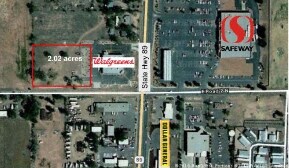
2.27 AC
2024
Prescott & Sedona
2026
Other Market Areas
000211
Prescott, AZ
12,771 SF
DEMOGRAPHICS near 1020 N State Route 89
1 Mile
3 Mile
5 Mile
2024 Total Population
3,140
14,539
17,552
2029 Population
3,467
15,924
19,225
Pop Growth 2024-2029
+ 10.41%
+ 9.53%
+ 9.53%
Average Age
46
46
46
2024 Total Households
1,328
5,884
7,153
HH Growth 2024-2029
+ 10.99%
+ 9.96%
+ 9.97%
Median Household Inc
$45,690
$47,610
$48,948
Avg Household Size
2.40
2.40
2.40
2024 Avg HH Vehicles
2.00
2.00
2.00
Median Home Value
$287,942
$304,973
$312,337
Median Year Built
1992
1994
1995
Nearby Places
Map Layers
Map Styles
 Street
 Aerial
- Restaurants
- Banks
- Shops
- Fitness
- Groceries
Nearby Properties
Address
Land Use
TOTAL SIZE
Lot Size
Zoning
Address
Land Use
TOTAL SIZE
Lot Size
Zoning
140,738 SF
38.44 AC
Address
Land Use
TOTAL SIZE
Lot Size
Zoning
67,687 SF
14.67 AC
Address
Land Use
TOTAL SIZE
Lot Size
Zoning
70,562 SF
15.10 AC
Address
Land Use
TOTAL SIZE
Lot Size
Zoning
30,116 SF
1.79 AC
Address
Land Use
TOTAL SIZE
Lot Size
Zoning
22,431 SF
4.85 AC
Address
Land Use
TOTAL SIZE
Lot Size
Zoning
29,751 SF
15 AC
Address
Land Use
TOTAL SIZE
Lot Size
Zoning
55,398 SF
6.30 AC
Address
Land Use
TOTAL SIZE
Lot Size
Zoning
97,797 SF
26.67 AC
Address
Land Use
TOTAL SIZE
Lot Size
Zoning
46,400 SF
23.19 AC
Address
Land Use
TOTAL SIZE
Lot Size
Zoning
378,204 SF
39.24 AC
Address
Land Use
TOTAL SIZE
Lot Size
Zoning
5,711 SF
19.90 AC
Address
Land Use
TOTAL SIZE
Lot Size
Zoning
25,904 SF
3.95 AC
Address
Land Use
TOTAL SIZE
Lot Size
Zoning
29,215 SF
3.82 AC
Address
Land Use
TOTAL SIZE
Lot Size
Zoning
36,490 SF
4.86 AC
Address
Land Use
TOTAL SIZE
Lot Size
Zoning
51,105 SF
5.44 AC
Address
Land Use
TOTAL SIZE
Lot Size
Zoning
18,300 SF
2.95 AC
Address
Land Use
TOTAL SIZE
Lot Size
Zoning
13,785 SF
42.87 AC
Address
Land Use
TOTAL SIZE
Lot Size
Zoning
17,110 SF
5 AC
Address
Land Use
TOTAL SIZE
Lot Size
Zoning
164,570 SF
21.07 AC
Address
Land Use
TOTAL SIZE
Lot Size
Zoning
44,137 SF
7.71 AC
Address
Land Use
TOTAL SIZE
Lot Size
Zoning
21,192 SF
1.48 AC
Address
Land Use
TOTAL SIZE
Lot Size
Zoning
9,203 SF
0.93 AC
Address
Land Use
TOTAL SIZE
Lot Size
Zoning
38,052 SF
6.19 AC
Address
Land Use
TOTAL SIZE
Lot Size
Zoning
6,675 SF
9.49 AC
Address
Land Use
TOTAL SIZE
Lot Size
Zoning
14,662 SF
1.28 AC
Address
Land Use
TOTAL SIZE
Lot Size
Zoning
14,180 SF
169.08 AC
Address
Land Use
TOTAL SIZE
Lot Size
Zoning
32,422 SF
2.32 AC
Address
Land Use
TOTAL SIZE
Lot Size
Zoning
44,630 SF
2.81 AC
Address
Land Use
TOTAL SIZE
Lot Size
Zoning
12,584 SF
3.36 AC
The World's #1 Commercial Real Estate Marketplace
Connect with us
© 2026 CoStar Group
The information above has been obtained from sources believed reliable. While we do not doubt its accuracy we have not verified it and make no guarantee, warranty or representation about it. It is your responsibility to independently confirm its accuracy and completeness. Any projections, opinions, assumptions, or estimates used are for example only and do not represent the current or future performance of the property. The value of this transaction to you depends on tax and other factors which should be evaluated by your tax, financial, and legal advisors. You and your advisors should conduct a careful, independent investigation of the property to determine to your satisfaction the suitability of the property for your needs.