Property Record
1020 Pier Branch Rd, Dripping Springs, TX 78620
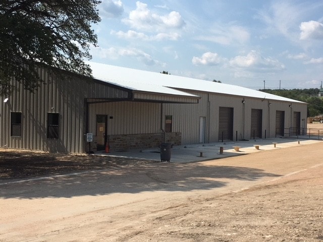

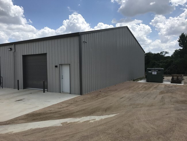
Property Detail
1020 Pier Branch Rd
Austin-Round Rock-San Marcos, TX
SUNSET CANYON SEC II-C LOT 17 1.928 AC
R44799
Hays
Commercialnec
Texas
B and X Area of moderate flood hazard, usually the area between the limits of the 100-year and 500-year floods.
17
2024
1.93 AC
2025
Hays County
010806
Austin
12,667 SF
NEARBY LISTINGS FOR SALE OR LEASE
DEMOGRAPHICS near 1020 Pier Branch Rd
1 mile
3 mile
5 mile
2024 Total Population
1,271
20,297
35,543
2029 Population
1,698
26,951
46,883
Pop Growth 2024-2029
+ 33.60%
+ 32.78%
+ 31.91%
Average Age
42
39
40
2024 Total Households
457
6,971
12,351
HH Growth 2024-2029
+ 34.79%
+ 33.85%
+ 32.90%
Median Household Inc
$127,907
$142,423
$140,239
Avg Household Size
2.80
2.90
2.90
2024 Avg HH Vehicles
2.00
2.00
2.00
Median Home Value
$649,377
$586,136
$623,648
Median Year Built
2007
2010
2009
Nearby Places
Map Layers
Map Styles
 Street
 Aerial
Transit
 Traffic
 Biking
Places
Listings with unknown addresses are not visible on the map
- Restaurants
- Banks
- Shops
- Fitness
- Groceries
PUBLIC TRANSPORTATION
AIRPORT
Austin-Bergstrom International
Drive
Walk
Distance
Austin-Bergstrom International
42 min
25.9 mi
Freight Ports
Calhoun Port
Drive
Walk
Distance
Calhoun Port
207 min
169.4 mi
SALE & LEASE HISTORY
LISTING DATE
SALE/LEASE

Oct 18, 2019
For Lease
Jun 12, 2018
For Lease
Feb 12, 2018
For Lease
Nearby Properties
Address
Land Use
TOTAL SIZE
Lot Size
Zoning
Address
Land Use
TOTAL SIZE
Lot Size
Zoning
399,662 SF
16.72 AC
Address
Land Use
TOTAL SIZE
Lot Size
Zoning
324,987 SF
8.29 AC
Address
Land Use
TOTAL SIZE
Lot Size
Zoning
219,299 SF
4.89 AC
Address
Land Use
TOTAL SIZE
Lot Size
Zoning
275,753 SF
15.68 AC
Address
Land Use
TOTAL SIZE
Lot Size
Zoning
64,670 SF
13.53 AC
Address
Land Use
TOTAL SIZE
Lot Size
Zoning
231,472 SF
9.53 AC
Address
Land Use
TOTAL SIZE
Lot Size
Zoning
199,572 SF
9.63 AC
Address
Land Use
TOTAL SIZE
Lot Size
Zoning
Address
Land Use
TOTAL SIZE
Lot Size
Zoning
77,801 SF
14.49 AC
Address
Land Use
TOTAL SIZE
Lot Size
Zoning
37,380 SF
4.35 AC
Address
Land Use
TOTAL SIZE
Lot Size
Zoning
Address
Land Use
TOTAL SIZE
Lot Size
Zoning
600 SF
12.61 AC
Address
Land Use
TOTAL SIZE
Lot Size
Zoning
56.63 AC
Address
Land Use
TOTAL SIZE
Lot Size
Zoning
94.05 AC
Address
Land Use
TOTAL SIZE
Lot Size
Zoning
3 SF
14.51 AC
Address
Land Use
TOTAL SIZE
Lot Size
Zoning
82,488 SF
20.23 AC
Address
Land Use
TOTAL SIZE
Lot Size
Zoning
15,750 SF
1.94 AC
Address
Land Use
TOTAL SIZE
Lot Size
Zoning
Address
Land Use
TOTAL SIZE
Lot Size
Zoning
17,987 SF
12.07 AC
Address
Land Use
TOTAL SIZE
Lot Size
Zoning
Address
Land Use
TOTAL SIZE
Lot Size
Zoning
4,844 SF
13.44 AC
Address
Land Use
TOTAL SIZE
Lot Size
Zoning
2,280 SF
9.05 AC
Address
Land Use
TOTAL SIZE
Lot Size
Zoning
Address
Land Use
TOTAL SIZE
Lot Size
Zoning
4,500 SF
5.31 AC
Address
Land Use
TOTAL SIZE
Lot Size
Zoning
20,860 SF
5.13 AC
Address
Land Use
TOTAL SIZE
Lot Size
Zoning
12,592 SF
3.74 AC
Address
Land Use
TOTAL SIZE
Lot Size
Zoning
8,221 SF
10.01 AC
Address
Land Use
TOTAL SIZE
Lot Size
Zoning
19,701 SF
1.34 AC
Address
Land Use
TOTAL SIZE
Lot Size
Zoning
Address
Land Use
TOTAL SIZE
Lot Size
Zoning
The World's #1 Commercial Real Estate Marketplace
Connect with us
© 2026 CoStar Group
The information above has been obtained from sources believed reliable. While we do not doubt its accuracy we have not verified it and make no guarantee, warranty or representation about it. It is your responsibility to independently confirm its accuracy and completeness. Any projections, opinions, assumptions, or estimates used are for example only and do not represent the current or future performance of the property. The value of this transaction to you depends on tax and other factors which should be evaluated by your tax, financial, and legal advisors. You and your advisors should conduct a careful, independent investigation of the property to determine to your satisfaction the suitability of the property for your needs.