Property Record
1020 Stanhope St, Pittsburgh, PA 15204


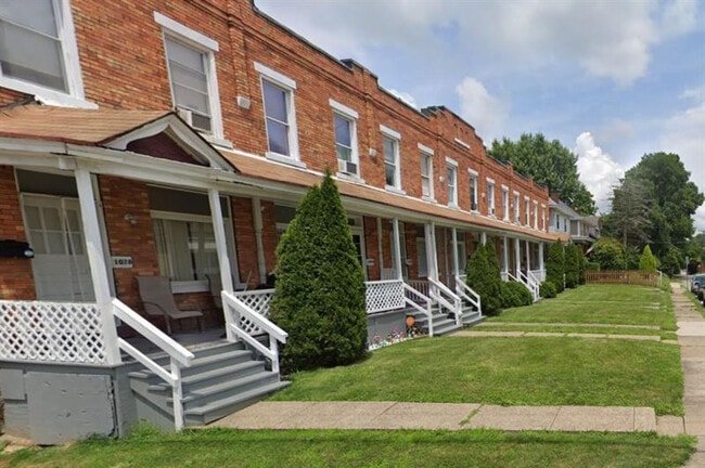
Property Detail
1020 Stanhope St
Pittsburgh, PA
PATTERSON PLAN 111 LOT 100X100 STANHOPE ST COR UNIVERSAL 7-2 STY BRK HSES 1020 TO 1028
0042-J-00141-0000-00
Allegheny
Apartment
Pennsylvania
B and X Area of moderate flood hazard, usually the area between the limits of the 100-year and 500-year floods.
141
2024
0.23 AC
2025
Sheraden
202200
Pittsburgh
7,128 SF
NEARBY LISTINGS FOR SALE OR LEASE
DEMOGRAPHICS near 1020 Stanhope St
1 mile
3 mile
5 mile
2025 Total Population
15,880
87,685
248,147
2030 Population
15,804
87,048
246,229
Pop Growth 2025-2030
(0.48%)
(0.73%)
(0.77%)
Average Age
39
41
41
2025 Total Households
6,848
41,066
114,952
HH Growth 2025-2030
(0.54%)
(0.81%)
(0.81%)
Median Household Inc
$52,356
$63,967
$71,335
Avg Household Size
2.20
2.10
2.00
2025 Avg HH Vehicles
1.00
1.00
1.00
Median Home Value
$133,237
$178,142
$206,974
Median Year Built
1949
1950
1952
Nearby Places
Map Layers
Map Styles
 Street
 Aerial
Layers
 Traffic
 Biking
Places
Listings with unknown addresses are not visible on the map
- Restaurants
- Banks
- Shops
- Fitness
- Groceries
PUBLIC TRANSPORTATION
COMMUTER RAIL
Drive
Walk
Distance
12 min
4.8 mi
AIRPORT
Pittsburgh International
Drive
Walk
Distance
Pittsburgh International
30 min
14.0 mi
Arnold Palmer Regional
Drive
Walk
Distance
Arnold Palmer Regional
75 min
47.0 mi
Nearby Properties
Address
Land Use
TOTAL SIZE
Lot Size
Zoning
Address
Land Use
TOTAL SIZE
Lot Size
Zoning
10.41 AC
Address
Land Use
TOTAL SIZE
Lot Size
Zoning
13.75 AC
Address
Land Use
TOTAL SIZE
Lot Size
Zoning
26.68 AC
Address
Land Use
TOTAL SIZE
Lot Size
Zoning
Address
Land Use
TOTAL SIZE
Lot Size
Zoning
21.20 AC
Address
Land Use
TOTAL SIZE
Lot Size
Zoning
105.09 AC
Address
Land Use
TOTAL SIZE
Lot Size
Zoning
6.55 AC
Address
Land Use
TOTAL SIZE
Lot Size
Zoning
0.81 AC
Address
Land Use
TOTAL SIZE
Lot Size
Zoning
1.66 AC
Address
Land Use
TOTAL SIZE
Lot Size
Zoning
6.40 AC
Address
Land Use
TOTAL SIZE
Lot Size
Zoning
1.22 AC
Address
Land Use
TOTAL SIZE
Lot Size
Zoning
16.54 AC
Address
Land Use
TOTAL SIZE
Lot Size
Zoning
1,556 SF
36.30 AC
Address
Land Use
TOTAL SIZE
Lot Size
Zoning
Address
Land Use
TOTAL SIZE
Lot Size
Zoning
Address
Land Use
TOTAL SIZE
Lot Size
Zoning
Address
Land Use
TOTAL SIZE
Lot Size
Zoning
Address
Land Use
TOTAL SIZE
Lot Size
Zoning
16.01 AC
Address
Land Use
TOTAL SIZE
Lot Size
Zoning
72.69 AC
Address
Land Use
TOTAL SIZE
Lot Size
Zoning
1.06 AC
Address
Land Use
TOTAL SIZE
Lot Size
Zoning
25.09 AC
Address
Land Use
TOTAL SIZE
Lot Size
Zoning
6.31 AC
Address
Land Use
TOTAL SIZE
Lot Size
Zoning
2.19 AC
Address
Land Use
TOTAL SIZE
Lot Size
Zoning
24.04 AC
Address
Land Use
TOTAL SIZE
Lot Size
Zoning
39.74 AC
Address
Land Use
TOTAL SIZE
Lot Size
Zoning
3.83 AC
Address
Land Use
TOTAL SIZE
Lot Size
Zoning
13.86 AC
Address
Land Use
TOTAL SIZE
Lot Size
Zoning
Address
Land Use
TOTAL SIZE
Lot Size
Zoning
Address
Land Use
TOTAL SIZE
Lot Size
Zoning
11.93 AC
The World's #1 Commercial Real Estate Marketplace
Connect with us
© 2026 CoStar Group
The information above has been obtained from sources believed reliable. While we do not doubt its accuracy we have not verified it and make no guarantee, warranty or representation about it. It is your responsibility to independently confirm its accuracy and completeness. Any projections, opinions, assumptions, or estimates used are for example only and do not represent the current or future performance of the property. The value of this transaction to you depends on tax and other factors which should be evaluated by your tax, financial, and legal advisors. You and your advisors should conduct a careful, independent investigation of the property to determine to your satisfaction the suitability of the property for your needs.