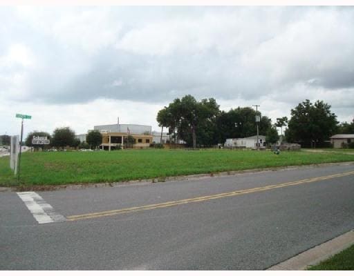
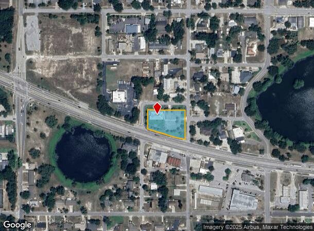
Property Record
1020 W Highway 50, Clermont, FL 34711
NEARBY LISTINGS FOR SALE OR LEASE
Property Detail
1020 W Highway 50
Orlando-Kissimmee-Sanford, FL
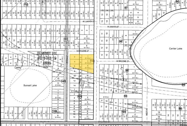
Clermont Sunset Park
23-22-25-0500-110-00100
CLERMONT SUNSET PARK LOTS 1 2 3 4 5 LOTS 6 7 8 N OF HWY BLK 110 PB 8 PGS 18-23 ORB 4468 PG 917
Medicalbuilding
Lake
X
Florida
12069C0570E
1
2024
0.94 AC
2026
Lake County
031312
Orlando
4,126 SF
DEMOGRAPHICS near 1020 W Highway 50
1 Mile
3 Mile
5 Mile
2024 Total Population
4,300
36,312
95,397
2029 Population
5,018
42,175
111,531
Pop Growth 2024-2029
+ 16.70%
+ 16.15%
+ 16.91%
Average Age
42
40
41
2024 Total Households
1,727
13,593
35,001
HH Growth 2024-2029
+ 16.50%
+ 15.88%
+ 16.67%
Median Household Inc
$71,228
$78,914
$81,483
Avg Household Size
2.40
2.60
2.70
2024 Avg HH Vehicles
2.00
2.00
2.00
Median Home Value
$318,831
$296,085
$315,761
Median Year Built
1977
2000
2003
Nearby Places
Map Layers
Map Styles
 Street
 Aerial
- Restaurants
- Banks
- Shops
- Fitness
- Groceries
PUBLIC TRANSPORTATION
AIRPORT
Orlando International
DRIVE
WALK
Distance
Orlando International
47 min
34.5 mi
Freight Ports
Port of Tampa Bay
DRIVE
WALK
Distance
Port of Tampa Bay
96 min
73.8 mi
Nearby Properties
Address
Land Use
TOTAL SIZE
Lot Size
Zoning
Address
Land Use
TOTAL SIZE
Lot Size
Zoning
403,970 SF
30.99 AC
PUD
Address
Land Use
TOTAL SIZE
Lot Size
Zoning
285,581 SF
19.34 AC
CFD
Address
Land Use
TOTAL SIZE
Lot Size
Zoning
321,012 SF
22.55 AC
PUD
Address
Land Use
TOTAL SIZE
Lot Size
Zoning
269,594 SF
25.23 AC
PUD
Address
Land Use
TOTAL SIZE
Lot Size
Zoning
179,290 SF
23.79 AC
Address
Land Use
TOTAL SIZE
Lot Size
Zoning
212,649 SF
4.20 AC
Address
Land Use
TOTAL SIZE
Lot Size
Zoning
204,472 SF
43.52 AC
Address
Land Use
TOTAL SIZE
Lot Size
Zoning
Address
Land Use
TOTAL SIZE
Lot Size
Zoning
124,634 SF
18.57 AC
Address
Land Use
TOTAL SIZE
Lot Size
Zoning
142,824 SF
9.90 AC
C2
Address
Land Use
TOTAL SIZE
Lot Size
Zoning
126,067 SF
9.34 AC
Address
Land Use
TOTAL SIZE
Lot Size
Zoning
203,762 SF
18.28 AC
R1
Address
Land Use
TOTAL SIZE
Lot Size
Zoning
95,182 SF
12.34 AC
PUD
Address
Land Use
TOTAL SIZE
Lot Size
Zoning
158,351 SF
19.10 AC
C2
Address
Land Use
TOTAL SIZE
Lot Size
Zoning
80,774 SF
6.61 AC
Address
Land Use
TOTAL SIZE
Lot Size
Zoning
74,375 SF
6.69 AC
Address
Land Use
TOTAL SIZE
Lot Size
Zoning
90,469 SF
5.99 AC
PUD
Address
Land Use
TOTAL SIZE
Lot Size
Zoning
99,348 SF
34.10 AC
R1A
Address
Land Use
TOTAL SIZE
Lot Size
Zoning
72,336 SF
13.62 AC
C2
Address
Land Use
TOTAL SIZE
Lot Size
Zoning
66,526 SF
8.98 AC
C1
Address
Land Use
TOTAL SIZE
Lot Size
Zoning
123,387 SF
47.51 AC
R3
Address
Land Use
TOTAL SIZE
Lot Size
Zoning
48,496 SF
3.35 AC
C2
Address
Land Use
TOTAL SIZE
Lot Size
Zoning
30,415 SF
3.47 AC
Address
Land Use
TOTAL SIZE
Lot Size
Zoning
46,996 SF
7.93 AC
CP
Address
Land Use
TOTAL SIZE
Lot Size
Zoning
41,006 SF
8.43 AC
A
Address
Land Use
TOTAL SIZE
Lot Size
Zoning
30,926 SF
0.38 AC
Address
Land Use
TOTAL SIZE
Lot Size
Zoning
81,188 SF
7.70 AC
C2
Address
Land Use
TOTAL SIZE
Lot Size
Zoning
108,772 SF
12 AC
Address
Land Use
TOTAL SIZE
Lot Size
Zoning
59,648 SF
8.86 AC
R6
Address
Land Use
TOTAL SIZE
Lot Size
Zoning
51,408 SF
10.26 AC
The World's #1 Commercial Real Estate Marketplace
Connect with us
© 2025 CoStar Group
The information above has been obtained from sources believed reliable. While we do not doubt its accuracy we have not verified it and make no guarantee, warranty or representation about it. It is your responsibility to independently confirm its accuracy and completeness. Any projections, opinions, assumptions, or estimates used are for example only and do not represent the current or future performance of the property. The value of this transaction to you depends on tax and other factors which should be evaluated by your tax, financial, and legal advisors. You and your advisors should conduct a careful, independent investigation of the property to determine to your satisfaction the suitability of the property for your needs.