Property Record
10200 Boulder Ln, Austin, TX 78726


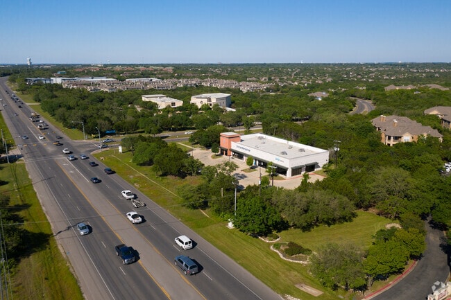
Property Detail
10200 Boulder Ln
Austin-Round Rock-San Marcos, TX
LOT 1 BLK A CANYON CREEK SEC 6A
543281
Travis
Stripcommercialcenter
Texas
B and X Area of moderate flood hazard, usually the area between the limits of the 100-year and 500-year floods.
1
2025
1.84 AC
2025
Far Northwest
034600
Austin
9,005 SF
NEARBY LISTINGS FOR SALE OR LEASE
DEMOGRAPHICS near 10200 Boulder Ln
1 mile
3 mile
5 mile
2025 Total Population
7,831
43,392
141,828
2030 Population
8,110
45,786
153,855
Pop Growth 2025-2030
+ 3.56%
+ 5.52%
+ 8.48%
Average Age
36
40
39
2025 Total Households
3,552
16,766
58,224
HH Growth 2025-2030
+ 4.17%
+ 6.17%
+ 9.44%
Median Household Inc
$76,753
$138,155
$117,611
Avg Household Size
2.20
2.50
2.40
2025 Avg HH Vehicles
2.00
2.00
2.00
Median Home Value
$746,082
$694,887
$654,316
Median Year Built
2004
1998
1998
Nearby Places
Map Layers
Map Styles
 Street
 Aerial
Transit
 Traffic
 Biking
Places
Listings with unknown addresses are not visible on the map
- Restaurants
- Banks
- Shops
- Fitness
- Groceries
PUBLIC TRANSPORTATION
AIRPORT
Austin-Bergstrom International
Drive
Walk
Distance
Austin-Bergstrom International
45 min
30.6 mi
SALE & LEASE HISTORY
LISTING DATE
SALE/LEASE

Sep 14, 2017
For Lease
Jan 18, 2019
For Lease
Nearby Properties
Address
Land Use
TOTAL SIZE
Lot Size
Zoning
Address
Land Use
TOTAL SIZE
Lot Size
Zoning
1,396,406 SF
107.21 AC
Address
Land Use
TOTAL SIZE
Lot Size
Zoning
525,852 SF
30.92 AC
Address
Land Use
TOTAL SIZE
Lot Size
Zoning
494,958 SF
39.50 AC
Address
Land Use
TOTAL SIZE
Lot Size
Zoning
369,192 SF
78.87 AC
Address
Land Use
TOTAL SIZE
Lot Size
Zoning
411,288 SF
27.68 AC
Address
Land Use
TOTAL SIZE
Lot Size
Zoning
342,992 SF
17.53 AC
Address
Land Use
TOTAL SIZE
Lot Size
Zoning
576,996 SF
38.77 AC
Address
Land Use
TOTAL SIZE
Lot Size
Zoning
610,326 SF
43.30 AC
Address
Land Use
TOTAL SIZE
Lot Size
Zoning
388,673 SF
30.98 AC
Address
Land Use
TOTAL SIZE
Lot Size
Zoning
306,900 SF
34.50 AC
Address
Land Use
TOTAL SIZE
Lot Size
Zoning
323,718 SF
17.45 AC
Address
Land Use
TOTAL SIZE
Lot Size
Zoning
172,975 SF
33.88 AC
Address
Land Use
TOTAL SIZE
Lot Size
Zoning
349,600 SF
14.62 AC
Address
Land Use
TOTAL SIZE
Lot Size
Zoning
349,200 SF
28.91 AC
Address
Land Use
TOTAL SIZE
Lot Size
Zoning
638,467 SF
47.71 AC
Address
Land Use
TOTAL SIZE
Lot Size
Zoning
276,728 SF
16.25 AC
Address
Land Use
TOTAL SIZE
Lot Size
Zoning
285,768 SF
23.77 AC
Address
Land Use
TOTAL SIZE
Lot Size
Zoning
262,480 SF
27.52 AC
Address
Land Use
TOTAL SIZE
Lot Size
Zoning
270,504 SF
21.75 AC
Address
Land Use
TOTAL SIZE
Lot Size
Zoning
153,450 SF
14.70 AC
Address
Land Use
TOTAL SIZE
Lot Size
Zoning
173,608 SF
16.20 AC
Address
Land Use
TOTAL SIZE
Lot Size
Zoning
264,990 SF
17.44 AC
Address
Land Use
TOTAL SIZE
Lot Size
Zoning
196,610 SF
383.96 AC
Address
Land Use
TOTAL SIZE
Lot Size
Zoning
182,320 SF
13.67 AC
Address
Land Use
TOTAL SIZE
Lot Size
Zoning
155,600 SF
6.19 AC
Address
Land Use
TOTAL SIZE
Lot Size
Zoning
222,200 SF
39.03 AC
Address
Land Use
TOTAL SIZE
Lot Size
Zoning
116,463 SF
15.27 AC
Address
Land Use
TOTAL SIZE
Lot Size
Zoning
179,796 SF
5.08 AC
Address
Land Use
TOTAL SIZE
Lot Size
Zoning
273,841 SF
14.69 AC
Address
Land Use
TOTAL SIZE
Lot Size
Zoning
128,040 SF
14.99 AC
The World's #1 Commercial Real Estate Marketplace
Connect with us
© 2026 CoStar Group
The information above has been obtained from sources believed reliable. While we do not doubt its accuracy we have not verified it and make no guarantee, warranty or representation about it. It is your responsibility to independently confirm its accuracy and completeness. Any projections, opinions, assumptions, or estimates used are for example only and do not represent the current or future performance of the property. The value of this transaction to you depends on tax and other factors which should be evaluated by your tax, financial, and legal advisors. You and your advisors should conduct a careful, independent investigation of the property to determine to your satisfaction the suitability of the property for your needs.