Property Record
10200 Sw 72Nd St, Miami, FL 33173


NEARBY LISTINGS FOR SALE OR LEASE
Property Detail
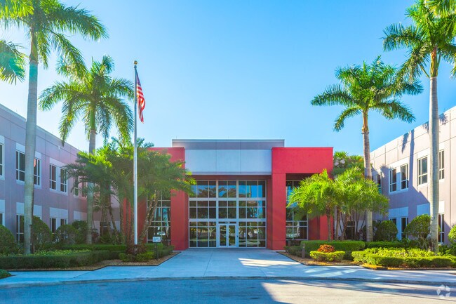
10200 Sw 72Nd St
30-4032-045-0010
Nicoi
Officebuilding
NICOI TRACT PB 154-22 T-18268 TR A LOT SIZE 8.61 AC M/L FAU 30-4032-033-0010 OR 18750-3722 0399 4
AH
Miami/Dade
12086C0453L
Florida
2024
8.61 AC
2025
Kendall
008422
South Florida
94,148 SF
Miami-Miami Beach-Kendall, FL
DEMOGRAPHICS near 10200 Sw 72Nd St
1 Mile
3 Mile
5 Mile
2024 Total Population
17,730
138,602
426,691
2029 Population
17,179
134,630
414,757
Pop Growth 2024-2029
(3.11%)
(2.87%)
(2.80%)
Average Age
43
44
43
2024 Total Households
6,658
50,758
148,381
HH Growth 2024-2029
(3.48%)
(3.15%)
(3.12%)
Median Household Inc
$69,770
$71,988
$70,383
Avg Household Size
2.60
2.60
2.70
2024 Avg HH Vehicles
2.00
2.00
2.00
Median Home Value
$367,920
$408,146
$406,722
Median Year Built
1978
1975
1977
Nearby Places
Map Layers
Map Styles
 Street
 Aerial
- Restaurants
- Banks
- Shops
- Fitness
- Groceries
PUBLIC TRANSPORTATION
COMMUTER RAIL
Dadeland South (Metrorail Green Line - Miami-Dade Transit (Metrorail/Metromover))
DRIVE
WALK
Distance
Dadeland South (Metrorail Green Line - Miami-Dade Transit (Metrorail/Metromover))
9 min
4.2 mi
Dadeland North (Metrorail Green Line - Miami-Dade Transit (Metrorail/Metromover))
DRIVE
WALK
Distance
Dadeland North (Metrorail Green Line - Miami-Dade Transit (Metrorail/Metromover))
8 min
4.3 mi
AIRPORT
Miami International
DRIVE
WALK
Distance
Miami International
23 min
11.6 mi
Fort Lauderdale/Hollywood International
DRIVE
WALK
Distance
Fort Lauderdale/Hollywood International
53 min
38.8 mi
Freight Ports
Port of Miami
DRIVE
WALK
Distance
Port of Miami
31 min
15.3 mi
Nearby Properties
Address
Land Use
TOTAL SIZE
Lot Size
Zoning
Address
Land Use
TOTAL SIZE
Lot Size
Zoning
2,238,641 SF
39 AC
6114
Address
Land Use
TOTAL SIZE
Lot Size
Zoning
1,018,683 SF
11.46 AC
5000
Address
Land Use
TOTAL SIZE
Lot Size
Zoning
1,527,515 SF
55.17 AC
5000
Address
Land Use
TOTAL SIZE
Lot Size
Zoning
1,335,151 SF
180 AC
0100
Address
Land Use
TOTAL SIZE
Lot Size
Zoning
1,275,460 SF
15.30 AC
6400
Address
Land Use
TOTAL SIZE
Lot Size
Zoning
766,093 SF
8.91 AC
5000
Address
Land Use
TOTAL SIZE
Lot Size
Zoning
634,144 SF
3.12 AC
6114
Address
Land Use
TOTAL SIZE
Lot Size
Zoning
521,667 SF
1.08 AC
6112
Address
Land Use
TOTAL SIZE
Lot Size
Zoning
332,017 SF
6400
Address
Land Use
TOTAL SIZE
Lot Size
Zoning
333,947 SF
21.32 AC
6400
Address
Land Use
TOTAL SIZE
Lot Size
Zoning
452,547 SF
0.90 AC
6114
Address
Land Use
TOTAL SIZE
Lot Size
Zoning
553,491 SF
10.64 AC
3900
Address
Land Use
TOTAL SIZE
Lot Size
Zoning
277,025 SF
0.01 AC
6114
Address
Land Use
TOTAL SIZE
Lot Size
Zoning
349,295 SF
25.16 AC
6061
Address
Land Use
TOTAL SIZE
Lot Size
Zoning
350,948 SF
22.42 AC
3800
Address
Land Use
TOTAL SIZE
Lot Size
Zoning
401,432 SF
4.63 AC
6111
Address
Land Use
TOTAL SIZE
Lot Size
Zoning
245,376 SF
27 AC
6400
Address
Land Use
TOTAL SIZE
Lot Size
Zoning
196,806 SF
158.17 AC
8900
Address
Land Use
TOTAL SIZE
Lot Size
Zoning
540,778 SF
0.01 AC
6114
Address
Land Use
TOTAL SIZE
Lot Size
Zoning
367,374 SF
9.89 AC
8900
Address
Land Use
TOTAL SIZE
Lot Size
Zoning
313,755 SF
5 AC
2300
Address
Land Use
TOTAL SIZE
Lot Size
Zoning
183,845 SF
18.77 AC
5000
Address
Land Use
TOTAL SIZE
Lot Size
Zoning
276,202 SF
13.46 AC
3800
Address
Land Use
TOTAL SIZE
Lot Size
Zoning
240,674 SF
8.71 AC
6400
Address
Land Use
TOTAL SIZE
Lot Size
Zoning
228,254 SF
10.80 AC
3800
Address
Land Use
TOTAL SIZE
Lot Size
Zoning
116,627 SF
74.78 AC
8900
Address
Land Use
TOTAL SIZE
Lot Size
Zoning
291,110 SF
13.38 AC
3800
Address
Land Use
TOTAL SIZE
Lot Size
Zoning
237,857 SF
9.09 AC
2300
Address
Land Use
TOTAL SIZE
Lot Size
Zoning
249,202 SF
29.49 AC
8900
Address
Land Use
TOTAL SIZE
Lot Size
Zoning
283,695 SF
9.22 AC
3900
The World's #1 Commercial Real Estate Marketplace
Connect with us
© 2025 CoStar Group
The information above has been obtained from sources believed reliable. While we do not doubt its accuracy we have not verified it and make no guarantee, warranty or representation about it. It is your responsibility to independently confirm its accuracy and completeness. Any projections, opinions, assumptions, or estimates used are for example only and do not represent the current or future performance of the property. The value of this transaction to you depends on tax and other factors which should be evaluated by your tax, financial, and legal advisors. You and your advisors should conduct a careful, independent investigation of the property to determine to your satisfaction the suitability of the property for your needs.