Property Record
10201 Broad River Rd, Irmo, SC 29063


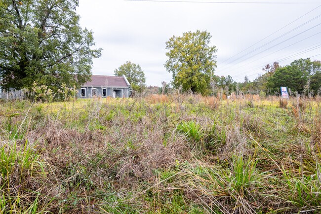
Property Detail
10201 Broad River Rd
04000-01-02
154.8X210.6X149 #SU #PR 10-213 57-506
Commercialnec
RICHLAND
RU
South Carolina
B and X Area of moderate flood hazard, usually the area between the limits of the 100-year and 500-year floods.
0.47 AC
2025
Dutch Fork/Irmo
2025
Columbia
010305
Columbia, SC
NEARBY LISTINGS FOR SALE OR LEASE
DEMOGRAPHICS near 10201 Broad River Rd
1 mile
3 mile
5 mile
2025 Total Population
4,170
38,618
71,337
2030 Population
4,254
39,678
73,338
Pop Growth 2025-2030
+ 2.01%
+ 2.74%
+ 2.80%
Average Age
38
40
41
2025 Total Households
1,604
15,028
28,659
HH Growth 2025-2030
+ 2.00%
+ 2.88%
+ 2.97%
Median Household Inc
$77,568
$90,621
$86,927
Avg Household Size
2.60
2.50
2.50
2025 Avg HH Vehicles
2.00
2.00
2.00
Median Home Value
$176,683
$266,095
$267,185
Median Year Built
1985
1993
1991
Nearby Places
Map Layers
Map Styles
 Street
 Aerial
Layers
 Traffic
 Biking
Places
Listings with unknown addresses are not visible on the map
- Restaurants
- Banks
- Shops
- Fitness
- Groceries
PUBLIC TRANSPORTATION
AIRPORT
Columbia Metro
Drive
Walk
Distance
Columbia Metro
31 min
17.7 mi
SALE & LEASE HISTORY
LISTING DATE
SALE/LEASE

Nov 21, 2024
For Sale
Mar 19, 2021
For Sale
Jun 06, 2023
For Sale
Jun 02, 2023
For Sale
Apr 27, 2023
For Sale
Nearby Properties
Address
Land Use
TOTAL SIZE
Lot Size
Zoning
Address
Land Use
TOTAL SIZE
Lot Size
Zoning
24.90 AC
PD
Address
Land Use
TOTAL SIZE
Lot Size
Zoning
3,957 SF
20.32 AC
GC
Address
Land Use
TOTAL SIZE
Lot Size
Zoning
215,796 SF
12.71 AC
PD
Address
Land Use
TOTAL SIZE
Lot Size
Zoning
191,009 SF
28.02 AC
CG
Address
Land Use
TOTAL SIZE
Lot Size
Zoning
86,542 SF
3.25 AC
PD
Address
Land Use
TOTAL SIZE
Lot Size
Zoning
88,284 SF
0.78 AC
PD
Address
Land Use
TOTAL SIZE
Lot Size
Zoning
81,197 SF
10.34 AC
C-3
Address
Land Use
TOTAL SIZE
Lot Size
Zoning
153,210 SF
31.78 AC
LM
Address
Land Use
TOTAL SIZE
Lot Size
Zoning
70,390 SF
12.76 AC
CAC
Address
Land Use
TOTAL SIZE
Lot Size
Zoning
77,644 SF
2.59 AC
PD
Address
Land Use
TOTAL SIZE
Lot Size
Zoning
75,358 SF
13.84 AC
M-1
Address
Land Use
TOTAL SIZE
Lot Size
Zoning
15,098 SF
1.78 AC
CAC
Address
Land Use
TOTAL SIZE
Lot Size
Zoning
8,358 SF
9.12 AC
CG
Address
Land Use
TOTAL SIZE
Lot Size
Zoning
66,351 SF
2.20 AC
PD
Address
Land Use
TOTAL SIZE
Lot Size
Zoning
243,045 SF
12.97 AC
PD
Address
Land Use
TOTAL SIZE
Lot Size
Zoning
76,204 SF
2.26 AC
CN
Address
Land Use
TOTAL SIZE
Lot Size
Zoning
21,580 SF
16.15 AC
GC
Address
Land Use
TOTAL SIZE
Lot Size
Zoning
66,612 SF
5.56 AC
CG
Address
Land Use
TOTAL SIZE
Lot Size
Zoning
54,842 SF
1.73 AC
PD
Address
Land Use
TOTAL SIZE
Lot Size
Zoning
85,201 SF
48.22 AC
CG
Address
Land Use
TOTAL SIZE
Lot Size
Zoning
49,840 SF
2.25 AC
CG
Address
Land Use
TOTAL SIZE
Lot Size
Zoning
76,066 SF
7.29 AC
M-1
Address
Land Use
TOTAL SIZE
Lot Size
Zoning
7.81 AC
PD
Address
Land Use
TOTAL SIZE
Lot Size
Zoning
67,864 SF
3.94 AC
CG
Address
Land Use
TOTAL SIZE
Lot Size
Zoning
54,544 SF
5.71 AC
CAC
Address
Land Use
TOTAL SIZE
Lot Size
Zoning
95,450 SF
3.68 AC
PDD
Address
Land Use
TOTAL SIZE
Lot Size
Zoning
27,431 SF
1.97 AC
PD
Address
Land Use
TOTAL SIZE
Lot Size
Zoning
56,958 SF
6.21 AC
CG
Address
Land Use
TOTAL SIZE
Lot Size
Zoning
9.83 AC
CG
Address
Land Use
TOTAL SIZE
Lot Size
Zoning
56,588 SF
6.46 AC
GC
The World's #1 Commercial Real Estate Marketplace
Connect with us
© 2026 CoStar Group
The information above has been obtained from sources believed reliable. While we do not doubt its accuracy we have not verified it and make no guarantee, warranty or representation about it. It is your responsibility to independently confirm its accuracy and completeness. Any projections, opinions, assumptions, or estimates used are for example only and do not represent the current or future performance of the property. The value of this transaction to you depends on tax and other factors which should be evaluated by your tax, financial, and legal advisors. You and your advisors should conduct a careful, independent investigation of the property to determine to your satisfaction the suitability of the property for your needs.