Property Record
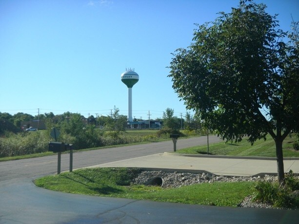
10201 Vine St, Huntley, IL 60142


Property Detail
10201 Vine St
Chicago-Naperville-Elgin, IL-IN
DOC 2002R0042617 LT 4 A W GARLIEBS SUB
18-28-102-004
MCHENRY
Commercialnec
Illinois
B and X Area of moderate flood hazard, usually the area between the limits of the 100-year and 500-year floods.
4
2024
0.49 AC
2024
Far Northwest
871502
Chicago
5,822 SF
NEARBY LISTINGS FOR SALE OR LEASE
-
-
View all Huntley listings for lease on LoopNet.com
DEMOGRAPHICS near 10201 Vine St
1 mile
3 mile
5 mile
2025 Total Population
7,846
40,389
85,788
2030 Population
8,044
41,001
87,153
Pop Growth 2025-2030
+ 2.52%
+ 1.52%
+ 1.59%
Average Age
37
42
42
2025 Total Households
2,484
14,037
30,997
HH Growth 2025-2030
+ 2.66%
+ 1.62%
+ 1.65%
Median Household Inc
$124,106
$111,957
$112,346
Avg Household Size
3.10
2.80
2.70
2025 Avg HH Vehicles
2.00
2.00
2.00
Median Home Value
$371,999
$348,106
$351,569
Median Year Built
2004
2002
2000
Nearby Places
Map Layers
Map Styles
 Street
 Aerial
Layers
 Traffic
 Biking
Places
Listings with unknown addresses are not visible on the map
- Restaurants
- Banks
- Shops
- Fitness
- Groceries
PUBLIC TRANSPORTATION
AIRPORT
Chicago O'Hare International
Drive
Walk
Distance
Chicago O'Hare International
49 min
38.5 mi
Chicago/Rockford International
Drive
Walk
Distance
Chicago/Rockford International
60 min
45.2 mi
SALE & LEASE HISTORY
LISTING DATE
SALE/LEASE

Sep 05, 2017
For Lease
Nearby Properties
Address
Land Use
TOTAL SIZE
Lot Size
Zoning
Address
Land Use
TOTAL SIZE
Lot Size
Zoning
7.26 AC
Address
Land Use
TOTAL SIZE
Lot Size
Zoning
11.86 AC
Address
Land Use
TOTAL SIZE
Lot Size
Zoning
189,735 SF
21.85 AC
Address
Land Use
TOTAL SIZE
Lot Size
Zoning
3.50 AC
Address
Land Use
TOTAL SIZE
Lot Size
Zoning
Address
Land Use
TOTAL SIZE
Lot Size
Zoning
0.71 AC
Address
Land Use
TOTAL SIZE
Lot Size
Zoning
9.28 AC
Address
Land Use
TOTAL SIZE
Lot Size
Zoning
8.23 AC
Address
Land Use
TOTAL SIZE
Lot Size
Zoning
57,813 SF
4.11 AC
Address
Land Use
TOTAL SIZE
Lot Size
Zoning
Address
Land Use
TOTAL SIZE
Lot Size
Zoning
11.15 AC
Address
Land Use
TOTAL SIZE
Lot Size
Zoning
92,850 SF
5 AC
Address
Land Use
TOTAL SIZE
Lot Size
Zoning
24,700 SF
3.08 AC
Address
Land Use
TOTAL SIZE
Lot Size
Zoning
85,500 SF
7 AC
Address
Land Use
TOTAL SIZE
Lot Size
Zoning
2.55 AC
Address
Land Use
TOTAL SIZE
Lot Size
Zoning
5.40 AC
Address
Land Use
TOTAL SIZE
Lot Size
Zoning
14,606 SF
2.14 AC
Address
Land Use
TOTAL SIZE
Lot Size
Zoning
0.27 AC
Address
Land Use
TOTAL SIZE
Lot Size
Zoning
24,157 SF
1.97 AC
Address
Land Use
TOTAL SIZE
Lot Size
Zoning
71,064 SF
7 AC
Address
Land Use
TOTAL SIZE
Lot Size
Zoning
65,235 SF
4.74 AC
Address
Land Use
TOTAL SIZE
Lot Size
Zoning
48,150 SF
3.42 AC
Address
Land Use
TOTAL SIZE
Lot Size
Zoning
9,440 SF
1.68 AC
Address
Land Use
TOTAL SIZE
Lot Size
Zoning
24,425 SF
4.20 AC
Address
Land Use
TOTAL SIZE
Lot Size
Zoning
71,331 SF
8 AC
Address
Land Use
TOTAL SIZE
Lot Size
Zoning
Address
Land Use
TOTAL SIZE
Lot Size
Zoning
2.10 AC
Address
Land Use
TOTAL SIZE
Lot Size
Zoning
1.65 AC
Address
Land Use
TOTAL SIZE
Lot Size
Zoning
66,416 SF
3.04 AC
The World's #1 Commercial Real Estate Marketplace
Connect with us
© 2026 CoStar Group
The information above has been obtained from sources believed reliable. While we do not doubt its accuracy we have not verified it and make no guarantee, warranty or representation about it. It is your responsibility to independently confirm its accuracy and completeness. Any projections, opinions, assumptions, or estimates used are for example only and do not represent the current or future performance of the property. The value of this transaction to you depends on tax and other factors which should be evaluated by your tax, financial, and legal advisors. You and your advisors should conduct a careful, independent investigation of the property to determine to your satisfaction the suitability of the property for your needs.