Property Record
10202 N Ranch Road 620 Rd, Austin, TX 78726

NEARBY LISTINGS FOR SALE OR LEASE
Property Detail
10202 N Ranch Road 620 Rd
458368
Livingston A E
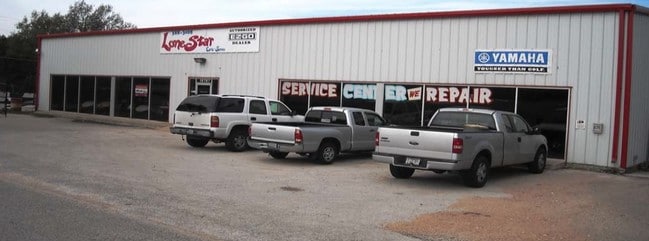
Vehiclerentalsvehiclesales
ABS 478 SUR 455 LIVINGSTON A E ACR 0.656
X
Travis
48453C0230K
Texas
2024
0.66 AC
2025
Far Northwest
034600
Austin
8,500 SF
Austin-Round Rock, TX
DEMOGRAPHICS near 10202 N Ranch Road 620 Rd
1 Mile
3 Mile
5 Mile
2024 Total Population
7,872
61,932
165,936
2029 Population
8,394
72,240
198,786
Pop Growth 2024-2029
+ 6.63%
+ 16.64%
+ 19.80%
Average Age
37
39
38
2024 Total Households
3,165
24,696
68,303
HH Growth 2024-2029
+ 7.36%
+ 17.97%
+ 20.94%
Median Household Inc
$84,780
$109,091
$101,299
Avg Household Size
2.50
2.50
2.40
2024 Avg HH Vehicles
2.00
2.00
2.00
Median Home Value
$575,269
$463,649
$473,319
Median Year Built
2001
1997
1998
Nearby Places
Map Layers
Map Styles
 Street
 Aerial
- Restaurants
- Banks
- Shops
- Fitness
- Groceries
PUBLIC TRANSPORTATION
AIRPORT
Austin-Bergstrom International
DRIVE
WALK
Distance
Austin-Bergstrom International
44 min
29.6 mi
SALE & LEASE HISTORY
LISTING DATE
SALE/LEASE

Nov 02, 2016
For Sale
Nearby Properties
Address
Land Use
TOTAL SIZE
Lot Size
Zoning
Address
Land Use
TOTAL SIZE
Lot Size
Zoning
557,037 SF
29.48 AC
Address
Land Use
TOTAL SIZE
Lot Size
Zoning
525,852 SF
30.92 AC
Address
Land Use
TOTAL SIZE
Lot Size
Zoning
423,057 SF
21.90 AC
4-GRMUCO
Address
Land Use
TOTAL SIZE
Lot Size
Zoning
369,192 SF
78.87 AC
Address
Land Use
TOTAL SIZE
Lot Size
Zoning
411,288 SF
27.68 AC
Address
Land Use
TOTAL SIZE
Lot Size
Zoning
576,996 SF
38.77 AC
Address
Land Use
TOTAL SIZE
Lot Size
Zoning
610,326 SF
43.30 AC
Address
Land Use
TOTAL SIZE
Lot Size
Zoning
557,037 SF
32.48 AC
Address
Land Use
TOTAL SIZE
Lot Size
Zoning
468,870 SF
22 AC
4-GRMUCO
Address
Land Use
TOTAL SIZE
Lot Size
Zoning
388,673 SF
30.98 AC
Address
Land Use
TOTAL SIZE
Lot Size
Zoning
306,900 SF
34.50 AC
Address
Land Use
TOTAL SIZE
Lot Size
Zoning
320,454 SF
19.56 AC
Address
Land Use
TOTAL SIZE
Lot Size
Zoning
365,955 SF
22.84 AC
Address
Land Use
TOTAL SIZE
Lot Size
Zoning
323,718 SF
17.45 AC
Address
Land Use
TOTAL SIZE
Lot Size
Zoning
172,975 SF
33.88 AC
Address
Land Use
TOTAL SIZE
Lot Size
Zoning
306,445 SF
23.59 AC
Address
Land Use
TOTAL SIZE
Lot Size
Zoning
349,200 SF
28.91 AC
Address
Land Use
TOTAL SIZE
Lot Size
Zoning
275,271 SF
14.14 AC
Address
Land Use
TOTAL SIZE
Lot Size
Zoning
474,472 SF
9.22 AC
Address
Land Use
TOTAL SIZE
Lot Size
Zoning
289,330 SF
25.35 AC
Address
Land Use
TOTAL SIZE
Lot Size
Zoning
299,893 SF
23.10 AC
Address
Land Use
TOTAL SIZE
Lot Size
Zoning
341,389 SF
12.19 AC
4-GRMUCO
Address
Land Use
TOTAL SIZE
Lot Size
Zoning
320,712 SF
35.56 AC
Address
Land Use
TOTAL SIZE
Lot Size
Zoning
285,768 SF
23.77 AC
Address
Land Use
TOTAL SIZE
Lot Size
Zoning
253,387 SF
12.87 AC
4-GRMUCO
Address
Land Use
TOTAL SIZE
Lot Size
Zoning
262,480 SF
27.52 AC
Address
Land Use
TOTAL SIZE
Lot Size
Zoning
256,664 SF
13 AC
Address
Land Use
TOTAL SIZE
Lot Size
Zoning
288,994 SF
13.58 AC
Address
Land Use
TOTAL SIZE
Lot Size
Zoning
169,886 SF
7.43 AC
Address
Land Use
TOTAL SIZE
Lot Size
Zoning
270,504 SF
21.75 AC
The World's #1 Commercial Real Estate Marketplace
Connect with us
© 2025 CoStar Group
The information above has been obtained from sources believed reliable. While we do not doubt its accuracy we have not verified it and make no guarantee, warranty or representation about it. It is your responsibility to independently confirm its accuracy and completeness. Any projections, opinions, assumptions, or estimates used are for example only and do not represent the current or future performance of the property. The value of this transaction to you depends on tax and other factors which should be evaluated by your tax, financial, and legal advisors. You and your advisors should conduct a careful, independent investigation of the property to determine to your satisfaction the suitability of the property for your needs.