Property Record
10203 Belton Honea Path Hwy, Belton, SC 29627


NEARBY LISTINGS FOR SALE OR LEASE
-
-
View all Belton listings for sale on LoopNet.com
Property Detail
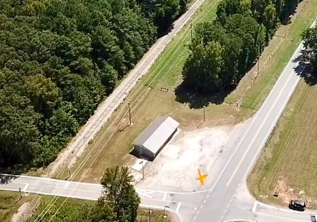
10203 Belton Honea Path Hwy
Greenville-Anderson-Mauldin, SC
CP S 1550/4B PP 43/163 F000 D000 PP 35/55 TR 1 BHP HWY .78 AC
251-00-08-023
Anderson
Storebuilding
South Carolina
2025
0.78 AC
2024
Anderson Cy S of I-85
011402
Greenville/Spartanburg
1,560 SF
DEMOGRAPHICS near 10203 Belton Honea Path Hwy
1 Mile
3 Mile
5 Mile
2024 Total Population
242
3,804
15,355
2029 Population
259
4,062
16,423
Pop Growth 2024-2029
+ 7.02%
+ 6.78%
+ 6.96%
Average Age
43
42
41
2024 Total Households
99
1,573
6,242
HH Growth 2024-2029
+ 7.07%
+ 6.87%
+ 7.05%
Median Household Inc
$61,630
$47,400
$55,156
Avg Household Size
2.40
2.40
2.40
2024 Avg HH Vehicles
2.00
2.00
2.00
Median Home Value
$141,071
$161,348
$136,245
Median Year Built
1988
1971
1975
Nearby Places
Map Layers
Map Styles
 Street
 Aerial
- Restaurants
- Banks
- Shops
- Fitness
- Groceries
SALE & LEASE HISTORY
LISTING DATE
SALE/LEASE

Dec 22, 2023
For Sale
Aug 29, 2024
For Sale
Nearby Properties
Address
Land Use
TOTAL SIZE
Lot Size
Zoning
Address
Land Use
TOTAL SIZE
Lot Size
Zoning
230,048 SF
16.62 AC
Address
Land Use
TOTAL SIZE
Lot Size
Zoning
53,387 SF
2.57 AC
Address
Land Use
TOTAL SIZE
Lot Size
Zoning
186,092 SF
24.32 AC
Address
Land Use
TOTAL SIZE
Lot Size
Zoning
8,425 SF
1.37 AC
Address
Land Use
TOTAL SIZE
Lot Size
Zoning
59,545 SF
15.42 AC
Address
Land Use
TOTAL SIZE
Lot Size
Zoning
6,722 SF
5.02 AC
Address
Land Use
TOTAL SIZE
Lot Size
Zoning
12,276 SF
1.97 AC
Address
Land Use
TOTAL SIZE
Lot Size
Zoning
158,791 SF
54.55 AC
Address
Land Use
TOTAL SIZE
Lot Size
Zoning
6,231 SF
4.05 AC
Address
Land Use
TOTAL SIZE
Lot Size
Zoning
2,347 SF
1.38 AC
Address
Land Use
TOTAL SIZE
Lot Size
Zoning
50,849 SF
7.07 AC
Address
Land Use
TOTAL SIZE
Lot Size
Zoning
2,482 SF
5.93 AC
Address
Land Use
TOTAL SIZE
Lot Size
Zoning
3,421 SF
1.18 AC
Address
Land Use
TOTAL SIZE
Lot Size
Zoning
2,905 SF
1.13 AC
Address
Land Use
TOTAL SIZE
Lot Size
Zoning
2,774 SF
2.12 AC
Address
Land Use
TOTAL SIZE
Lot Size
Zoning
9,760 SF
2.92 AC
Address
Land Use
TOTAL SIZE
Lot Size
Zoning
519 SF
14.49 AC
Address
Land Use
TOTAL SIZE
Lot Size
Zoning
7,000 SF
0.66 AC
Address
Land Use
TOTAL SIZE
Lot Size
Zoning
Address
Land Use
TOTAL SIZE
Lot Size
Zoning
54,269 SF
10.76 AC
Address
Land Use
TOTAL SIZE
Lot Size
Zoning
21,666 SF
0.25 AC
Address
Land Use
TOTAL SIZE
Lot Size
Zoning
0.92 AC
Address
Land Use
TOTAL SIZE
Lot Size
Zoning
3,807 SF
0.72 AC
Address
Land Use
TOTAL SIZE
Lot Size
Zoning
25,729 SF
5 AC
Address
Land Use
TOTAL SIZE
Lot Size
Zoning
2,482 SF
0.55 AC
Address
Land Use
TOTAL SIZE
Lot Size
Zoning
3,960 SF
0.60 AC
Address
Land Use
TOTAL SIZE
Lot Size
Zoning
5,130 SF
1.73 AC
Address
Land Use
TOTAL SIZE
Lot Size
Zoning
62,388 SF
19.99 AC
The World's #1 Commercial Real Estate Marketplace
Connect with us
© 2026 CoStar Group
The information above has been obtained from sources believed reliable. While we do not doubt its accuracy we have not verified it and make no guarantee, warranty or representation about it. It is your responsibility to independently confirm its accuracy and completeness. Any projections, opinions, assumptions, or estimates used are for example only and do not represent the current or future performance of the property. The value of this transaction to you depends on tax and other factors which should be evaluated by your tax, financial, and legal advisors. You and your advisors should conduct a careful, independent investigation of the property to determine to your satisfaction the suitability of the property for your needs.