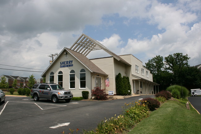
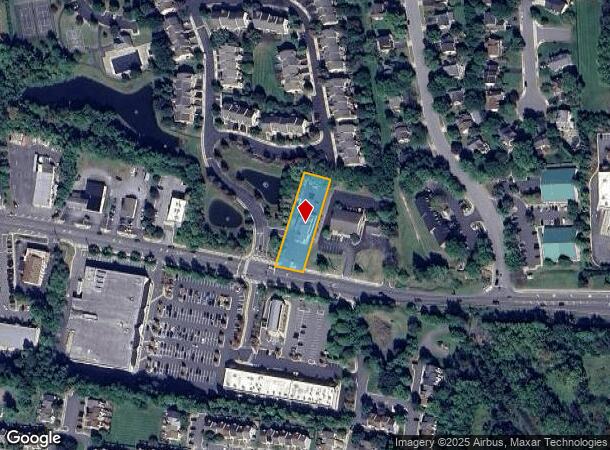
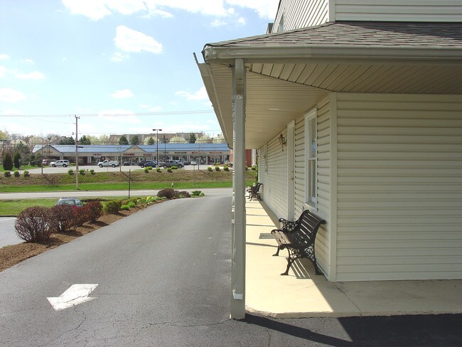
Property Record
1021 E Main St, Purcellville, VA 20132
NEARBY LISTINGS FOR SALE OR LEASE
Property Detail
1021 E Main St
453-36-3419
Purcellville
Officebuilding
PURCELLVILLE 201112010075414 200309220123931 ESMT
X
Loudoun
51107C0089E
Virginia
2025
0.57 AC
2025
Leesburg/West Loudoun
610702
Washington, DC
4,672 SF
Washington-Arlington-Alexandria, DC-VA-MD-WV
DEMOGRAPHICS near 1021 E Main St
1 mile
3 mile
5 mile
2024 Total Population
5,176
16,107
29,323
2029 Population
5,543
17,267
31,507
Pop Growth 2024-2029
+ 7.09%
+ 7.20%
+ 7.45%
Average Age
37
38
39
2024 Total Households
1,670
5,121
9,280
HH Growth 2024-2029
+ 7.25%
+ 7.34%
+ 7.56%
Median Household Inc
$133,672
$157,686
$171,300
Avg Household Size
3.10
3.10
3.10
2024 Avg HH Vehicles
2.00
3.00
3.00
Median Home Value
$618,788
$693,940
$728,152
Median Year Built
1994
1995
1995
Nearby Places
Map Layers
Map Styles
 Street
 Aerial
Transit
 Traffic
 Biking
Places
Listings with unknown addresses are not visible on the map
- Restaurants
- Banks
- Shops
- Fitness
- Groceries
PUBLIC TRANSPORTATION
AIRPORT
Washington Dulles International
Drive
Walk
Distance
Washington Dulles International
28 min
25.1 mi
Freight Ports
Port of Baltimore
Drive
Walk
Distance
Port of Baltimore
1 min
59.6 mi
SALE & LEASE HISTORY
LISTING DATE
SALE/LEASE

Sep 19, 2025
For Lease
Nearby Properties
Address
Land Use
TOTAL SIZE
Lot Size
Zoning
Address
Land Use
TOTAL SIZE
Lot Size
Zoning
347,910 SF
209.21 AC
PV:X
Address
Land Use
TOTAL SIZE
Lot Size
Zoning
244,039 SF
77.17 AC
AR1
Address
Land Use
TOTAL SIZE
Lot Size
Zoning
183,505 SF
106.46 AC
PV:X
Address
Land Use
TOTAL SIZE
Lot Size
Zoning
221,396 SF
30 AC
PV:IP
Address
Land Use
TOTAL SIZE
Lot Size
Zoning
79,555 SF
8.91 AC
PV:MC
Address
Land Use
TOTAL SIZE
Lot Size
Zoning
86,833 SF
10.85 AC
PV:MC
Address
Land Use
TOTAL SIZE
Lot Size
Zoning
152,836 SF
20.99 AC
PV:IP
Address
Land Use
TOTAL SIZE
Lot Size
Zoning
5,168 SF
199.35 AC
AR1
Address
Land Use
TOTAL SIZE
Lot Size
Zoning
64,784 SF
10.54 AC
PV:MC
Address
Land Use
TOTAL SIZE
Lot Size
Zoning
80,750 SF
7.37 AC
PV:MC
Address
Land Use
TOTAL SIZE
Lot Size
Zoning
35,560 SF
11.55 AC
PV:IP
Address
Land Use
TOTAL SIZE
Lot Size
Zoning
13,545 SF
40.99 AC
PV:IP
Address
Land Use
TOTAL SIZE
Lot Size
Zoning
39,004 SF
6.53 AC
PV:MC
Address
Land Use
TOTAL SIZE
Lot Size
Zoning
40,913 SF
21.32 AC
JLMA3
Address
Land Use
TOTAL SIZE
Lot Size
Zoning
52,400 SF
11.69 AC
PV:IP
Address
Land Use
TOTAL SIZE
Lot Size
Zoning
46,584 SF
2.62 AC
PV:C1
Address
Land Use
TOTAL SIZE
Lot Size
Zoning
23,740 SF
6.02 AC
PV:IP
Address
Land Use
TOTAL SIZE
Lot Size
Zoning
29,884 SF
7.31 AC
PV:IP
Address
Land Use
TOTAL SIZE
Lot Size
Zoning
77,135 SF
4.08 AC
PV:R15
Address
Land Use
TOTAL SIZE
Lot Size
Zoning
39,922 SF
11.34 AC
JLMA1
Address
Land Use
TOTAL SIZE
Lot Size
Zoning
12,000 SF
15.89 AC
PV:IP
Address
Land Use
TOTAL SIZE
Lot Size
Zoning
36,132 SF
4.59 AC
PV:R15
Address
Land Use
TOTAL SIZE
Lot Size
Zoning
18,860 SF
2.17 AC
PV:IP
Address
Land Use
TOTAL SIZE
Lot Size
Zoning
21,027 SF
3.06 AC
PV:IP
Address
Land Use
TOTAL SIZE
Lot Size
Zoning
28,440 SF
1.68 AC
PV:CM1
Address
Land Use
TOTAL SIZE
Lot Size
Zoning
11,805 SF
9.46 AC
PV:X
Address
Land Use
TOTAL SIZE
Lot Size
Zoning
25,400 SF
2.47 AC
PV:CM1
Address
Land Use
TOTAL SIZE
Lot Size
Zoning
28,000 SF
2.43 AC
PV:X
Address
Land Use
TOTAL SIZE
Lot Size
Zoning
22,953 SF
3.63 AC
PV:CM1
Address
Land Use
TOTAL SIZE
Lot Size
Zoning
22,812 SF
10.54 AC
JLMA1
The World's #1 Commercial Real Estate Marketplace
Connect with us
© 2026 CoStar Group
The information above has been obtained from sources believed reliable. While we do not doubt its accuracy we have not verified it and make no guarantee, warranty or representation about it. It is your responsibility to independently confirm its accuracy and completeness. Any projections, opinions, assumptions, or estimates used are for example only and do not represent the current or future performance of the property. The value of this transaction to you depends on tax and other factors which should be evaluated by your tax, financial, and legal advisors. You and your advisors should conduct a careful, independent investigation of the property to determine to your satisfaction the suitability of the property for your needs.