Property Record
1021 Jamestown Blvd, Watkinsville, GA 30677
NEARBY LISTINGS FOR SALE OR LEASE
-
-
View all Watkinsville listings for lease on LoopNet.com
Property Detail
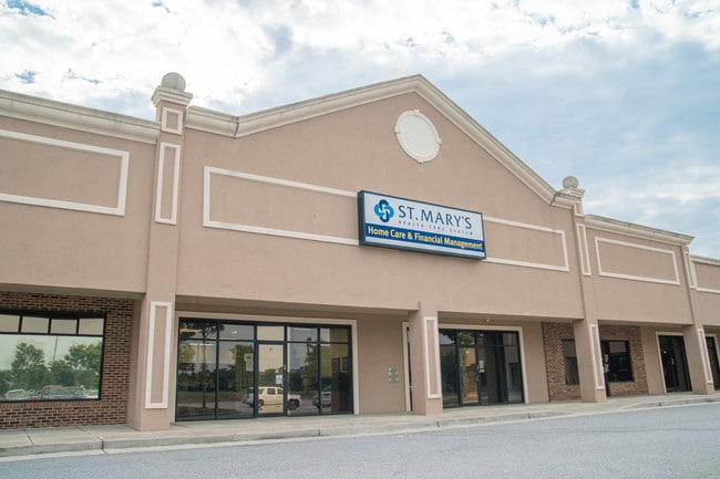
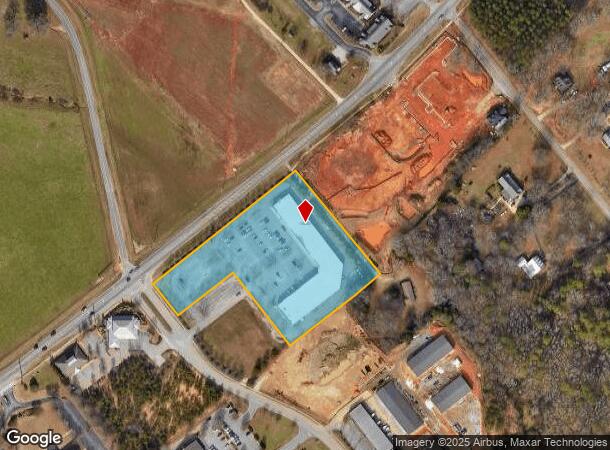
1021 Jamestown Blvd
Athens-Clarke County, GA
Colony Square
B06-P0-01
949/674 SUITE 200
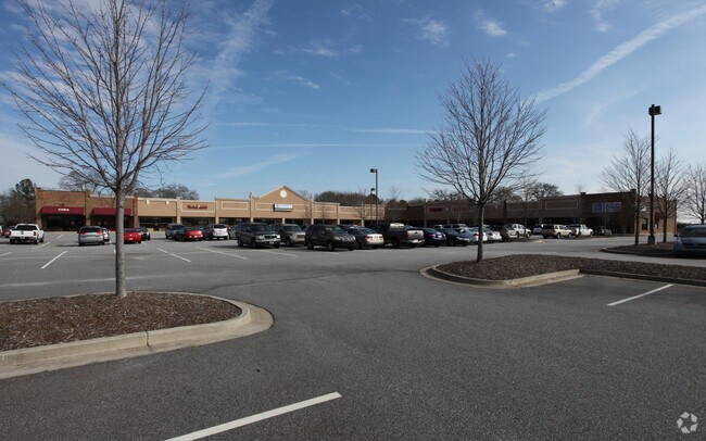
Stripcommercialcenter
Oconee
X
Georgia
13219C0130E
1
2024
4.37 AC
2024
Athens/Gainesville
030401
Other Market Areas
33,131 SF
DEMOGRAPHICS near 1021 Jamestown Blvd
1 Mile
3 Mile
5 Mile
2024 Total Population
1,796
15,425
37,289
2029 Population
2,013
17,281
40,915
Pop Growth 2024-2029
+ 12.08%
+ 12.03%
+ 9.72%
Average Age
40
39
39
2024 Total Households
609
5,308
13,593
HH Growth 2024-2029
+ 12.15%
+ 12.08%
+ 9.28%
Median Household Inc
$107,407
$102,848
$92,881
Avg Household Size
2.90
2.90
2.70
2024 Avg HH Vehicles
3.00
2.00
2.00
Median Home Value
$344,488
$355,374
$354,430
Median Year Built
1993
1993
1994
Nearby Places
Map Layers
Map Styles
 Street
 Aerial
- Restaurants
- Banks
- Shops
- Fitness
- Groceries
SALE & LEASE HISTORY
LISTING DATE
SALE/LEASE

Sep 25, 2016
For Lease
May 30, 2019
For Sale
Mar 29, 2018
For Sale
Dec 02, 2019
For Lease
Nearby Properties
Address
Land Use
TOTAL SIZE
Lot Size
Zoning
Address
Land Use
TOTAL SIZE
Lot Size
Zoning
20,748 SF
80.77 AC
AG
Address
Land Use
TOTAL SIZE
Lot Size
Zoning
107,030 SF
34.62 AC
AR
Address
Land Use
TOTAL SIZE
Lot Size
Zoning
12,483 SF
8.13 AC
Address
Land Use
TOTAL SIZE
Lot Size
Zoning
29,376 SF
197.43 AC
AG
Address
Land Use
TOTAL SIZE
Lot Size
Zoning
5,216 SF
12.81 AC
R-3
Address
Land Use
TOTAL SIZE
Lot Size
Zoning
29,032 SF
14 AC
AG
Address
Land Use
TOTAL SIZE
Lot Size
Zoning
76,360 SF
10.25 AC
B-1
Address
Land Use
TOTAL SIZE
Lot Size
Zoning
78,525 SF
15.81 AC
Address
Land Use
TOTAL SIZE
Lot Size
Zoning
57,735 SF
35 AC
AG
Address
Land Use
TOTAL SIZE
Lot Size
Zoning
25,519 SF
7.63 AC
OIP
Address
Land Use
TOTAL SIZE
Lot Size
Zoning
45,945 SF
2.27 AC
OIP
Address
Land Use
TOTAL SIZE
Lot Size
Zoning
Address
Land Use
TOTAL SIZE
Lot Size
Zoning
5,880 SF
17.18 AC
AG
Address
Land Use
TOTAL SIZE
Lot Size
Zoning
60,596 SF
15 AC
001
Address
Land Use
TOTAL SIZE
Lot Size
Zoning
4,000 SF
253.45 AC
AG
Address
Land Use
TOTAL SIZE
Lot Size
Zoning
3,600 SF
3.28 AC
B-2
Address
Land Use
TOTAL SIZE
Lot Size
Zoning
6,894 SF
1.47 AC
O-I-P
Address
Land Use
TOTAL SIZE
Lot Size
Zoning
Address
Land Use
TOTAL SIZE
Lot Size
Zoning
20,504 SF
9.96 AC
O-B-P
Address
Land Use
TOTAL SIZE
Lot Size
Zoning
14,746 SF
2.50 AC
001
Address
Land Use
TOTAL SIZE
Lot Size
Zoning
12,000 SF
1.66 AC
002
Address
Land Use
TOTAL SIZE
Lot Size
Zoning
27,200 SF
6.65 AC
002
Address
Land Use
TOTAL SIZE
Lot Size
Zoning
26,837 SF
3.64 AC
AG
Address
Land Use
TOTAL SIZE
Lot Size
Zoning
16,800 SF
37.92 AC
AG
Address
Land Use
TOTAL SIZE
Lot Size
Zoning
228.73 AC
AR
Address
Land Use
TOTAL SIZE
Lot Size
Zoning
211.24 AC
R-1
Address
Land Use
TOTAL SIZE
Lot Size
Zoning
38,275 SF
3.06 AC
002
Address
Land Use
TOTAL SIZE
Lot Size
Zoning
12,120 SF
0.27 AC
O-I-P
Address
Land Use
TOTAL SIZE
Lot Size
Zoning
7,810 SF
7.67 AC
AR
The World's #1 Commercial Real Estate Marketplace
Connect with us
© 2025 CoStar Group
The information above has been obtained from sources believed reliable. While we do not doubt its accuracy we have not verified it and make no guarantee, warranty or representation about it. It is your responsibility to independently confirm its accuracy and completeness. Any projections, opinions, assumptions, or estimates used are for example only and do not represent the current or future performance of the property. The value of this transaction to you depends on tax and other factors which should be evaluated by your tax, financial, and legal advisors. You and your advisors should conduct a careful, independent investigation of the property to determine to your satisfaction the suitability of the property for your needs.