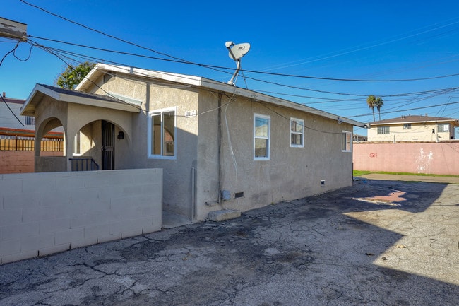
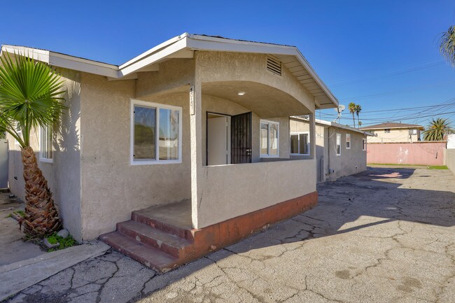
Property Record
1017 W 92Nd St, Los Angeles, CA 90044
NEARBY LISTINGS FOR SALE OR LEASE
Property Detail
1017 W 92Nd St
Los Angeles-Long Beach-Glendale, CA
Grider & Hamiltons Subdivision
6047-020-025
Los Angeles
Triplex
California
X
0.22 AC
06037C1785G
Westmont
2,568 SF
Los Angeles
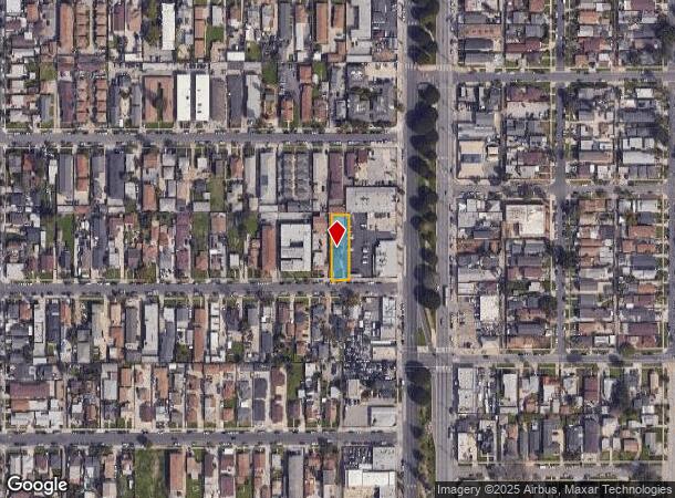
DEMOGRAPHICS near 1017 W 92Nd St
1 Mile
3 Mile
5 Mile
2024 Total Population
55,705
386,363
1,046,027
2029 Population
53,785
372,157
1,004,975
Pop Growth 2024-2029
(3.45%)
(3.68%)
(3.92%)
Average Age
36
36
37
2024 Total Households
16,338
107,556
300,546
HH Growth 2024-2029
(3.73%)
(3.94%)
(4.08%)
Median Household Inc
$43,035
$53,134
$56,799
Avg Household Size
3.20
3.40
3.30
2024 Avg HH Vehicles
2.00
2.00
2.00
Median Home Value
$590,654
$616,078
$646,379
Median Year Built
1953
1951
1955
Nearby Places
Map Layers
Map Styles
 Street
 Aerial
- Restaurants
- Banks
- Shops
- Fitness
- Groceries
PUBLIC TRANSPORTATION
AIRPORT
Los Angeles International
DRIVE
WALK
Distance
Los Angeles International
14 min
7.4 mi
Long Beach (Daugherty Field)
DRIVE
WALK
Distance
Long Beach (Daugherty Field)
23 min
15.6 mi
Bob Hope
DRIVE
WALK
Distance
Bob Hope
34 min
25.5 mi
Freight Ports
Port of Long Beach
DRIVE
WALK
Distance
Port of Long Beach
26 min
17.5 mi
SALE & LEASE HISTORY
LISTING DATE
SALE/LEASE

Jan 06, 2020
For Sale
Nearby Properties
Address
Land Use
TOTAL SIZE
Lot Size
Zoning
Address
Land Use
TOTAL SIZE
Lot Size
Zoning
2,531,696 SF
79.60 AC
INCR*
Address
Land Use
TOTAL SIZE
Lot Size
Zoning
Address
Land Use
TOTAL SIZE
Lot Size
Zoning
Address
Land Use
TOTAL SIZE
Lot Size
Zoning
Address
Land Use
TOTAL SIZE
Lot Size
Zoning
Address
Land Use
TOTAL SIZE
Lot Size
Zoning
724,715 SF
5.76 AC
INCR*
Address
Land Use
TOTAL SIZE
Lot Size
Zoning
227,596 SF
14.38 AC
HAM1YY
Address
Land Use
TOTAL SIZE
Lot Size
Zoning
1,359,630 SF
29 AC
INCR*
Address
Land Use
TOTAL SIZE
Lot Size
Zoning
181,213 SF
3.96 AC
INCR*
Address
Land Use
TOTAL SIZE
Lot Size
Zoning
57,488 SF
4.30 AC
LAPF
Address
Land Use
TOTAL SIZE
Lot Size
Zoning
111,254 SF
5.63 AC
INCR
Address
Land Use
TOTAL SIZE
Lot Size
Zoning
127,484 SF
7.33 AC
LAM2
Address
Land Use
TOTAL SIZE
Lot Size
Zoning
81,735 SF
4.10 AC
LAR4
Address
Land Use
TOTAL SIZE
Lot Size
Zoning
104,291 SF
7.35 AC
LAR3
Address
Land Use
TOTAL SIZE
Lot Size
Zoning
267,463 SF
INCR
Address
Land Use
TOTAL SIZE
Lot Size
Zoning
130,337 SF
9.31 AC
HAM2
Address
Land Use
TOTAL SIZE
Lot Size
Zoning
267,463 SF
1.97 AC
INCR
Address
Land Use
TOTAL SIZE
Lot Size
Zoning
93,597 SF
0.32 AC
LCC2
Address
Land Use
TOTAL SIZE
Lot Size
Zoning
507,000 SF
11.96 AC
INCR
Address
Land Use
TOTAL SIZE
Lot Size
Zoning
402,118 SF
9.39 AC
LAC2
Address
Land Use
TOTAL SIZE
Lot Size
Zoning
460,912 SF
3.96 AC
INCR
Address
Land Use
TOTAL SIZE
Lot Size
Zoning
111,213 SF
12.04 AC
LAR4
Address
Land Use
TOTAL SIZE
Lot Size
Zoning
153,520 SF
15.72 AC
INM1L*
Address
Land Use
TOTAL SIZE
Lot Size
Zoning
188,030 SF
3.09 AC
LAR5
Address
Land Use
TOTAL SIZE
Lot Size
Zoning
313,853 SF
8.96 AC
INCZ*
Address
Land Use
TOTAL SIZE
Lot Size
Zoning
102,260 SF
16.84 AC
LAR4
Address
Land Use
TOTAL SIZE
Lot Size
Zoning
80,606 SF
1.40 AC
INC2*
Address
Land Use
TOTAL SIZE
Lot Size
Zoning
90,887 SF
0.94 AC
LCR320U*
Address
Land Use
TOTAL SIZE
Lot Size
Zoning
135,195 SF
11.82 AC
INCR
The World's #1 Commercial Real Estate Marketplace
Connect with us
© 2025 CoStar Group
The information above has been obtained from sources believed reliable. While we do not doubt its accuracy we have not verified it and make no guarantee, warranty or representation about it. It is your responsibility to independently confirm its accuracy and completeness. Any projections, opinions, assumptions, or estimates used are for example only and do not represent the current or future performance of the property. The value of this transaction to you depends on tax and other factors which should be evaluated by your tax, financial, and legal advisors. You and your advisors should conduct a careful, independent investigation of the property to determine to your satisfaction the suitability of the property for your needs.