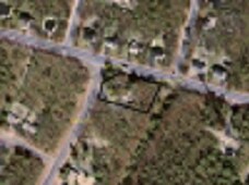
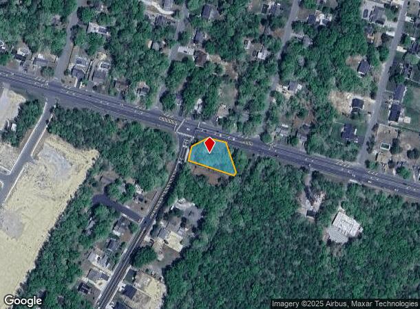
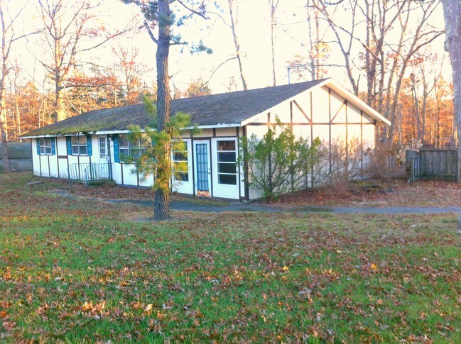
Property Record
1021 W Bay Ave, Barnegat, NJ 08005

NEARBY LISTINGS FOR SALE OR LEASE
Property Detail
1021 W Bay Ave
New York-Jersey City-White Plains, NY-NJ
18763 SF
01-00092-87-00002
Ocean
Vacantlandnec
New Jersey
X
2
34029C0395F
0.43 AC
2024
Ocean County
2025
Northern New Jersey
734004
DEMOGRAPHICS near 1021 W Bay Ave
1 Mile
3 Mile
5 Mile
2024 Total Population
7,437
41,795
57,614
2029 Population
7,993
44,543
61,717
Pop Growth 2024-2029
+ 7.48%
+ 6.57%
+ 7.12%
Average Age
50
44
44
2024 Total Households
3,146
15,875
22,323
HH Growth 2024-2029
+ 6.87%
+ 6.18%
+ 6.73%
Median Household Inc
$81,797
$87,676
$86,479
Avg Household Size
2.30
2.50
2.50
2024 Avg HH Vehicles
2.00
2.00
2.00
Median Home Value
$323,923
$313,729
$313,738
Median Year Built
2001
1995
1993
Nearby Places
Map Layers
Map Styles
 Street
 Aerial
- Restaurants
- Banks
- Shops
- Fitness
- Groceries
PUBLIC TRANSPORTATION
AIRPORT
Atlantic City International
DRIVE
WALK
Distance
Atlantic City International
62 min
33.5 mi
Freight Ports
South Jersey Port
DRIVE
WALK
Distance
South Jersey Port
67 min
50.2 mi
SALE & LEASE HISTORY
LISTING DATE
SALE/LEASE

Sep 24, 2016
For Sale
Nearby Properties
Address
Land Use
TOTAL SIZE
Lot Size
Zoning
Address
Land Use
TOTAL SIZE
Lot Size
Zoning
85.65 AC
R40
Address
Land Use
TOTAL SIZE
Lot Size
Zoning
46.40 AC
ML-4
Address
Land Use
TOTAL SIZE
Lot Size
Zoning
13.83 AC
CN
Address
Land Use
TOTAL SIZE
Lot Size
Zoning
85.65 AC
R40
Address
Land Use
TOTAL SIZE
Lot Size
Zoning
13.99 AC
MLSC
Address
Land Use
TOTAL SIZE
Lot Size
Zoning
7.49 AC
R20
Address
Land Use
TOTAL SIZE
Lot Size
Zoning
6,600 SF
10.67 AC
PRD
Address
Land Use
TOTAL SIZE
Lot Size
Zoning
67,548 SF
10.98 AC
CN
Address
Land Use
TOTAL SIZE
Lot Size
Zoning
86,000 SF
2.87 AC
R20
Address
Land Use
TOTAL SIZE
Lot Size
Zoning
12,066 SF
5.34 AC
HMC
Address
Land Use
TOTAL SIZE
Lot Size
Zoning
11,695 SF
9.31 AC
R20
Address
Land Use
TOTAL SIZE
Lot Size
Zoning
4,230 SF
10.65 AC
CPHD
Address
Land Use
TOTAL SIZE
Lot Size
Zoning
4.85 AC
CPHD
Address
Land Use
TOTAL SIZE
Lot Size
Zoning
3.34 AC
C-1
Address
Land Use
TOTAL SIZE
Lot Size
Zoning
5.14 AC
CPHD
Address
Land Use
TOTAL SIZE
Lot Size
Zoning
58,375 SF
5.46 AC
CPHD
Address
Land Use
TOTAL SIZE
Lot Size
Zoning
37,476 SF
14.66 AC
R6
Address
Land Use
TOTAL SIZE
Lot Size
Zoning
11.91 AC
RA
Address
Land Use
TOTAL SIZE
Lot Size
Zoning
16,992 SF
31.88 AC
FO
Address
Land Use
TOTAL SIZE
Lot Size
Zoning
30.95 AC
ML-P
Address
Land Use
TOTAL SIZE
Lot Size
Zoning
52,212 SF
4.41 AC
TCCN
Address
Land Use
TOTAL SIZE
Lot Size
Zoning
6.84 AC
MLP
Address
Land Use
TOTAL SIZE
Lot Size
Zoning
31,658 SF
5.88 AC
TCCN
Address
Land Use
TOTAL SIZE
Lot Size
Zoning
140.88 AC
RLAC
Address
Land Use
TOTAL SIZE
Lot Size
Zoning
6.39 AC
ML-1
Address
Land Use
TOTAL SIZE
Lot Size
Zoning
6.03 AC
MU
Address
Land Use
TOTAL SIZE
Lot Size
Zoning
18,960 SF
1.51 AC
NMC
Address
Land Use
TOTAL SIZE
Lot Size
Zoning
13,593 SF
2.11 AC
CN
Address
Land Use
TOTAL SIZE
Lot Size
Zoning
5,430 SF
2.15 AC
CN
Address
Land Use
TOTAL SIZE
Lot Size
Zoning
4.70 AC
ML5
The World's #1 Commercial Real Estate Marketplace
Connect with us
© 2025 CoStar Group
The information above has been obtained from sources believed reliable. While we do not doubt its accuracy we have not verified it and make no guarantee, warranty or representation about it. It is your responsibility to independently confirm its accuracy and completeness. Any projections, opinions, assumptions, or estimates used are for example only and do not represent the current or future performance of the property. The value of this transaction to you depends on tax and other factors which should be evaluated by your tax, financial, and legal advisors. You and your advisors should conduct a careful, independent investigation of the property to determine to your satisfaction the suitability of the property for your needs.