Property Record
10210 Couloak Dr, Charlotte, NC 28216


NEARBY LISTINGS FOR SALE OR LEASE
Property Detail
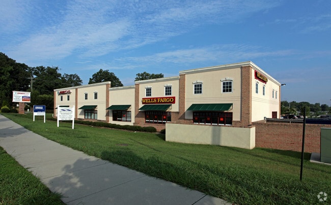
10210 Couloak Dr
Charlotte-Concord-Gastonia, NC-SC
Dunn Commons/Rocky Br Ph 01 Map
023-271-42
PAD C M41-263
Commercialnec
Mecklenburg
X
North Carolina
3710451700K
42
2024
0.23 AC
2025
Northwest
006103
Charlotte
10,090 SF
DEMOGRAPHICS near 10210 Couloak Dr
1 Mile
3 Mile
5 Mile
2024 Total Population
5,127
36,458
93,197
2029 Population
5,503
38,845
99,091
Pop Growth 2024-2029
+ 7.33%
+ 6.55%
+ 6.32%
Average Age
38
37
37
2024 Total Households
2,030
13,295
33,709
HH Growth 2024-2029
+ 7.49%
+ 6.69%
+ 6.46%
Median Household Inc
$81,597
$77,499
$69,205
Avg Household Size
2.50
2.70
2.70
2024 Avg HH Vehicles
2.00
2.00
2.00
Median Home Value
$356,598
$272,063
$243,535
Median Year Built
2002
2001
1999
Nearby Places
Map Layers
Map Styles
 Street
 Aerial
- Restaurants
- Banks
- Shops
- Fitness
- Groceries
PUBLIC TRANSPORTATION
AIRPORT
Charlotte/Douglas International
DRIVE
WALK
Distance
Charlotte/Douglas International
23 min
10.6 mi
Concord-Padgett Regional
DRIVE
WALK
Distance
Concord-Padgett Regional
22 min
15.9 mi
SALE & LEASE HISTORY
LISTING DATE
SALE/LEASE

Oct 05, 2017
For Sale
Nov 18, 2024
For Sale
Mar 24, 2017
For Sale
Jan 26, 2017
For Sale
Dec 20, 2019
For Lease
Nearby Properties
Address
Land Use
TOTAL SIZE
Lot Size
Zoning
Address
Land Use
TOTAL SIZE
Lot Size
Zoning
15.94 AC
Address
Land Use
TOTAL SIZE
Lot Size
Zoning
282,374 SF
11.58 AC
Address
Land Use
TOTAL SIZE
Lot Size
Zoning
197,874 SF
11.71 AC
Address
Land Use
TOTAL SIZE
Lot Size
Zoning
226,973 SF
16.97 AC
R17MFCD
Address
Land Use
TOTAL SIZE
Lot Size
Zoning
214,824 SF
18.78 AC
R12MFCD
Address
Land Use
TOTAL SIZE
Lot Size
Zoning
3,428 SF
13.21 AC
R-17MF
Address
Land Use
TOTAL SIZE
Lot Size
Zoning
437,434 SF
150.02 AC
MANU1
Address
Land Use
TOTAL SIZE
Lot Size
Zoning
89,113 SF
14.56 AC
R-3
Address
Land Use
TOTAL SIZE
Lot Size
Zoning
2,967 SF
9.01 AC
R-17MF
Address
Land Use
TOTAL SIZE
Lot Size
Zoning
186,364 SF
18.43 AC
R-3
Address
Land Use
TOTAL SIZE
Lot Size
Zoning
960 SF
24.24 AC
CC
Address
Land Use
TOTAL SIZE
Lot Size
Zoning
136,318 SF
4.13 AC
I1
Address
Land Use
TOTAL SIZE
Lot Size
Zoning
80,799 SF
7.10 AC
NS
Address
Land Use
TOTAL SIZE
Lot Size
Zoning
Address
Land Use
TOTAL SIZE
Lot Size
Zoning
29,320 SF
340.71 AC
R1
Address
Land Use
TOTAL SIZE
Lot Size
Zoning
75,208 SF
15.55 AC
R-3
Address
Land Use
TOTAL SIZE
Lot Size
Zoning
102,934 SF
10.41 AC
B1CD
Address
Land Use
TOTAL SIZE
Lot Size
Zoning
58,553 SF
7.78 AC
B1CD
Address
Land Use
TOTAL SIZE
Lot Size
Zoning
63,651 SF
7.81 AC
B1CD
Address
Land Use
TOTAL SIZE
Lot Size
Zoning
40,822 SF
7.13 AC
B1
Address
Land Use
TOTAL SIZE
Lot Size
Zoning
41,414 SF
4.85 AC
CC
Address
Land Use
TOTAL SIZE
Lot Size
Zoning
78,660 SF
5.88 AC
O1CD
Address
Land Use
TOTAL SIZE
Lot Size
Zoning
33,307 SF
81.36 AC
R5
Address
Land Use
TOTAL SIZE
Lot Size
Zoning
101,187 SF
5.90 AC
B1CD
Address
Land Use
TOTAL SIZE
Lot Size
Zoning
20.02 AC
R-12MF(CD)
Address
Land Use
TOTAL SIZE
Lot Size
Zoning
11,490 SF
17.14 AC
R-4
Address
Land Use
TOTAL SIZE
Lot Size
Zoning
128,976 SF
5.84 AC
R12MFCD
Address
Land Use
TOTAL SIZE
Lot Size
Zoning
112,980 SF
10.42 AC
R-6
Address
Land Use
TOTAL SIZE
Lot Size
Zoning
59,730 SF
2.36 AC
BP
Address
Land Use
TOTAL SIZE
Lot Size
Zoning
112 AC
R-3
The World's #1 Commercial Real Estate Marketplace
Connect with us
© 2026 CoStar Group
The information above has been obtained from sources believed reliable. While we do not doubt its accuracy we have not verified it and make no guarantee, warranty or representation about it. It is your responsibility to independently confirm its accuracy and completeness. Any projections, opinions, assumptions, or estimates used are for example only and do not represent the current or future performance of the property. The value of this transaction to you depends on tax and other factors which should be evaluated by your tax, financial, and legal advisors. You and your advisors should conduct a careful, independent investigation of the property to determine to your satisfaction the suitability of the property for your needs.