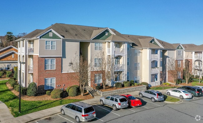
Property Record
10210 Red Crest Ln, Charlotte, NC 28262

NEARBY LISTINGS FOR SALE OR LEASE
Property Detail
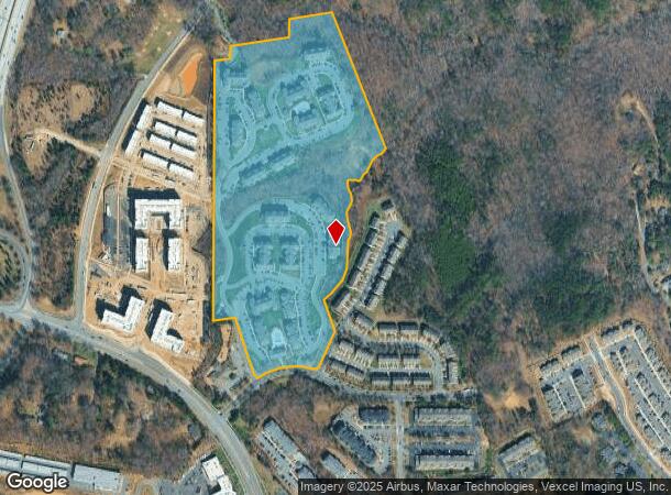
10210 Red Crest Ln
Charlotte-Concord-Gastonia, NC-SC
Mallard Glen Drive
029-651-03
L2 M41-441
Multifamilydwelling
Mecklenburg
X
North Carolina
3710458800K
2
2024
33.83 AC
2025
University City North
005532
Charlotte
389,720 SF
DEMOGRAPHICS near 10210 Red Crest Ln
1 Mile
3 Mile
5 Mile
2024 Total Population
9,497
72,503
190,774
2029 Population
10,123
77,025
204,220
Pop Growth 2024-2029
+ 6.59%
+ 6.24%
+ 7.05%
Average Age
31
33
35
2024 Total Households
4,425
30,107
73,374
HH Growth 2024-2029
+ 6.92%
+ 6.39%
+ 6.82%
Median Household Inc
$66,525
$60,921
$70,025
Avg Household Size
2.10
2.30
2.50
2024 Avg HH Vehicles
1.00
2.00
2.00
Median Home Value
$344,339
$267,818
$271,816
Median Year Built
2003
2000
2000
Nearby Places
Map Layers
Map Styles
 Street
 Aerial
- Restaurants
- Banks
- Shops
- Fitness
- Groceries
PUBLIC TRANSPORTATION
COMMUTER RAIL
Charlotte Amtrak Station (Carolinian - Amtrak, Crescent - Amtrak, Piedmont - Amtrak)
DRIVE
WALK
Distance
Charlotte Amtrak Station (Carolinian - Amtrak, Crescent - Amtrak, Piedmont - Amtrak)
15 min
9.4 mi
AIRPORT
Concord-Padgett Regional
DRIVE
WALK
Distance
Concord-Padgett Regional
11 min
5.9 mi
Charlotte/Douglas International
DRIVE
WALK
Distance
Charlotte/Douglas International
29 min
18.7 mi
Freight Ports
North Charleston Terminal
DRIVE
WALK
Distance
North Charleston Terminal
242 min
211.0 mi
Nearby Properties
Address
Land Use
TOTAL SIZE
Lot Size
Zoning
Address
Land Use
TOTAL SIZE
Lot Size
Zoning
701,530 SF
143.45 AC
C-2
Address
Land Use
TOTAL SIZE
Lot Size
Zoning
2,022,784 SF
654.80 AC
INST
Address
Land Use
TOTAL SIZE
Lot Size
Zoning
2,534,387 SF
135.23 AC
RE2
Address
Land Use
TOTAL SIZE
Lot Size
Zoning
2,215,042 SF
68.45 AC
RE2
Address
Land Use
TOTAL SIZE
Lot Size
Zoning
381,490 SF
29.24 AC
C-2
Address
Land Use
TOTAL SIZE
Lot Size
Zoning
1,474,585 SF
30.93 AC
Address
Land Use
TOTAL SIZE
Lot Size
Zoning
1,532,477 SF
92.30 AC
RE1
Address
Land Use
TOTAL SIZE
Lot Size
Zoning
628,300 SF
197.32 AC
INST
Address
Land Use
TOTAL SIZE
Lot Size
Zoning
727,169 SF
6.07 AC
INST
Address
Land Use
TOTAL SIZE
Lot Size
Zoning
471,271 SF
24.30 AC
MUDD-O
Address
Land Use
TOTAL SIZE
Lot Size
Zoning
374,697 SF
12.46 AC
Address
Land Use
TOTAL SIZE
Lot Size
Zoning
324,349 SF
4.69 AC
C-2
Address
Land Use
TOTAL SIZE
Lot Size
Zoning
315,076 SF
21.16 AC
RE1
Address
Land Use
TOTAL SIZE
Lot Size
Zoning
375,242 SF
25.64 AC
CC
Address
Land Use
TOTAL SIZE
Lot Size
Zoning
412,078 SF
27.46 AC
R17MFCD
Address
Land Use
TOTAL SIZE
Lot Size
Zoning
16,601 SF
7.42 AC
R-12MF(CD)
Address
Land Use
TOTAL SIZE
Lot Size
Zoning
401,069 SF
31.52 AC
R12MFCD
Address
Land Use
TOTAL SIZE
Lot Size
Zoning
346,666 SF
26.53 AC
R17MFCD
Address
Land Use
TOTAL SIZE
Lot Size
Zoning
164,809 SF
94.60 AC
Address
Land Use
TOTAL SIZE
Lot Size
Zoning
324,898 SF
22.31 AC
R17MFCD
Address
Land Use
TOTAL SIZE
Lot Size
Zoning
347,856 SF
21.16 AC
R17MFCD
Address
Land Use
TOTAL SIZE
Lot Size
Zoning
284,360 SF
21.68 AC
R12MFCD
Address
Land Use
TOTAL SIZE
Lot Size
Zoning
57,268 SF
25.88 AC
C-2
Address
Land Use
TOTAL SIZE
Lot Size
Zoning
549,120 SF
5.29 AC
NS
Address
Land Use
TOTAL SIZE
Lot Size
Zoning
300,275 SF
20.78 AC
MX2
Address
Land Use
TOTAL SIZE
Lot Size
Zoning
358,524 SF
23.80 AC
R17MFCD
Address
Land Use
TOTAL SIZE
Lot Size
Zoning
497,811 SF
49.75 AC
RE2
Address
Land Use
TOTAL SIZE
Lot Size
Zoning
306,269 SF
9.44 AC
MUDD-O
Address
Land Use
TOTAL SIZE
Lot Size
Zoning
31,248 SF
21.72 AC
C-2
The World's #1 Commercial Real Estate Marketplace
Connect with us
© 2025 CoStar Group
The information above has been obtained from sources believed reliable. While we do not doubt its accuracy we have not verified it and make no guarantee, warranty or representation about it. It is your responsibility to independently confirm its accuracy and completeness. Any projections, opinions, assumptions, or estimates used are for example only and do not represent the current or future performance of the property. The value of this transaction to you depends on tax and other factors which should be evaluated by your tax, financial, and legal advisors. You and your advisors should conduct a careful, independent investigation of the property to determine to your satisfaction the suitability of the property for your needs.