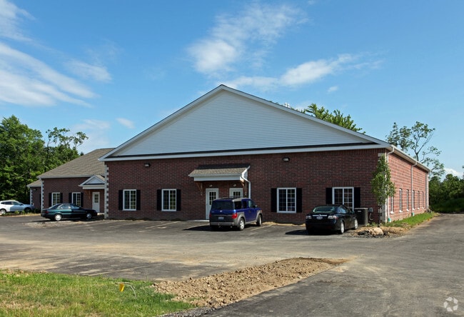
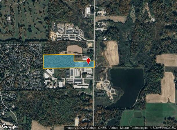
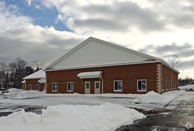
Property Record
17270 Munn Rd, Chagrin Falls, OH 44023
NEARBY LISTINGS FOR SALE OR LEASE
-
-
View all Chagrin Falls listings for lease on LoopNet.com
Property Detail
17270 Munn Rd
Cleveland-Elyria, OH
Township Of Auburn
01-002181
LOT 1 SEC 2 TR 2
Agriculturalland
Geauga
X
Ohio
39055C0218D
1
2024
20.82 AC
2024
Geauga County
311900
Cleveland
DEMOGRAPHICS near 17270 Munn Rd
1 mile
3 mile
5 mile
2024 Total Population
1,249
8,464
25,420
2029 Population
1,256
8,477
25,485
Pop Growth 2024-2029
+ 0.56%
+ 0.15%
+ 0.26%
Average Age
47
45
45
2024 Total Households
497
3,237
9,383
HH Growth 2024-2029
+ 0.60%
+ 0.09%
+ 0.17%
Median Household Inc
$111,853
$121,531
$121,964
Avg Household Size
2.50
2.60
2.60
2024 Avg HH Vehicles
3.00
2.00
2.00
Median Home Value
$356,874
$342,801
$348,723
Median Year Built
1992
1982
1980
Nearby Places
Map Layers
Map Styles
 Street
 Aerial
Transit
 Traffic
 Biking
Places
Listings with unknown addresses are not visible on the map
- Restaurants
- Banks
- Shops
- Fitness
- Groceries
PUBLIC TRANSPORTATION
AIRPORT
Cleveland-Hopkins International
Drive
Walk
Distance
Cleveland-Hopkins International
49 min
33.5 mi
Freight Ports
Port of Toledo
Drive
Walk
Distance
Port of Toledo
163 min
134.4 mi
SALE & LEASE HISTORY
LISTING DATE
SALE/LEASE

Sep 25, 2016
For Lease
Nearby Properties
Address
Land Use
TOTAL SIZE
Lot Size
Zoning
Address
Land Use
TOTAL SIZE
Lot Size
Zoning
227,389 SF
27.75 AC
R5A
Address
Land Use
TOTAL SIZE
Lot Size
Zoning
79,668 SF
14 AC
R5A
Address
Land Use
TOTAL SIZE
Lot Size
Zoning
100,601 SF
40.70 AC
R5A
Address
Land Use
TOTAL SIZE
Lot Size
Zoning
30,295 SF
7.12 AC
R5A
Address
Land Use
TOTAL SIZE
Lot Size
Zoning
20,820 SF
7.19 AC
B1
Address
Land Use
TOTAL SIZE
Lot Size
Zoning
7,862 SF
7.10 AC
R1C
Address
Land Use
TOTAL SIZE
Lot Size
Zoning
4,814 SF
63.75 AC
R1
Address
Land Use
TOTAL SIZE
Lot Size
Zoning
71,570 SF
11.04 AC
I1
Address
Land Use
TOTAL SIZE
Lot Size
Zoning
62,290 SF
7.38 AC
I1
Address
Land Use
TOTAL SIZE
Lot Size
Zoning
81,899 SF
2.23 AC
I1
Address
Land Use
TOTAL SIZE
Lot Size
Zoning
1,897 SF
44.70 AC
R5A
Address
Land Use
TOTAL SIZE
Lot Size
Zoning
8,324 SF
5.17 AC
R5A
Address
Land Use
TOTAL SIZE
Lot Size
Zoning
15,328 SF
54.91 AC
R1
Address
Land Use
TOTAL SIZE
Lot Size
Zoning
7,282 SF
12.17 AC
R1
Address
Land Use
TOTAL SIZE
Lot Size
Zoning
34,988 SF
12.36 AC
R5A
Address
Land Use
TOTAL SIZE
Lot Size
Zoning
4,887 SF
74.27 AC
R5A
Address
Land Use
TOTAL SIZE
Lot Size
Zoning
57,340 SF
17 AC
R5A
Address
Land Use
TOTAL SIZE
Lot Size
Zoning
6,910 SF
2.51 AC
R1
Address
Land Use
TOTAL SIZE
Lot Size
Zoning
2,472 SF
74.27 AC
R1
Address
Land Use
TOTAL SIZE
Lot Size
Zoning
7,173 SF
21.58 AC
R1
Address
Land Use
TOTAL SIZE
Lot Size
Zoning
7,368 SF
9.56 AC
R2
Address
Land Use
TOTAL SIZE
Lot Size
Zoning
75.78 AC
R5A
Address
Land Use
TOTAL SIZE
Lot Size
Zoning
6,452 SF
4.04 AC
R2
Address
Land Use
TOTAL SIZE
Lot Size
Zoning
250 AC
OS1
Address
Land Use
TOTAL SIZE
Lot Size
Zoning
5,148 SF
17.13 AC
R1
Address
Land Use
TOTAL SIZE
Lot Size
Zoning
5,179 SF
29.19 AC
R5A
Address
Land Use
TOTAL SIZE
Lot Size
Zoning
6,347 SF
5.09 AC
R5A
Address
Land Use
TOTAL SIZE
Lot Size
Zoning
7,810 SF
8.16 AC
R1
Address
Land Use
TOTAL SIZE
Lot Size
Zoning
7,034 SF
4.68 AC
R2
Address
Land Use
TOTAL SIZE
Lot Size
Zoning
5,219 SF
15.87 AC
R1D
The World's #1 Commercial Real Estate Marketplace
Connect with us
© 2026 CoStar Group
The information above has been obtained from sources believed reliable. While we do not doubt its accuracy we have not verified it and make no guarantee, warranty or representation about it. It is your responsibility to independently confirm its accuracy and completeness. Any projections, opinions, assumptions, or estimates used are for example only and do not represent the current or future performance of the property. The value of this transaction to you depends on tax and other factors which should be evaluated by your tax, financial, and legal advisors. You and your advisors should conduct a careful, independent investigation of the property to determine to your satisfaction the suitability of the property for your needs.