Property Record
10216 224Th St E, Graham, WA 98338
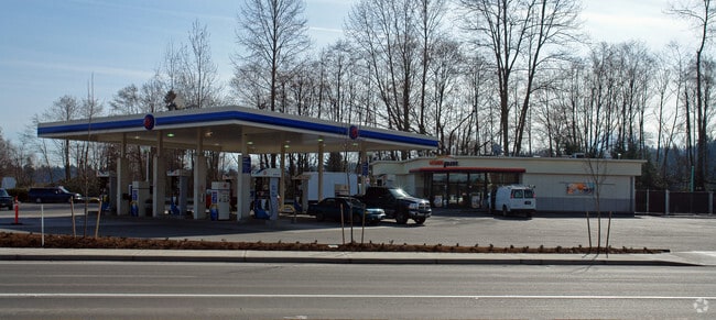

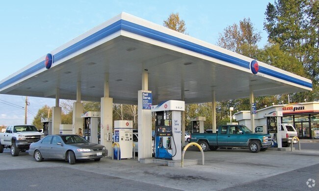

Property Detail
10216 224Th St E
041815-2015
SECTION 15 TOWNSHIP 18 RANGE 04 QUARTER 22 : W 1/2 OF NW OF NW OF NW EXC RDS ALSO EXC ADDITIONAL R/W FOR MUCK- KAPOWSIN CO RD PER 644519 ALSO EXC THAT POR CYD TO STATE OF WASH PER ETN 825302 & THAT POR CYD TO P CO PER ETN 826029 ALSO EXC THAT POR CYD
Servicestationmarket
Pierce
RAC
Washington
B and X Area of moderate flood hazard, usually the area between the limits of the 100-year and 500-year floods.
3.97 AC
2024
E Pierce County
2025
Seattle/Puget Sound
073118
Seattle-Tacoma-Bellevue, WA
2,892 SF
NEARBY LISTINGS FOR SALE OR LEASE
-
-
View all Graham listings for sale on LoopNet.com
DEMOGRAPHICS near 10216 224Th St E
1 mile
3 mile
5 mile
2025 Total Population
2,510
43,326
105,640
2030 Population
2,529
43,788
107,120
Pop Growth 2025-2030
+ 0.76%
+ 1.07%
+ 1.40%
Average Age
40
37
37
2025 Total Households
844
13,860
34,533
HH Growth 2025-2030
+ 0.83%
+ 1.07%
+ 1.40%
Median Household Inc
$113,397
$113,883
$115,094
Avg Household Size
2.90
3.10
3.00
2025 Avg HH Vehicles
3.00
3.00
2.00
Median Home Value
$468,047
$507,712
$507,977
Median Year Built
1994
1999
1998
Nearby Places
Map Layers
Map Styles
 Street
 Aerial
Layers
 Traffic
 Biking
Places
Listings with unknown addresses are not visible on the map
- Restaurants
- Banks
- Shops
- Fitness
- Groceries
PUBLIC TRANSPORTATION
AIRPORT
Seattle-Tacoma International
Drive
Walk
Distance
Seattle-Tacoma International
54 min
32.6 mi
Freight Ports
Port of Tacoma
Drive
Walk
Distance
Port of Tacoma
32 min
17.8 mi
Nearby Properties
Address
Land Use
TOTAL SIZE
Lot Size
Zoning
Address
Land Use
TOTAL SIZE
Lot Size
Zoning
782,773 SF
53.33 AC
Address
Land Use
TOTAL SIZE
Lot Size
Zoning
305,680 SF
14.48 AC
Address
Land Use
TOTAL SIZE
Lot Size
Zoning
341,699 SF
54.72 AC
MPC
Address
Land Use
TOTAL SIZE
Lot Size
Zoning
218,262 SF
3.58 AC
MUD
Address
Land Use
TOTAL SIZE
Lot Size
Zoning
241,111 SF
16.67 AC
R10
Address
Land Use
TOTAL SIZE
Lot Size
Zoning
106,599 SF
20.88 AC
MSF
Address
Land Use
TOTAL SIZE
Lot Size
Zoning
69,447 SF
11.58 AC
NMHR
Address
Land Use
TOTAL SIZE
Lot Size
Zoning
282,007 SF
14.20 AC
R10
Address
Land Use
TOTAL SIZE
Lot Size
Zoning
92,841 SF
12.36 AC
CC
Address
Land Use
TOTAL SIZE
Lot Size
Zoning
83,601 SF
3.18 AC
MHR
Address
Land Use
TOTAL SIZE
Lot Size
Zoning
81,168 SF
15 AC
MSF
Address
Land Use
TOTAL SIZE
Lot Size
Zoning
156,323 SF
4.17 AC
MUD
Address
Land Use
TOTAL SIZE
Lot Size
Zoning
82,882 SF
20.87 AC
R10
Address
Land Use
TOTAL SIZE
Lot Size
Zoning
47,442 SF
19.03 AC
R10
Address
Land Use
TOTAL SIZE
Lot Size
Zoning
163,600 SF
20.10 AC
EC
Address
Land Use
TOTAL SIZE
Lot Size
Zoning
126,030 SF
5.88 AC
MHR
Address
Land Use
TOTAL SIZE
Lot Size
Zoning
107,586 SF
0.70 AC
MUD
Address
Land Use
TOTAL SIZE
Lot Size
Zoning
58,754 SF
25.09 AC
SF
Address
Land Use
TOTAL SIZE
Lot Size
Zoning
9,964 SF
36.23 AC
EC
Address
Land Use
TOTAL SIZE
Lot Size
Zoning
37.28 AC
EC
Address
Land Use
TOTAL SIZE
Lot Size
Zoning
24,022 SF
5 AC
MUD
Address
Land Use
TOTAL SIZE
Lot Size
Zoning
59,468 SF
17.99 AC
R10
Address
Land Use
TOTAL SIZE
Lot Size
Zoning
42,946 SF
9.55 AC
R10
Address
Land Use
TOTAL SIZE
Lot Size
Zoning
34,480 SF
1.86 AC
MUD
Address
Land Use
TOTAL SIZE
Lot Size
Zoning
52,482 SF
1.91 AC
MUD
Address
Land Use
TOTAL SIZE
Lot Size
Zoning
52,648 SF
9.90 AC
MSF
Address
Land Use
TOTAL SIZE
Lot Size
Zoning
12,495 SF
39.03 AC
CC
Address
Land Use
TOTAL SIZE
Lot Size
Zoning
24,645 SF
5 AC
R10
Address
Land Use
TOTAL SIZE
Lot Size
Zoning
20,673 SF
15.68 AC
R10
Address
Land Use
TOTAL SIZE
Lot Size
Zoning
44,626 SF
3.60 AC
RAC
The World's #1 Commercial Real Estate Marketplace
Connect with us
© 2026 CoStar Group
The information above has been obtained from sources believed reliable. While we do not doubt its accuracy we have not verified it and make no guarantee, warranty or representation about it. It is your responsibility to independently confirm its accuracy and completeness. Any projections, opinions, assumptions, or estimates used are for example only and do not represent the current or future performance of the property. The value of this transaction to you depends on tax and other factors which should be evaluated by your tax, financial, and legal advisors. You and your advisors should conduct a careful, independent investigation of the property to determine to your satisfaction the suitability of the property for your needs.