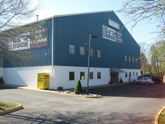
Property Record
10215 Nokesville Rd, Manassas, VA 20110
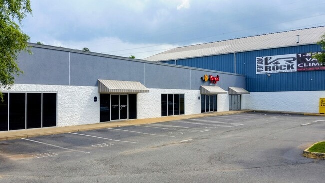
Current Lease Availabilities
NEARBY LISTINGS FOR SALE OR LEASE
Property Detail
10215 Nokesville Rd
102-01-00-25A1
LENGTHY LEGAL SEE DEED
Stripcommercialcenter
Manassas City
X
Virginia
51061C0375D
25a
2025
2.76 AC
2025
Manassas
901232
Washington, DC
13,150 SF
Washington-Arlington-Alexandria, DC-VA-MD-WV
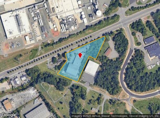
DEMOGRAPHICS near 10215 Nokesville Rd
1 Mile
3 Mile
5 Mile
2024 Total Population
2,955
87,905
171,319
2029 Population
2,963
88,761
173,387
Pop Growth 2024-2029
+ 0.27%
+ 0.97%
+ 1.21%
Average Age
36
35
36
2024 Total Households
978
28,498
53,814
HH Growth 2024-2029
+ 0.51%
+ 1.02%
+ 1.23%
Median Household Inc
$126,817
$105,369
$108,415
Avg Household Size
2.90
3.00
3.10
2024 Avg HH Vehicles
2.00
2.00
2.00
Median Home Value
$412,048
$398,609
$425,643
Median Year Built
1988
1988
1990
Nearby Places
Map Layers
Map Styles
 Street
 Aerial
- Restaurants
- Banks
- Shops
- Fitness
- Groceries
PUBLIC TRANSPORTATION
COMMUTER RAIL
Lead (Manassas Line - Virginia Railway Express)
DRIVE
WALK
Distance
Lead (Manassas Line - Virginia Railway Express)
6 min
2.5 mi
Broad Run/Airport (Manassas Line - Virginia Railway Express)
DRIVE
WALK
Distance
Broad Run/Airport (Manassas Line - Virginia Railway Express)
6 min
2.5 mi
AIRPORT
Washington Dulles International
DRIVE
WALK
Distance
Washington Dulles International
37 min
22.1 mi
Ronald Reagan Washington Ntl
DRIVE
WALK
Distance
Ronald Reagan Washington Ntl
51 min
36.7 mi
Freight Ports
Port of Baltimore
DRIVE
WALK
Distance
Port of Baltimore
96 min
72.5 mi
Nearby Properties
Address
Land Use
TOTAL SIZE
Lot Size
Zoning
Address
Land Use
TOTAL SIZE
Lot Size
Zoning
656,797 SF
Address
Land Use
TOTAL SIZE
Lot Size
Zoning
824,085 SF
120.07 AC
MIXED
Address
Land Use
TOTAL SIZE
Lot Size
Zoning
352,401 SF
91.60 AC
M2
Address
Land Use
TOTAL SIZE
Lot Size
Zoning
395,617 SF
19.08 AC
PMD
Address
Land Use
TOTAL SIZE
Lot Size
Zoning
187,752 SF
20.77 AC
HEAVY INDU
Address
Land Use
TOTAL SIZE
Lot Size
Zoning
51.84 AC
MIXED
Address
Land Use
TOTAL SIZE
Lot Size
Zoning
2,357 SF
216.41 AC
AIRPORT
Address
Land Use
TOTAL SIZE
Lot Size
Zoning
75,816 SF
29.15 AC
R16
Address
Land Use
TOTAL SIZE
Lot Size
Zoning
402,295 SF
8.50 AC
A1
Address
Land Use
TOTAL SIZE
Lot Size
Zoning
203,544 SF
20.90 AC
GENERAL CO
Address
Land Use
TOTAL SIZE
Lot Size
Zoning
30.22 AC
M2
Address
Land Use
TOTAL SIZE
Lot Size
Zoning
243,217 SF
LIGHT INDU
Address
Land Use
TOTAL SIZE
Lot Size
Zoning
380,264 SF
15.25 AC
PMD
Address
Land Use
TOTAL SIZE
Lot Size
Zoning
240,103 SF
19.93 AC
R16
Address
Land Use
TOTAL SIZE
Lot Size
Zoning
18,128 SF
MULTI-FAMI
Address
Land Use
TOTAL SIZE
Lot Size
Zoning
335,553 SF
45.93 AC
M2
Address
Land Use
TOTAL SIZE
Lot Size
Zoning
69,276 SF
18.15 AC
R16
Address
Land Use
TOTAL SIZE
Lot Size
Zoning
35.60 AC
PBD
Address
Land Use
TOTAL SIZE
Lot Size
Zoning
406,297 SF
67.08 AC
A1
Address
Land Use
TOTAL SIZE
Lot Size
Zoning
34.66 AC
PBD
Address
Land Use
TOTAL SIZE
Lot Size
Zoning
3,621 SF
48.25 AC
A1
Address
Land Use
TOTAL SIZE
Lot Size
Zoning
213,662 SF
22.18 AC
R16
Address
Land Use
TOTAL SIZE
Lot Size
Zoning
371,926 SF
38.17 AC
B1
Address
Land Use
TOTAL SIZE
Lot Size
Zoning
198,708 SF
16.21 AC
MULTI-FAMI
Address
Land Use
TOTAL SIZE
Lot Size
Zoning
111,222 SF
15.75 AC
R16
Address
Land Use
TOTAL SIZE
Lot Size
Zoning
28.58 AC
M1
Address
Land Use
TOTAL SIZE
Lot Size
Zoning
30.92 AC
PMD
Address
Land Use
TOTAL SIZE
Lot Size
Zoning
49,528 SF
15.34 AC
R16
Address
Land Use
TOTAL SIZE
Lot Size
Zoning
414,766 SF
14.93 AC
PBD
Address
Land Use
TOTAL SIZE
Lot Size
Zoning
499,912 SF
49.96 AC
B1
The World's #1 Commercial Real Estate Marketplace
Connect with us
© 2026 CoStar Group
The information above has been obtained from sources believed reliable. While we do not doubt its accuracy we have not verified it and make no guarantee, warranty or representation about it. It is your responsibility to independently confirm its accuracy and completeness. Any projections, opinions, assumptions, or estimates used are for example only and do not represent the current or future performance of the property. The value of this transaction to you depends on tax and other factors which should be evaluated by your tax, financial, and legal advisors. You and your advisors should conduct a careful, independent investigation of the property to determine to your satisfaction the suitability of the property for your needs.