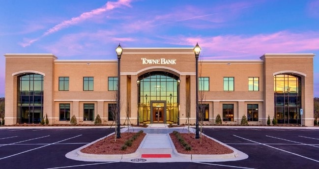
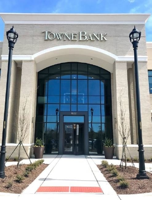
Property Record
1022 Ashes Dr, Wilmington, NC 28405

Property Detail
1022 Ashes Dr
R05100-003-108-000
TR A-4 RENAISSANCE II OFFICE PARK REV
Officebuilding
NEW HANOVER
O&I,OFFICE
North Carolina
B and X Area of moderate flood hazard, usually the area between the limits of the 100-year and 500-year floods.
a
2025
2.50 AC
2025
Landfall
011703
Wilmington
35,564 SF
Wilmington, NC
NEARBY LISTINGS FOR SALE OR LEASE
DEMOGRAPHICS near 1022 Ashes Dr
1 mile
3 mile
5 mile
2025 Total Population
5,093
52,623
114,535
2030 Population
5,417
55,991
121,314
Pop Growth 2025-2030
+ 6.36%
+ 6.40%
+ 5.92%
Average Age
49
40
40
2025 Total Households
2,604
21,632
48,433
HH Growth 2025-2030
+ 6.45%
+ 7.04%
+ 6.23%
Median Household Inc
$121,710
$91,427
$81,946
Avg Household Size
2.00
2.20
2.20
2025 Avg HH Vehicles
2.00
2.00
2.00
Median Home Value
$764,722
$474,077
$408,127
Median Year Built
2005
1996
1994
Nearby Places
Map Layers
Map Styles
 Street
 Aerial
Transit
 Traffic
 Biking
Places
Listings with unknown addresses are not visible on the map
- Restaurants
- Banks
- Shops
- Fitness
- Groceries
PUBLIC TRANSPORTATION
AIRPORT
Wilmington International
Drive
Walk
Distance
Wilmington International
20 min
8.9 mi
SALE & LEASE HISTORY
LISTING DATE
SALE/LEASE

Sep 25, 2016
For Lease
Jun 25, 2019
For Lease
Nearby Properties
Address
Land Use
TOTAL SIZE
Lot Size
Zoning
Address
Land Use
TOTAL SIZE
Lot Size
Zoning
18,848 SF
649.08 AC
O&I,OFFICE
Address
Land Use
TOTAL SIZE
Lot Size
Zoning
13,398 SF
15.67 AC
O&I,OFFICE
Address
Land Use
TOTAL SIZE
Lot Size
Zoning
12,336 SF
67.48 AC
IND
Address
Land Use
TOTAL SIZE
Lot Size
Zoning
194,040 SF
7.74 AC
MX
Address
Land Use
TOTAL SIZE
Lot Size
Zoning
241,296 SF
15.67 AC
B-2,BUSINE
Address
Land Use
TOTAL SIZE
Lot Size
Zoning
Address
Land Use
TOTAL SIZE
Lot Size
Zoning
3,540 SF
25.10 AC
MX
Address
Land Use
TOTAL SIZE
Lot Size
Zoning
74,696 SF
4.39 AC
O&I,OFFICE
Address
Land Use
TOTAL SIZE
Lot Size
Zoning
186,960 SF
8.80 AC
O&I,OFFICE
Address
Land Use
TOTAL SIZE
Lot Size
Zoning
128,015 SF
6.91 AC
RB,REGIONA
Address
Land Use
TOTAL SIZE
Lot Size
Zoning
153,764 SF
22.87 AC
RB,REGIONA
Address
Land Use
TOTAL SIZE
Lot Size
Zoning
102,524 SF
2.88 AC
C-4,COMMER
Address
Land Use
TOTAL SIZE
Lot Size
Zoning
136,312 SF
4.11 AC
C-4,COMMER
Address
Land Use
TOTAL SIZE
Lot Size
Zoning
41,145 SF
13.58 AC
CB,COMMUNI
Address
Land Use
TOTAL SIZE
Lot Size
Zoning
2,112 SF
6.99 AC
C-3,COMMER
Address
Land Use
TOTAL SIZE
Lot Size
Zoning
101,003 SF
7.89 AC
MX
Address
Land Use
TOTAL SIZE
Lot Size
Zoning
2,016 SF
14.69 AC
G-1,OFFICE
Address
Land Use
TOTAL SIZE
Lot Size
Zoning
94,518 SF
13.73 AC
O&I,OFFICE
Address
Land Use
TOTAL SIZE
Lot Size
Zoning
73,457 SF
6.77 AC
MX
Address
Land Use
TOTAL SIZE
Lot Size
Zoning
30,595 SF
4.12 AC
O&I,OFFICE
Address
Land Use
TOTAL SIZE
Lot Size
Zoning
66,622 SF
3.28 AC
MX
Address
Land Use
TOTAL SIZE
Lot Size
Zoning
93,059 SF
2.76 AC
MX
Address
Land Use
TOTAL SIZE
Lot Size
Zoning
1,560 SF
4.20 AC
CB,COMMUNI
Address
Land Use
TOTAL SIZE
Lot Size
Zoning
4,674 SF
55.08 AC
MX
Address
Land Use
TOTAL SIZE
Lot Size
Zoning
95,303 SF
19.20 AC
O&I,OFFICE
Address
Land Use
TOTAL SIZE
Lot Size
Zoning
85,973 SF
10 AC
RB,REGIONA
Address
Land Use
TOTAL SIZE
Lot Size
Zoning
43,454 SF
5.80 AC
G-1,OFFICE
Address
Land Use
TOTAL SIZE
Lot Size
Zoning
53,134 SF
14.19 AC
RB,REGIONA
Address
Land Use
TOTAL SIZE
Lot Size
Zoning
11,000 SF
7.59 AC
RB,REGIONA
Address
Land Use
TOTAL SIZE
Lot Size
Zoning
123,166 SF
12.45 AC
RB,REGIONA
The World's #1 Commercial Real Estate Marketplace
Connect with us
© 2026 CoStar Group
The information above has been obtained from sources believed reliable. While we do not doubt its accuracy we have not verified it and make no guarantee, warranty or representation about it. It is your responsibility to independently confirm its accuracy and completeness. Any projections, opinions, assumptions, or estimates used are for example only and do not represent the current or future performance of the property. The value of this transaction to you depends on tax and other factors which should be evaluated by your tax, financial, and legal advisors. You and your advisors should conduct a careful, independent investigation of the property to determine to your satisfaction the suitability of the property for your needs.