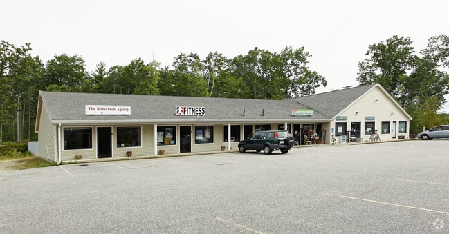
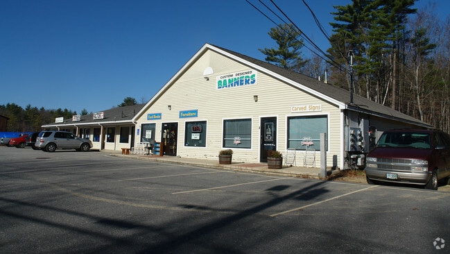
Property Record
1022 Dover Rd, Epsom, NH 03234

Property Detail
1022 Dover Rd
EPSO-000001U-000000-000020
MERRIMACK
Commercialnec
New Hampshire
RES/CO
20
B and X Area of moderate flood hazard, usually the area between the limits of the 100-year and 500-year floods.
2.63 AC
2025
Concord/New Hampshire North Area
2025
Other Market Areas
034000
Concord, NH
NEARBY LISTINGS FOR SALE OR LEASE
-
-
View all Epsom listings for sale on LoopNet.com
DEMOGRAPHICS near 1022 Dover Rd
1 mile
3 mile
5 mile
2025 Total Population
882
3,912
9,238
2030 Population
903
4,015
9,458
Pop Growth 2025-2030
+ 2.38%
+ 2.63%
+ 2.38%
Average Age
43
43
43
2025 Total Households
339
1,512
3,570
HH Growth 2025-2030
+ 2.36%
+ 2.65%
+ 2.38%
Median Household Inc
$100,980
$107,724
$105,164
Avg Household Size
2.60
2.50
2.50
2025 Avg HH Vehicles
2.00
2.00
2.00
Median Home Value
$379,891
$382,023
$380,546
Median Year Built
1980
1979
1980
Nearby Places
Map Layers
Map Styles
 Street
 Aerial
Layers
 Traffic
 Biking
Places
Listings with unknown addresses are not visible on the map
- Restaurants
- Banks
- Shops
- Fitness
- Groceries
PUBLIC TRANSPORTATION
AIRPORT
Portsmouth International at Pease
Drive
Walk
Distance
Portsmouth International at Pease
48 min
29.1 mi
Manchester Boston Regional
Drive
Walk
Distance
Manchester Boston Regional
56 min
31.5 mi
Nearby Properties
Address
Land Use
TOTAL SIZE
Lot Size
Zoning
Address
Land Use
TOTAL SIZE
Lot Size
Zoning
886 SF
286 AC
NWL RN
Address
Land Use
TOTAL SIZE
Lot Size
Zoning
16,575 SF
14.55 AC
GENERA
Address
Land Use
TOTAL SIZE
Lot Size
Zoning
663 SF
2 AC
AR AGR
Address
Land Use
TOTAL SIZE
Lot Size
Zoning
2,237 SF
0.37 AC
AR AGR
Address
Land Use
TOTAL SIZE
Lot Size
Zoning
3,390 SF
0.47 AC
AR AGR
Address
Land Use
TOTAL SIZE
Lot Size
Zoning
2,456 SF
30.09 AC
GENERA
Address
Land Use
TOTAL SIZE
Lot Size
Zoning
4.16 AC
RES/LT
Address
Land Use
TOTAL SIZE
Lot Size
Zoning
413 SF
5.56 AC
NWL RN
Address
Land Use
TOTAL SIZE
Lot Size
Zoning
8,064 SF
12.68 AC
RES/CO
Address
Land Use
TOTAL SIZE
Lot Size
Zoning
5.95 AC
AR AGR
Address
Land Use
TOTAL SIZE
Lot Size
Zoning
21,459 SF
15.31 AC
GENERA
Address
Land Use
TOTAL SIZE
Lot Size
Zoning
7.06 AC
AR AGR
Address
Land Use
TOTAL SIZE
Lot Size
Zoning
1.06 AC
R/C NO
Address
Land Use
TOTAL SIZE
Lot Size
Zoning
6,708 SF
300 AC
LONG P
Address
Land Use
TOTAL SIZE
Lot Size
Zoning
10,671 SF
2 AC
GENERA
Address
Land Use
TOTAL SIZE
Lot Size
Zoning
2,656 SF
0.58 AC
AR AGR
Address
Land Use
TOTAL SIZE
Lot Size
Zoning
0.69 AC
PL RRP
Address
Land Use
TOTAL SIZE
Lot Size
Zoning
3.60 AC
NWL RN
Address
Land Use
TOTAL SIZE
Lot Size
Zoning
1.58 AC
PL RRP
Address
Land Use
TOTAL SIZE
Lot Size
Zoning
2,121 SF
2.40 AC
AR AGR
Address
Land Use
TOTAL SIZE
Lot Size
Zoning
1.50 AC
NWL RN
Address
Land Use
TOTAL SIZE
Lot Size
Zoning
15,978 SF
2.02 AC
GENERA
Address
Land Use
TOTAL SIZE
Lot Size
Zoning
2.90 AC
RES/LT
Address
Land Use
TOTAL SIZE
Lot Size
Zoning
0.50 AC
PL RRP
Address
Land Use
TOTAL SIZE
Lot Size
Zoning
2,616 SF
22 AC
AR AGR
Address
Land Use
TOTAL SIZE
Lot Size
Zoning
2,474 SF
1.90 AC
AR AGR
Address
Land Use
TOTAL SIZE
Lot Size
Zoning
2.86 AC
RES/AG
Address
Land Use
TOTAL SIZE
Lot Size
Zoning
3,917 SF
17 AC
LONG P
Address
Land Use
TOTAL SIZE
Lot Size
Zoning
1,563 SF
0.72 AC
PL RRP
Address
Land Use
TOTAL SIZE
Lot Size
Zoning
1,190 SF
0.22 AC
R/C NO
The World's #1 Commercial Real Estate Marketplace
Connect with us
© 2026 CoStar Group
The information above has been obtained from sources believed reliable. While we do not doubt its accuracy we have not verified it and make no guarantee, warranty or representation about it. It is your responsibility to independently confirm its accuracy and completeness. Any projections, opinions, assumptions, or estimates used are for example only and do not represent the current or future performance of the property. The value of this transaction to you depends on tax and other factors which should be evaluated by your tax, financial, and legal advisors. You and your advisors should conduct a careful, independent investigation of the property to determine to your satisfaction the suitability of the property for your needs.