Property Record
1022 Highway 51, Madison, MS 39110


Property Detail
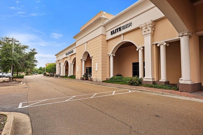
1022 Highway 51
Jackson, MS
LOT 1 MADISON CROSSING -4.99A C-
072C-08D-021-02-00
Madison
Regionalshoppingcenterormallwithanchorstore
Mississippi
AE The base floodplain where base flood elevations are provided. AE Zones are now used on new format FIRMs instead of A1-A30 Zones.
1
2025
6.17 AC
2025
Madison/Ridgeland
030202
Jackson
49,404 SF
NEARBY LISTINGS FOR SALE OR LEASE
DEMOGRAPHICS near 1022 Highway 51
1 mile
3 mile
5 mile
2025 Total Population
5,708
28,276
66,445
2030 Population
5,829
29,256
68,738
Pop Growth 2025-2030
+ 2.12%
+ 3.47%
+ 3.45%
Average Age
40
41
40
2025 Total Households
2,180
10,885
26,709
HH Growth 2025-2030
+ 2.29%
+ 3.77%
+ 3.57%
Median Household Inc
$97,279
$94,260
$83,798
Avg Household Size
2.60
2.50
2.40
2025 Avg HH Vehicles
2.00
2.00
2.00
Median Home Value
$332,077
$345,761
$341,259
Median Year Built
1992
1994
1992
Nearby Places
Map Layers
Map Styles
 Street
 Aerial
Layers
 Traffic
 Biking
Places
Listings with unknown addresses are not visible on the map
- Restaurants
- Banks
- Shops
- Fitness
- Groceries
PUBLIC TRANSPORTATION
AIRPORT
Jackson-Medgar Wiley Evers International
Drive
Walk
Distance
Jackson-Medgar Wiley Evers International
32 min
19.3 mi
Nearby Properties
Address
Land Use
TOTAL SIZE
Lot Size
Zoning
Address
Land Use
TOTAL SIZE
Lot Size
Zoning
8,901 SF
37.80 AC
Address
Land Use
TOTAL SIZE
Lot Size
Zoning
326,732 SF
2 AC
Address
Land Use
TOTAL SIZE
Lot Size
Zoning
297,150 SF
5.70 AC
Address
Land Use
TOTAL SIZE
Lot Size
Zoning
78,922 SF
26.14 AC
Address
Land Use
TOTAL SIZE
Lot Size
Zoning
2,261 SF
15 AC
Address
Land Use
TOTAL SIZE
Lot Size
Zoning
178,482 SF
23.13 AC
Address
Land Use
TOTAL SIZE
Lot Size
Zoning
117,149 SF
10.58 AC
Address
Land Use
TOTAL SIZE
Lot Size
Zoning
79,666 SF
7.92 AC
Address
Land Use
TOTAL SIZE
Lot Size
Zoning
225 SF
12.81 AC
Address
Land Use
TOTAL SIZE
Lot Size
Zoning
107,871 SF
3 AC
Address
Land Use
TOTAL SIZE
Lot Size
Zoning
84,542 SF
6.29 AC
Address
Land Use
TOTAL SIZE
Lot Size
Zoning
68,017 SF
10.56 AC
Address
Land Use
TOTAL SIZE
Lot Size
Zoning
3,369 SF
9 AC
Address
Land Use
TOTAL SIZE
Lot Size
Zoning
112 SF
7 AC
Address
Land Use
TOTAL SIZE
Lot Size
Zoning
148,808 SF
12.80 AC
Address
Land Use
TOTAL SIZE
Lot Size
Zoning
23,474 SF
9.50 AC
Address
Land Use
TOTAL SIZE
Lot Size
Zoning
76,309 SF
7.38 AC
Address
Land Use
TOTAL SIZE
Lot Size
Zoning
122,775 SF
8.40 AC
Address
Land Use
TOTAL SIZE
Lot Size
Zoning
85,526 SF
6.94 AC
Address
Land Use
TOTAL SIZE
Lot Size
Zoning
70,744 SF
5.04 AC
Address
Land Use
TOTAL SIZE
Lot Size
Zoning
66,974 SF
2.54 AC
Address
Land Use
TOTAL SIZE
Lot Size
Zoning
62,194 SF
3.03 AC
Address
Land Use
TOTAL SIZE
Lot Size
Zoning
5,586 SF
3.27 AC
Address
Land Use
TOTAL SIZE
Lot Size
Zoning
110,361 SF
11.35 AC
Address
Land Use
TOTAL SIZE
Lot Size
Zoning
66,354 SF
0.61 AC
Address
Land Use
TOTAL SIZE
Lot Size
Zoning
68,984 SF
2.56 AC
Address
Land Use
TOTAL SIZE
Lot Size
Zoning
77,099 SF
7.10 AC
Address
Land Use
TOTAL SIZE
Lot Size
Zoning
63,374 SF
7.40 AC
Address
Land Use
TOTAL SIZE
Lot Size
Zoning
90,847 SF
5.40 AC
C2
Address
Land Use
TOTAL SIZE
Lot Size
Zoning
71,357 SF
2.50 AC
The World's #1 Commercial Real Estate Marketplace
Connect with us
© 2026 CoStar Group
The information above has been obtained from sources believed reliable. While we do not doubt its accuracy we have not verified it and make no guarantee, warranty or representation about it. It is your responsibility to independently confirm its accuracy and completeness. Any projections, opinions, assumptions, or estimates used are for example only and do not represent the current or future performance of the property. The value of this transaction to you depends on tax and other factors which should be evaluated by your tax, financial, and legal advisors. You and your advisors should conduct a careful, independent investigation of the property to determine to your satisfaction the suitability of the property for your needs.