Property Record
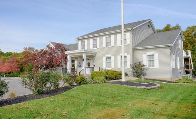
1022 Lacey Rd, Forked River, NJ 08731


NEARBY LISTINGS FOR SALE OR LEASE
Property Detail
1022 Lacey Rd
New York-Jersey City-White Plains, NY-NJ
Bernegat Pines Realty Co Inc M
13-01860-0000-00013
160 X 200 14,15,16,17,18,19,20 21,22,23,24,25,26-28
Commercialnec
Ocean
X
New Jersey
34029C0402F
13
2024
0.74 AC
2025
Ocean County
732001
Northern New Jersey
7,790 SF
DEMOGRAPHICS near 1022 Lacey Rd
1 Mile
3 Mile
5 Mile
2024 Total Population
5,399
26,587
55,944
2029 Population
5,708
28,185
59,655
Pop Growth 2024-2029
+ 5.72%
+ 6.01%
+ 6.63%
Average Age
41
40
40
2024 Total Households
2,001
9,531
20,367
HH Growth 2024-2029
+ 5.25%
+ 5.56%
+ 6.22%
Median Household Inc
$90,683
$92,754
$91,582
Avg Household Size
2.60
2.70
2.60
2024 Avg HH Vehicles
2.00
2.00
2.00
Median Home Value
$309,410
$321,495
$320,765
Median Year Built
1979
1981
1980
Nearby Places
Map Layers
Map Styles
 Street
 Aerial
- Restaurants
- Banks
- Shops
- Fitness
- Groceries
SALE & LEASE HISTORY
LISTING DATE
SALE/LEASE

Dec 05, 2017
For Sale
Apr 24, 2024
For Sale
Nearby Properties
Address
Land Use
TOTAL SIZE
Lot Size
Zoning
Address
Land Use
TOTAL SIZE
Lot Size
Zoning
96.60 AC
R100
Address
Land Use
TOTAL SIZE
Lot Size
Zoning
2,000 SF
94 AC
CR
Address
Land Use
TOTAL SIZE
Lot Size
Zoning
72.26 AC
R100
Address
Land Use
TOTAL SIZE
Lot Size
Zoning
1,807.87 AC
FA
Address
Land Use
TOTAL SIZE
Lot Size
Zoning
21.34 AC
C200
Address
Land Use
TOTAL SIZE
Lot Size
Zoning
10.49 AC
PURD
Address
Land Use
TOTAL SIZE
Lot Size
Zoning
9,617 SF
14.28 AC
WTB1
Address
Land Use
TOTAL SIZE
Lot Size
Zoning
142,047 SF
18.72 AC
C150
Address
Land Use
TOTAL SIZE
Lot Size
Zoning
9.88 AC
C150
Address
Land Use
TOTAL SIZE
Lot Size
Zoning
28.80 AC
R100
Address
Land Use
TOTAL SIZE
Lot Size
Zoning
960 SF
9.62 AC
R100
Address
Land Use
TOTAL SIZE
Lot Size
Zoning
19.28 AC
MLOF
Address
Land Use
TOTAL SIZE
Lot Size
Zoning
6.14 AC
C150
Address
Land Use
TOTAL SIZE
Lot Size
Zoning
9.45 AC
C200
Address
Land Use
TOTAL SIZE
Lot Size
Zoning
47,440 SF
6.09 AC
R150
Address
Land Use
TOTAL SIZE
Lot Size
Zoning
8.44 AC
AH10
Address
Land Use
TOTAL SIZE
Lot Size
Zoning
8.76 AC
C150
Address
Land Use
TOTAL SIZE
Lot Size
Zoning
3,840 SF
244.21 AC
CR
Address
Land Use
TOTAL SIZE
Lot Size
Zoning
5.86 AC
AH10
Address
Land Use
TOTAL SIZE
Lot Size
Zoning
5 AC
C200
Address
Land Use
TOTAL SIZE
Lot Size
Zoning
7,200 SF
6.58 AC
CR/
Address
Land Use
TOTAL SIZE
Lot Size
Zoning
6.21 AC
C150
Address
Land Use
TOTAL SIZE
Lot Size
Zoning
2,968 SF
14.08 AC
C150
Address
Land Use
TOTAL SIZE
Lot Size
Zoning
504 SF
144.46 AC
R400
Address
Land Use
TOTAL SIZE
Lot Size
Zoning
6,294 SF
4.13 AC
OC
Address
Land Use
TOTAL SIZE
Lot Size
Zoning
6,976 SF
1.29 AC
C150
Address
Land Use
TOTAL SIZE
Lot Size
Zoning
4 AC
C200
Address
Land Use
TOTAL SIZE
Lot Size
Zoning
2.20 AC
OC
Address
Land Use
TOTAL SIZE
Lot Size
Zoning
9.33 AC
C100
Address
Land Use
TOTAL SIZE
Lot Size
Zoning
29,562 SF
1.82 AC
OC
The World's #1 Commercial Real Estate Marketplace
Connect with us
© 2026 CoStar Group
The information above has been obtained from sources believed reliable. While we do not doubt its accuracy we have not verified it and make no guarantee, warranty or representation about it. It is your responsibility to independently confirm its accuracy and completeness. Any projections, opinions, assumptions, or estimates used are for example only and do not represent the current or future performance of the property. The value of this transaction to you depends on tax and other factors which should be evaluated by your tax, financial, and legal advisors. You and your advisors should conduct a careful, independent investigation of the property to determine to your satisfaction the suitability of the property for your needs.