Property Record
1022 State Route 173, Asbury, NJ 08802


NEARBY LISTINGS FOR SALE OR LEASE
-
-
View all Asbury listings for lease on LoopNet.com
Property Detail
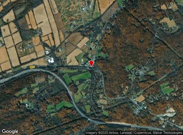
1022 State Route 173
02-00018-0000-00005-01
Hunterdon
Industrialgeneral
New Jersey
X
5.1
34041C0316E
1 AC
2024
Hunterdon
2025
Northern New Jersey
010400
Newark, NJ-PA
6,000 SF
DEMOGRAPHICS near 1022 State Route 173
1 Mile
3 Mile
5 Mile
2024 Total Population
214
4,965
16,395
2029 Population
215
5,000
16,591
Pop Growth 2024-2029
+ 0.47%
+ 0.70%
+ 1.20%
Average Age
44
44
44
2024 Total Households
78
1,843
5,797
HH Growth 2024-2029
0.00%
+ 0.65%
+ 1.28%
Median Household Inc
$129,167
$115,942
$125,249
Avg Household Size
2.70
2.70
2.80
2024 Avg HH Vehicles
3.00
2.00
3.00
Median Home Value
$464,705
$424,455
$432,252
Median Year Built
1978
1971
1976
Nearby Places
Map Layers
Map Styles
 Street
 Aerial
- Restaurants
- Banks
- Shops
- Fitness
- Groceries
PUBLIC TRANSPORTATION
COMMUTER RAIL
Annandale (Raritan Valley Line - NJ Transit Commuter Rail (NJ Transit))
DRIVE
WALK
Distance
Annandale (Raritan Valley Line - NJ Transit Commuter Rail (NJ Transit))
14 min
9.8 mi
AIRPORT
Lehigh Valley International
DRIVE
WALK
Distance
Lehigh Valley International
40 min
25.1 mi
Trenton Mercer
DRIVE
WALK
Distance
Trenton Mercer
57 min
38.3 mi
Freight Ports
New York Container Terminal
DRIVE
WALK
Distance
New York Container Terminal
71 min
53.8 mi
SALE & LEASE HISTORY
LISTING DATE
SALE/LEASE

May 03, 2017
For Lease
Nearby Properties
Address
Land Use
TOTAL SIZE
Lot Size
Zoning
Address
Land Use
TOTAL SIZE
Lot Size
Zoning
9.05 AC
MR
Address
Land Use
TOTAL SIZE
Lot Size
Zoning
800 SF
28.04 AC
MR
Address
Land Use
TOTAL SIZE
Lot Size
Zoning
1,392 SF
5.89 AC
PC
Address
Land Use
TOTAL SIZE
Lot Size
Zoning
185.60 AC
AR
Address
Land Use
TOTAL SIZE
Lot Size
Zoning
11.15 AC
MFG
Address
Land Use
TOTAL SIZE
Lot Size
Zoning
12.02 AC
B-2
Address
Land Use
TOTAL SIZE
Lot Size
Zoning
14.29 AC
B-2
Address
Land Use
TOTAL SIZE
Lot Size
Zoning
14.70 AC
MFG
Address
Land Use
TOTAL SIZE
Lot Size
Zoning
13,478 SF
0.98 AC
R-3
Address
Land Use
TOTAL SIZE
Lot Size
Zoning
6,004 SF
5 AC
RC
Address
Land Use
TOTAL SIZE
Lot Size
Zoning
153.13 AC
MR
Address
Land Use
TOTAL SIZE
Lot Size
Zoning
6.04 AC
ROM
Address
Land Use
TOTAL SIZE
Lot Size
Zoning
3,840 SF
3.32 AC
B-2
Address
Land Use
TOTAL SIZE
Lot Size
Zoning
4.07 AC
PC
Address
Land Use
TOTAL SIZE
Lot Size
Zoning
875 SF
0.67 AC
DB
Address
Land Use
TOTAL SIZE
Lot Size
Zoning
2,672 SF
4.52 AC
B-2
Address
Land Use
TOTAL SIZE
Lot Size
Zoning
3,120 SF
7 AC
MR
Address
Land Use
TOTAL SIZE
Lot Size
Zoning
51.80 AC
MR
Address
Land Use
TOTAL SIZE
Lot Size
Zoning
9,979 SF
0.46 AC
R-2
Address
Land Use
TOTAL SIZE
Lot Size
Zoning
97.27 AC
MR
Address
Land Use
TOTAL SIZE
Lot Size
Zoning
0.47 AC
C-1
Address
Land Use
TOTAL SIZE
Lot Size
Zoning
43.52 AC
MR
Address
Land Use
TOTAL SIZE
Lot Size
Zoning
4,210 SF
7.34 AC
MR
Address
Land Use
TOTAL SIZE
Lot Size
Zoning
39.64 AC
MR
Address
Land Use
TOTAL SIZE
Lot Size
Zoning
2,788 SF
8 AC
AR
Address
Land Use
TOTAL SIZE
Lot Size
Zoning
3,250 SF
3.32 AC
VCCM
Address
Land Use
TOTAL SIZE
Lot Size
Zoning
75.05 AC
MR
Address
Land Use
TOTAL SIZE
Lot Size
Zoning
6,106 SF
5 AC
MR
Address
Land Use
TOTAL SIZE
Lot Size
Zoning
1,140 SF
11.22 AC
PC
Address
Land Use
TOTAL SIZE
Lot Size
Zoning
5,072 SF
1 AC
AR
The World's #1 Commercial Real Estate Marketplace
Connect with us
© 2025 CoStar Group
The information above has been obtained from sources believed reliable. While we do not doubt its accuracy we have not verified it and make no guarantee, warranty or representation about it. It is your responsibility to independently confirm its accuracy and completeness. Any projections, opinions, assumptions, or estimates used are for example only and do not represent the current or future performance of the property. The value of this transaction to you depends on tax and other factors which should be evaluated by your tax, financial, and legal advisors. You and your advisors should conduct a careful, independent investigation of the property to determine to your satisfaction the suitability of the property for your needs.