Property Record
10220 N 31St Ave, Phoenix, AZ 85051

NEARBY LISTINGS FOR SALE OR LEASE
Property Detail
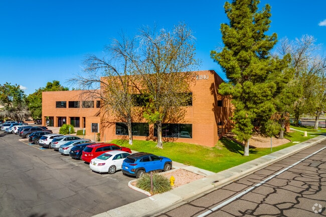
10220 N 31St Ave
149-15-004D
NE4 NW4 EX S 60F OF N 285F OF E 110F OF N2 NE4 NW 4 & EX S 198F OF E 260F OF S2 NE4 NW4 & EX E 40F & EX N 33F RDS & EX PER RD DKT 12001-0366
Officebuilding
Maricopa
X
Arizona
04013C1710L
1
2025
2.13 AC
2025
Northwest Phoenix
104205
Phoenix
3,241 SF
Phoenix-Mesa-Chandler, AZ
DEMOGRAPHICS near 10220 N 31St Ave
1 mile
3 mile
5 mile
2024 Total Population
16,736
176,416
450,526
2029 Population
18,101
190,463
485,571
Pop Growth 2024-2029
+ 8.16%
+ 7.96%
+ 7.78%
Average Age
37
37
37
2024 Total Households
6,477
64,033
164,556
HH Growth 2024-2029
+ 8.37%
+ 8.24%
+ 8.07%
Median Household Inc
$47,233
$54,329
$57,840
Avg Household Size
2.40
2.60
2.60
2024 Avg HH Vehicles
2.00
2.00
2.00
Median Home Value
$269,422
$277,486
$303,090
Median Year Built
1975
1976
1976
Nearby Places
Map Layers
Map Styles
 Street
 Aerial
Transit
 Traffic
 Biking
Places
Listings with unknown addresses are not visible on the map
- Restaurants
- Banks
- Shops
- Fitness
- Groceries
PUBLIC TRANSPORTATION
TRANSIT/SUBWAY
Metro Pkwy (Valley Metro Rail - Valley Metro (Phoenix Light Rail))
Drive
Walk
Distance
Metro Pkwy (Valley Metro Rail - Valley Metro (Phoenix Light Rail))
2 min
12 min
0.6 mi
AIRPORT
Phoenix Sky Harbor International
Drive
Walk
Distance
Phoenix Sky Harbor International
26 min
16.8 mi
Freight Ports
Port of San Diego
Drive
Walk
Distance
Port of San Diego
404 min
361.0 mi
SALE & LEASE HISTORY
LISTING DATE
SALE/LEASE

Sep 25, 2018
For Lease
Jun 04, 2019
For Lease
Feb 01, 2017
For Lease
Dec 09, 2020
For Lease
Nearby Properties
Address
Land Use
TOTAL SIZE
Lot Size
Zoning
Address
Land Use
TOTAL SIZE
Lot Size
Zoning
249,119 SF
15.40 AC
PUD
Address
Land Use
TOTAL SIZE
Lot Size
Zoning
10.70 AC
I-P
Address
Land Use
TOTAL SIZE
Lot Size
Zoning
98,760 SF
6.76 AC
A-1
Address
Land Use
TOTAL SIZE
Lot Size
Zoning
742,601 SF
295.89 AC
R-8
Address
Land Use
TOTAL SIZE
Lot Size
Zoning
3.58 AC
Address
Land Use
TOTAL SIZE
Lot Size
Zoning
4.71 AC
Address
Land Use
TOTAL SIZE
Lot Size
Zoning
19,474 SF
8.43 AC
C-3
Address
Land Use
TOTAL SIZE
Lot Size
Zoning
74,376 SF
2.12 AC
C-N
Address
Land Use
TOTAL SIZE
Lot Size
Zoning
2.62 AC
IND.PK.
Address
Land Use
TOTAL SIZE
Lot Size
Zoning
215,150 SF
13.24 AC
R-3
Address
Land Use
TOTAL SIZE
Lot Size
Zoning
16,284 SF
3.77 AC
M-H
Address
Land Use
TOTAL SIZE
Lot Size
Zoning
276,102 SF
39.72 AC
AG
Address
Land Use
TOTAL SIZE
Lot Size
Zoning
4.43 AC
Address
Land Use
TOTAL SIZE
Lot Size
Zoning
146,867 SF
12.95 AC
CPGCP
Address
Land Use
TOTAL SIZE
Lot Size
Zoning
290,321 SF
37.97 AC
R-8
Address
Land Use
TOTAL SIZE
Lot Size
Zoning
268,958 SF
38.42 AC
R-6
Address
Land Use
TOTAL SIZE
Lot Size
Zoning
469,322 SF
22.40 AC
M-H
Address
Land Use
TOTAL SIZE
Lot Size
Zoning
212,227 SF
27.71 AC
R-6
Address
Land Use
TOTAL SIZE
Lot Size
Zoning
584,674 SF
27.83 AC
R-3A
Address
Land Use
TOTAL SIZE
Lot Size
Zoning
362,729 SF
21.85 AC
Address
Land Use
TOTAL SIZE
Lot Size
Zoning
99,714 SF
11.72 AC
R-6
Address
Land Use
TOTAL SIZE
Lot Size
Zoning
154,128 SF
9.32 AC
I-1
Address
Land Use
TOTAL SIZE
Lot Size
Zoning
2.99 AC
C-R
Address
Land Use
TOTAL SIZE
Lot Size
Zoning
228,072 SF
14.72 AC
C-C
Address
Land Use
TOTAL SIZE
Lot Size
Zoning
153,980 SF
20.11 AC
R-8
Address
Land Use
TOTAL SIZE
Lot Size
Zoning
122,646 SF
14.69 AC
I-P
Address
Land Use
TOTAL SIZE
Lot Size
Zoning
387,832 SF
20.25 AC
M-H
Address
Land Use
TOTAL SIZE
Lot Size
Zoning
144,000 SF
12.50 AC
C-C
Address
Land Use
TOTAL SIZE
Lot Size
Zoning
99,877 SF
13.52 AC
R-8
The World's #1 Commercial Real Estate Marketplace
Connect with us
© 2026 CoStar Group
The information above has been obtained from sources believed reliable. While we do not doubt its accuracy we have not verified it and make no guarantee, warranty or representation about it. It is your responsibility to independently confirm its accuracy and completeness. Any projections, opinions, assumptions, or estimates used are for example only and do not represent the current or future performance of the property. The value of this transaction to you depends on tax and other factors which should be evaluated by your tax, financial, and legal advisors. You and your advisors should conduct a careful, independent investigation of the property to determine to your satisfaction the suitability of the property for your needs.